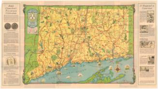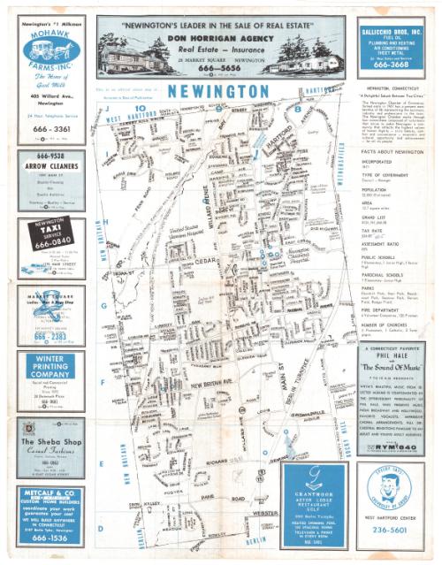
Newington, Connecticut street map and directory
PublisherPublished by
Town Maps, Inc.
American, founded 1968
Dateabout 1968
MediumOffset lithography; black and blue printer's inks on wove paper
DimensionsPrimary Dimensions (image height x width): 17 3/4 x 10 3/8in. (45.1 x 26.4cm)
Sheet (height x width): 22 x 17in. (55.9 x 43.2cm)
Sheet (height x width): 22 x 17in. (55.9 x 43.2cm)
ClassificationsGraphics
Credit LineConnecticut Museum of Culture and History collection
DescriptionDouble-sided map and street directory of Newington, Connecticut. The map, which is on a grid, extends from the town lines of West Hartford and Hartford to the north, the town line of Wethersfield to the east, the town line of Berlin to the south, and the town line of New Britain to the west. Streets, schools, hospitals and parks and the Waterbury and New Haven lines of the New York, New Haven and Hartford Railroad are labeled on the map. There are several blue stars at various locations on the map that correspond to the advertisements that appear around it. To the right of the map is a list containing facts about the town. On the verso is the street index and more advertisements.
Object number2012.312.47
InscribedRecto, printed in blue with white letters, and black printer's ink: "Newington [blue/white] / Connecticut [blue/white] / streep map and directory fifty cents [black ink] / Published and Copyrighted by [black ink] / TOWN MAPS, inc., [black ink] / Southington, Conn. [black ink]"Top left corner, handwritten in blue ink: various arithmetical calculations
Recto, top, printed in blue ink: "This is an official street map of... NEWINGTON / Accurate to Date of Publication"
Right side, handwritten in blue ink: Under "TAX RATE," "$34.50" has been crossed out and "42.5" written in blue
Center bottom, handwritten in blue ink: ""STREET"
Center bottom, handwritten in blue ink: "[inscribed within a square that is indicates a house or other building] H.O. [illegible]"
NotesCartographic Note: No scale
Collections
- Maps and Charts: Finding Your Place in Connecticut History
On View
Not on view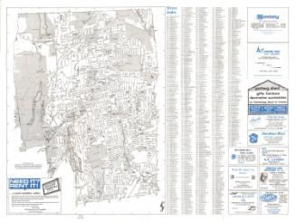
Blum's Commercial Map Publishing Company
1927-1928

R. A. Welcke Offset Co.
probably 1967