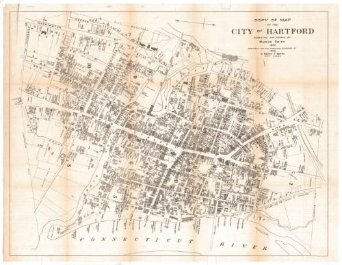
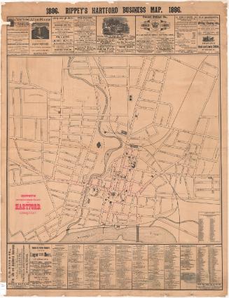
Copy of Map of the City of Hartford
SurveyorSurveyed by
Marcus Smith
possibly British, born about 1810
DraftsmanDrawn by
Marcus Smith
possibly British, born about 1810
MakerCopied by
Henry F. Smith
American, 1853 - 1922
Date1902
MediumLithography; printer's ink on wove paper
DimensionsPrimary Dimensions (image height x width): 19 3/4 x 25 5/8in. (50.2 x 65.1cm)
Sheet (height x width): 20 3/4 x 26 7/8in. (52.7 x 68.3cm)
Sheet (height x width): 20 3/4 x 26 7/8in. (52.7 x 68.3cm)
ClassificationsGraphics
Credit LineConnecticut Museum of Culture and History collection
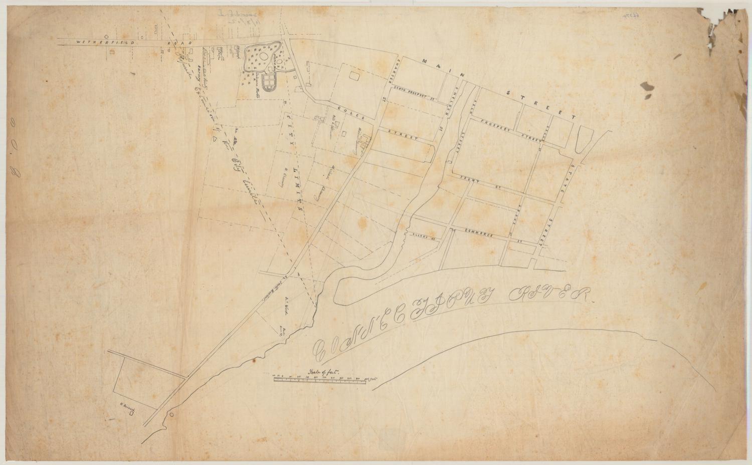
DescriptionCity map of Hartford, Connecticut, as it appeared in 1850. The area depicted extends from Pleasant Street on the north, the Connecticut River on the east, South Park and Jefferson Street on the south, and Cooper Lane to the west. The city appears to have been divided into 12 sections, possibly wards, labeled with numbers. Buildings are shaded in diagonal lines, and the names of streets, property owners, businesses and institutions are provided. The Little, Mill, or Park River runs east-west through the lower half of the city. Notable landmarks include Union Station, the State House, Trinity College, and Orphans Asylum. In the upper right corner, the Hartford, New Haven and Springfield Branch to the freight house (presumably associated with the railroad).
Object number2012.312.8
InscribedRecto, top right, printed in black ink: "COPY OF MAP / OF THE / CITY OF HARTFORD / SURVEYED AND DRAWN BY / MARCUS SMITH / 1850 / PREPARED FOR THE MUNICIPAL REGISTER OF 1902 / BY HENRY F. SMITH / CITY CLERK"NotesCartographic Note: No scale.Classification Note: In terms of this project, "historical maps" refer to those made at a later date than the time period depicted.
Subject Note: This 1902 map differs in both content and presentation from the original 1850 map. The 1850 map shows more of the city, going beyond what the 1902 map refers to as the "city boundary" (what is originally described as "proposed extension of the city limits"), while the 1902 map stops at the city line. The 1850 map has decorative borders and includes vignettes of some of Hartford's notable landmarks: Union Station, the Wadsworth Athenaeum, the Pearman apple tree, the State House and the Charter Oak; the 1902 copy does not have any decoration or vignettes.
Collections
- Maps and Charts: Finding Your Place in Connecticut History
On View
Not on view

Object/Object