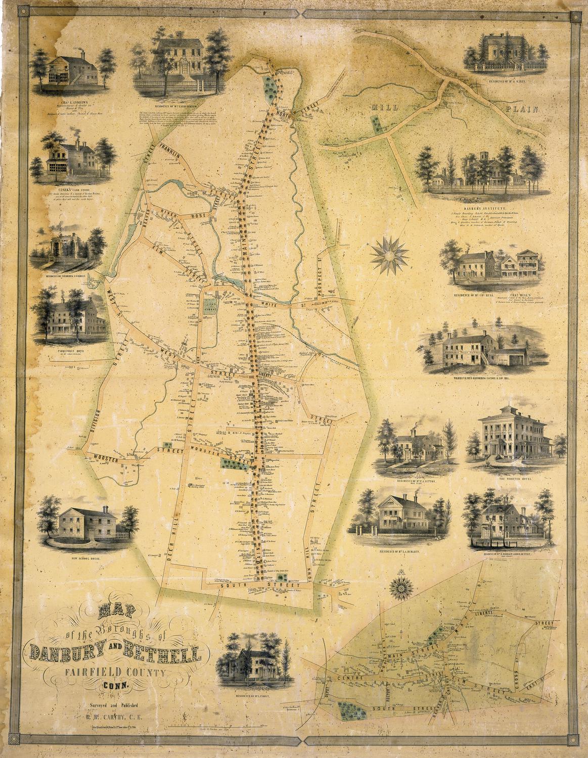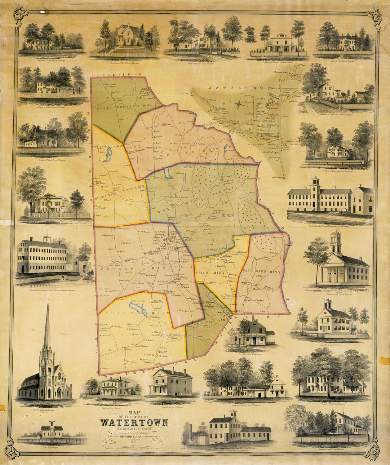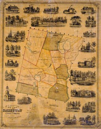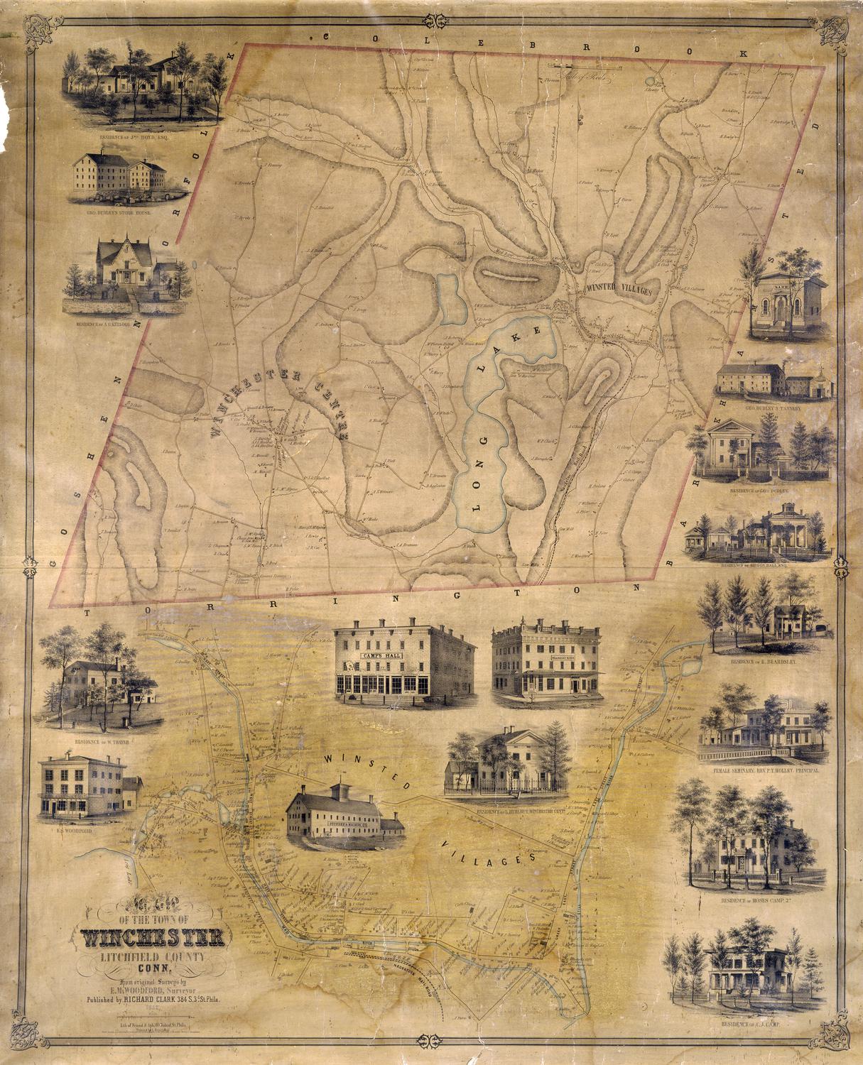
Map of the Town of Winchester, Litchfield County, Conn.
SurveyorSurveyed by
E. M. Woodford
(American, 1824 - 1862)
PrintmakerLithographed by
Friend & Aub
(American, founded 1852)
PrinterPrinted by
L. Rosenthal
(Polish-American)
PublisherPublished by
Richard Clark
(American)
Date1852
MediumLithography; black printer's ink and watercolor on wove paper mounted on fabric
DimensionsPrimary Dimensions (image height x width): 43 x 34 3/4in. (109.2 x 88.3cm)
Sheet (height x width): 45 1/2 x 37in. (115.6 x 94cm)
ClassificationsGraphics
Credit LineConnecticut Museum of Culture and History collection
Object number2012.312.292
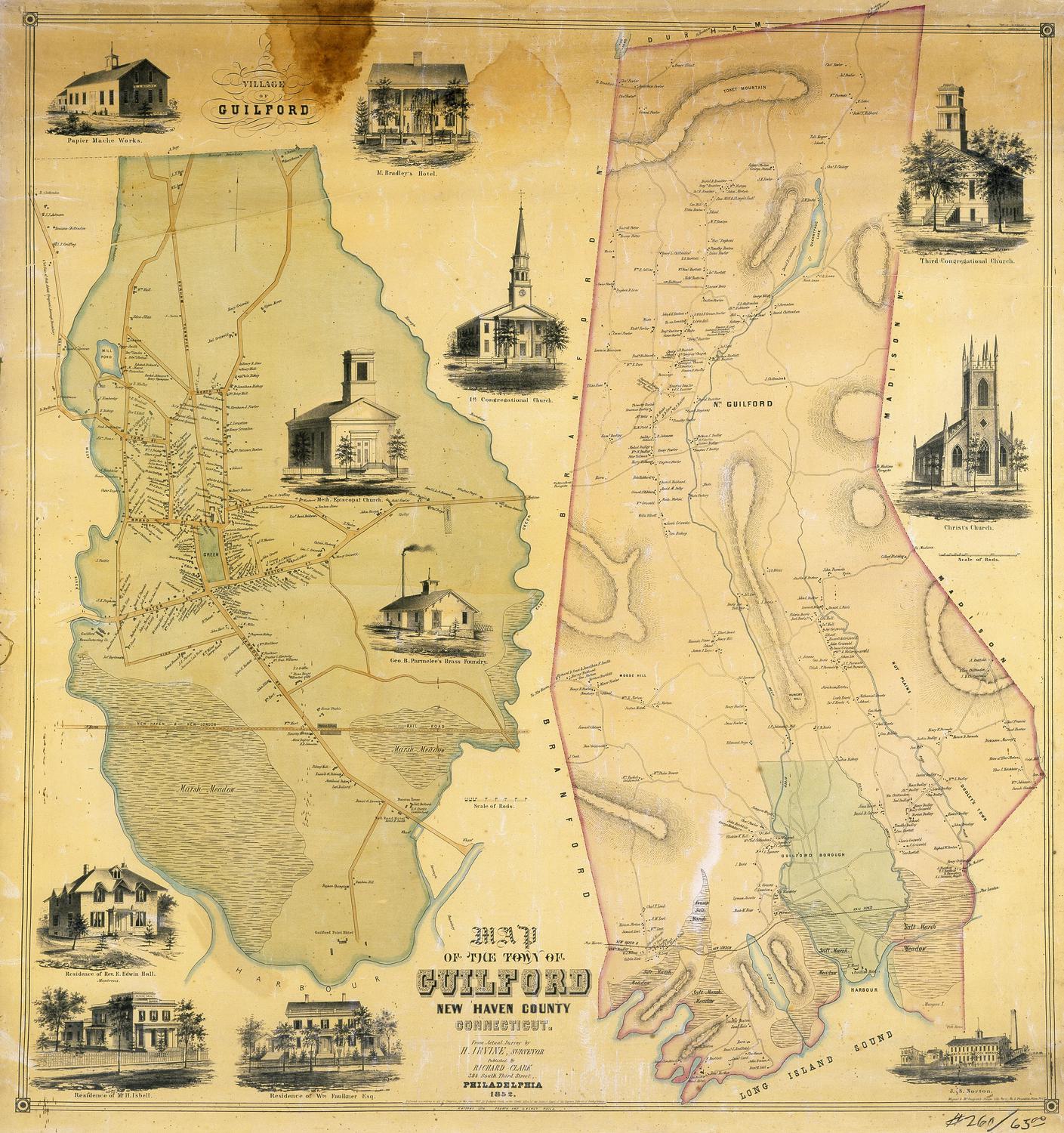
DescriptionMap of the town of Winchester, Connecticut, with Colebrook to the north, Barkhamsted to the east, Torrington to the south, and Goshen and Norfolk to the west. Geographical features include the Still River, the Mad River, Long Lake, and an unnamed pond. The terrain is hilly; elevation is conveyed by hachure marks. The Naugatuc (Naugatuck) Railroad terminates in the village of Winsted. Streets and buildings, with names of property owners are shown. A second detailed map below the main map shows "Winsted Villages." Several vignettes are superimposed on this lower map, while others overlap the main map. Vignettes depict the business block of E. S. Woodford, George Dudley's Store House, George Dudley's Tannery, Camp's Hall, Beardsley House (a hotel), a bank, a foundry and machine company, the Female Seminary (Rev. P. T. Holley, principal), and the residences of George Dudley, E. Beardsley, Moses Camp 2d., C. J. Camp, L. Hurlbut, W. Thayer, A. G. Kellogg, and John Boyd.
Label TextUntil about 1850, the town of Winchester, Connecticut, consisted of three distinct villages. Winchester Center was located in the southwestern part of town. Three miles to the northeast, Winsted was divided into two separate villages, East Village and West Village, with an uninhabited area in between known as the Flats. The name Winsted was a portmanteau word derived from the names of Winchester and the adjoining town of Barkhamsted. The coming of the Naugatuck Railroad to Winsted in 1849 unified East and West Village, since its depot was located in the Flats. This 1852 map already shows substantial development in this area, spurred by the railroad and the abundant water power provided by the Mad and Still Rivers. Winsted would become a booming industrial center in the later nineteenth century, while neighboring Winchester would remain a quiet country village.
NotesCartographic Note: One inche equals 80 rods (main map) One inch equals 20 rods (detail)Status
Not on view