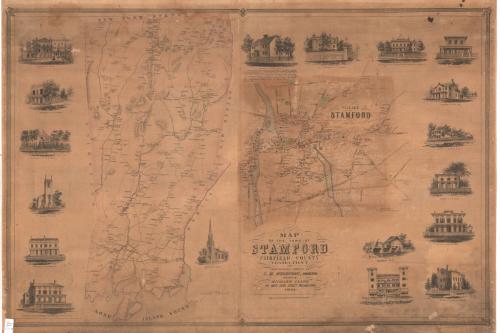
Map of the Town of Stamford, Fairfield County, Connecticut
SurveyorSurveyed by
E. M. Woodford
(American, 1824 - 1862)
PrinterPrinted by
Wagner & McGuigan
(American, 1845 - 1859)
PublisherPublished by
Richard Clark
(American)
Date1851
MediumLithography; black printer's ink and watercolor on paper
DimensionsPrimary Dimensions (image height x width): 34 3/8 x 51 7/8in. (87.3 x 131.8cm)
Sheet (height x width): 37 1/2 x 53in. (95.3 x 134.6cm)
ClassificationsGraphics
Credit LineConnecticut Museum of Culture and History collection
Object number2012.312.185
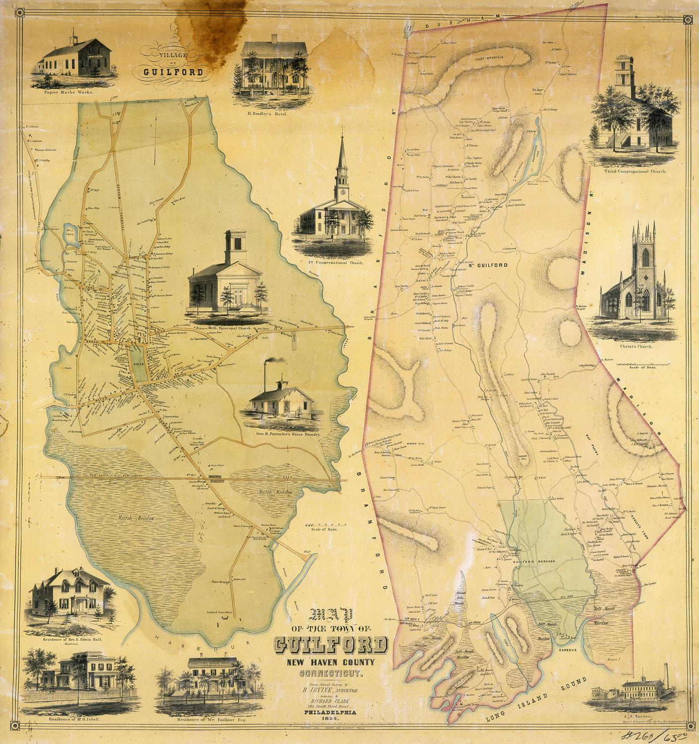
DescriptionPolitical and physical map of the town and village of Stamford consisting of two sheets. On the left is the town, extending from New York State to the north, New Canaan and Darien to the east, the Long Island Sound to the south, and Greenwich to the west. Buildings are represented by small black squares and roads by double lines. Elevation is denoted by hachure marks, while forests are represented by clusters of trees. On the right is the village, extending from North Street to the north, Clark and Elm Streets to the east, the New York and New Haven Railroad to the south, and Greenwich Street to the west. Buildings are shaded differently for residences and churches, and they are labeled with the owner's name. Burial grounds and parks are shaded green. The Mill River and a canal, both shaded blue, run through the village. On both maps, small clusters of horizontal lines are used to denote what are probably marshes; contour lines are used for water.
Arranged around the maps are eighteen vignettes, clockwise from the top of the right sheet: the residence of Thomas Read; the residence of J.D. Weeks; Stamford Classical English Boarding School, of which James Betts was the principal; Pond and Playford; the residence of William Gray; the residence of H.K. Skelding; the residence of Thomas Read; Rippowam Works; Union House; Episcopal House; Stamford Bank; the residence of J.S. Dodge; the residence of A.R. Moen; Baptist Church; the residence of A. Knowlton; and R.E. Rice's Classical & English Boarding School for Boys.
Arranged around the maps are eighteen vignettes, clockwise from the top of the right sheet: the residence of Thomas Read; the residence of J.D. Weeks; Stamford Classical English Boarding School, of which James Betts was the principal; Pond and Playford; the residence of William Gray; the residence of H.K. Skelding; the residence of Thomas Read; Rippowam Works; Union House; Episcopal House; Stamford Bank; the residence of J.S. Dodge; the residence of A.R. Moen; Baptist Church; the residence of A. Knowlton; and R.E. Rice's Classical & English Boarding School for Boys.
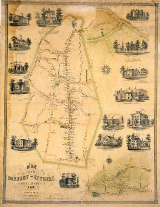
Label TextWhile most early maps of Connecticut towns were printed and published locally, by the mid-1800s, much of the prnting and publishing of Connecticut maps was being done out of state. Philadephia was a major center of lithography in this period, and the Philadephia publisher Richard Clark issued a number of town plans surveyed by E. M. Woodford and Lawrence Fagan in the early 1850s. This map of Stamford was among the earliest of these Connecticut town maps. The format, which included a border featuring separate small vignettes of important businesses and private residences would be come standard for this kind of map. The owners of these establishments paid extra to have their buildings depicted; being prominently featured on such a map was considered a good form of advertising. Stamford in 1851 was growing rapidly, but had yet to become a major manufacturing center. The population was increasing rapidly: 42 % in the 1840s, 45% in the 1850s. Within a very few years, this large, elaborate--and expensive--map would be out-of-date.
NotesCartographic Note: Scale for town of Stamford: 1 inch equals 100 rods. Scale for the village of Stamford: 1 1/2 inches equals 500 feetStatus
Not on view