
Parkville, with part of the West End, and one view of Avon
PhotographerPhotographed by
Unknown
Date1966-1970
MediumPhotography; color slides on plastic in cardboard mounts
DimensionsPrimary Dimensions (image height x width): 7/8 x 1 5/16in. (2.2 x 3.3cm)
Mount (height x width): 2 x 2in. (5.1 x 5.1cm)
Mount (height x width): 2 x 2in. (5.1 x 5.1cm)
ClassificationsGraphics
Credit LineGift of Ruth Goodale
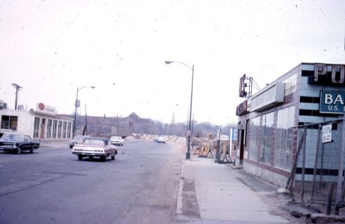
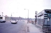
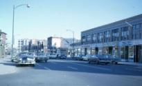
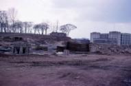
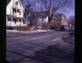
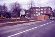
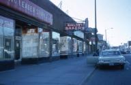
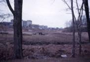
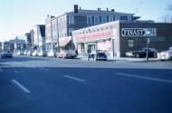
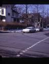
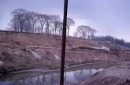
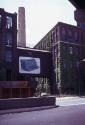
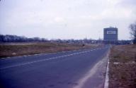
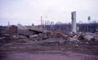
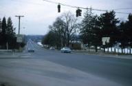
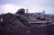
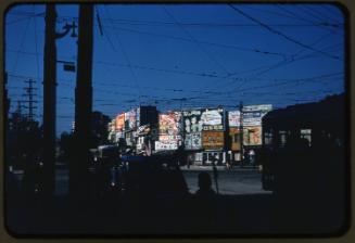
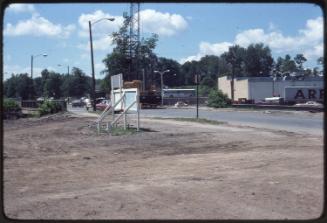
DescriptionColor slides document demolition and construction in Parkville and the West End Section of Hartford, showing the Park Street Development Area, the Pope Park Development Area, the Underwood Typewriter Factory, and other local businesses. Several slides were taken from near the New Park Avenue School; several others at the corner of Park Street and Newton Street. Another group of slides depicts construction near the junction of South Whitney Street and Capital Avenue in Hartford. Individual slides show construction at the corner of Quaker Lane and Prospect Street in West Hartford and a house about to be torn down at the corner of Waterville Road, Nod Road, and Route 44 in Avon.
Object number2006.44.1-.20
MarkingsDates are blind-stamped on mounts of most slidesInscribed2006.44.1, on verso, upper margin, in blue ink, "Looking East on Park St./ near underpass"; lower margin, in pencil, accession number2006.44.2, on verso, upper margin, in blue ink, "Looking West from / New Park Ave School / along Park St."; lower margin, in pencil, accession number
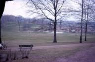
2006.44.3, on verso, upper margin, in blue ink, "Looking North-West / across Pope Park / from Park Terr. So. End"; lower margin, in pencil, accession number
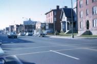
2006.44.4, on verso, upper margin, in blue ink, "Looking East on Park St./ from cor. Newton St. / 1967"; lower margin, in pencil, accession number
2006.44.5, on verso, upper margin, in blue ink, "Pope Park Dev. Area / Looking West / April 1966"; lower margin, in pencil, accession number
2006.44.6, on verso, upper margin, in blue ink, "Park St. Dev. Area"; lower margin, in pencil, accession number
2006.44.7, on verso, upper margin, in blue ink, "Pope Park Lt. / Dev. Area"; lower margin, in pencil, accession number
2006.44.8, on verso, upper margin, in blue ink, "Looking north on Park St. / from Newton St. / First Nat'l now Schwabs / 1967"; lower margin, in pencil, accession number
2006.44.9, on verso, upper margin, in blue ink, "Looking North on Park St. from New Park Ave School"; lower margin, in pencil, accession number
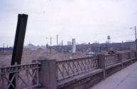
2006.44.10, on verso, upper margin, in blue ink, "View to South Cor. So. Whitney and Capitol"; lower margin, in pencil, accession number
2006.44.11, on verso, upper margin, in blue ink, "View to North down So. Whitney / corner So. Whitney & Capitol"; lower margin, in pencil, accession number
2006.44.12, on verso, upper margin, in blue ink, "View to N.W. cor. of / So. Whit & Capital before / construction of apts."; lower margin, in pencil, accession number
2006.44.13, on verso, upper margin, in blue ink, "Construction - So. Whitney / & Capital - looking So. East"; lower margin, in pencil, accession number
2006.44.14, on verso, upper margin, in blue ink, "Looking South-East / to Pope Park from / Park St. Dev. Area"; lower margin, in pencil, accession number
2006.44.15, on verso, upper margin, in blue ink, "Construction - cor. Capital / And So. Whitney / Looking west n."; lower margin, in pencil, accession number
2006.44.16, on verso, upper margin, in blue ink, "Underwood Typewriter / Co. before torn down / Aug. 1970"; lower margin, in pencil, accession number
2006.44.17, on verso, upper margin, in blue ink, "Park St. Dev. Area - / Factory Down"; lower margin, in pencil, accession number
2006.44.18, on verso, upper margin, in blue ink, "Looking West across / Park St. Dev. Area / Porcelain Plant"; lower margin, in pencil, accession number
2006.44.19, on verso, upper margin, in blue ink, "Corner Quaker La. / Looking toward Prospect / Ave and gas tank - / Fist Nat'l & Kings Dev. Area / W. Htfd. Conn."; lower margin, in pencil, accession number
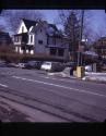
2006.44.20, on verso, upper margin, in blue ink, "Cor. Waterville Rd. / Nod Rd. & Rt. 44 looking w. / towards Avon Center. / House coming down / Winter 1966-67"; lower margin, in pencil, accession number
NotesDate Note: Most photographs are dated 1966, but a few are dated 1967 and one is dated 1970.
On View
Not on view
Graciela Quiñones-Rodriguez
2004 October
O.H. Bailey and Company