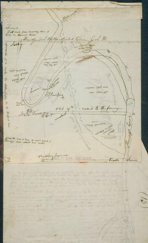
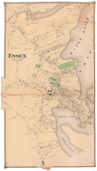
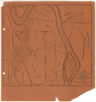
Diagram showing changes in the course of the Connecticut River.
ArtistDrawn by
John Warner Barber
American, 1798 - 1885
Dateprobably 1835
MediumDrawing; pencil on paper
DimensionsPrimary Dimensions (overall height x width): 12 3/16 x 7 1/2in. (31 x 19cm)
ClassificationsGraphics
Credit LineGift of Houghton Bulkeley
DescriptionMap showing the course of the Connecticut River between Hartford, East Hartford, Wethersfield and Glastonbury. The course in the 17th century is indicated by solid lines, wavy lines indicated its course in 1836. The Hockanum River is at the upper right and the locations of Keney's Cove, Keney's Island, Pratt's Ferry, the State Prison and the Meeting House are indicated. Notations include "heron shot here," "all worn over/ now good meadow," and "valuable fisheries now."
Object number1953.5.339
NotesSubject Note: Preliminary drawing for Connecticut Historical Collections, John Warner Barber, New Haven, 1836.On View
Not on view


8 July 2025

Sherman Wolcott Adams
1885