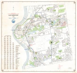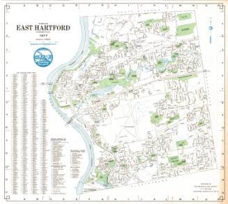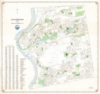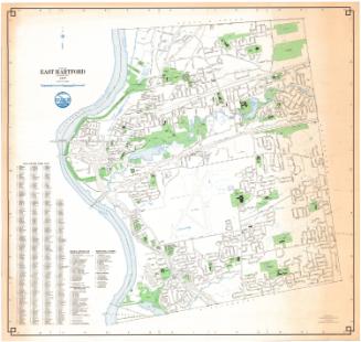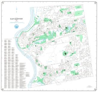
Geodetic and Topographical Survey Map of East Hartford, Connecticut
MakerPrepared by the
Metropolitan District Commission
American, founded 1929
Date1972
MediumLithography; colored printer's inks on wove paper
DimensionsPrimary Dimensions (image height x width): 29 x 29in. (73.7 x 73.7cm)
Sheet (height x width): 30 1/8 x 30 1/8in. (76.5 x 76.5cm)
Sheet (height x width): 30 1/8 x 30 1/8in. (76.5 x 76.5cm)
ClassificationsGraphics
Credit LineConnecticut Museum of Culture and History collection
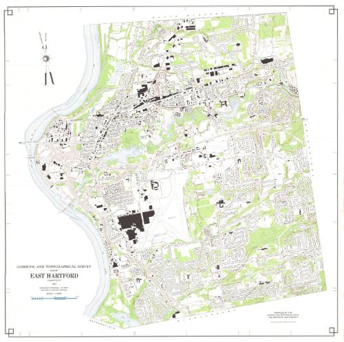
DescriptionMap of East Hartford, Connecticut, from the town line of South Windsor to the north, Manchester to the east, Glastonbury to the south, and the Connecticut River to the west. Highways and local roads are depicted and labeled, and schools, parks, cemeteries, golf courses, and "open spaces" are colored green, with water depicted in blue, including the Hockanum River, Keeney Cove, Porter Brook and several small unnamed bodies of water. Buildings are shown in black and contour intervals are shown in red. A compass pointing to magnetic north and true north is at upper left.
Object number1988.220.0
MarkingsOn verso, lower right, stamped in blue ink, "CtHi"InscribedOn recto, lower left, printed in black ink, "GEODETIC AND TOPOGRAPHICAL SURVEY / MAP OF EAST HARTFORD / CONNECTICUT / 1972 / CONTOUR INTERVAL 10 FEET / DATUM IS USC & GS DATUM / SCALE: 1:12000"; lower right, printed in black ink, "Metropolitan District Plane Coordinates"On verso, lower right, in pencil, "1988.220.0" "#088226"NotesCartographic Note: One inch equals 1000 feet
Collections
- Maps and Charts: Finding Your Place in Connecticut History
On View
Not on view