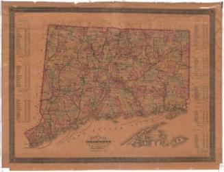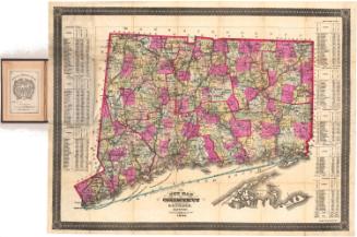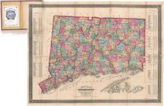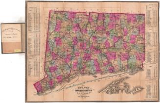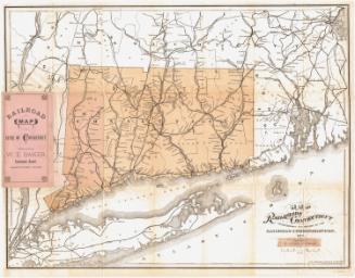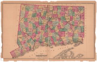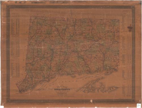
New Map of Connecticut
PublisherPublished by
Samuel D. Tilden
American, 1828 - 1893
PrinterPrinted by
Bingham & Dodd
1860 - 1878
Date1875
MediumLithography; printer's ink and watercolor on wove paper
DimensionsPrimary Dimensions (image height x width): 20 3/4 x 27 1/4 x 22 3/4 x 29 3/4in. (52.7 x 69.2 x 57.8 x 75.6cm)
ClassificationsGraphics
Credit LineGift of J. Coolidge Hills
DescriptionMap of Connecticut, from Massachusetts to the north, Rhode Island to the east, part of Long Island and the Long Island Sound to the south, and New York to the west. The state is divided into counties and towns, outlined and colored pink, green, or yellow. Natural features include lakes, rivers and islands, and roads are depicted. Railroad lines shown on the map include Portchester and Ridgefield; New York, New Haven and Hartford; Housatonic; Boston, Hartford and Erie; Connecticut Valley; Boston and New York Air Line; New London Northern; Connecticut Western; and Shore Line Railroads. On the left and right sides of the map are population tables for towns in each of the counties
Object number1909.6.1
MarkingsOn verso, on rectangular gummed label, typed in red ink, "Map / Rack / #58", typed in black ink, "Connecticut, 1875 / S. D. Tilden"; on circular gummed label, in pencil, "MAP / RACK / #58"InscribedOn recto, lower center, printed in black ink, "NEW MAP / OF / CONNECTICUT"On verso, upper left, in red ink, "21396"NotesCartographic Note: One inch equals four and a half miles
Collections
- Maps and Charts: Finding Your Place in Connecticut History
On View
Not on view