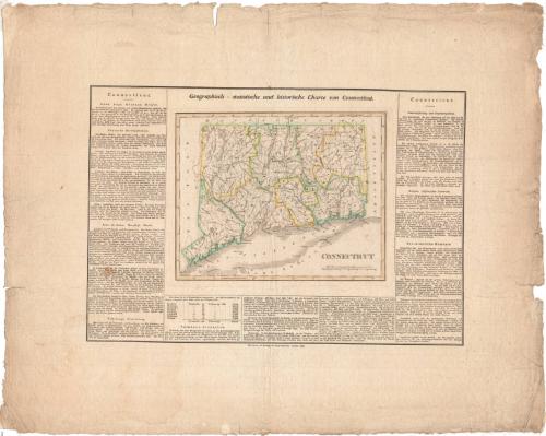
Geographisch-statistische und historische Charte von Connecticut
PrintmakerEngraved by
Carl Ferdinand Weiland
German, 1782 - 1847
After a work byAfter a work by
Fielding Lucas Jr.
American, 1781 - 1854
PublisherPublished by
Geographisches Institut (Weimar, Thuringia, Germany)
German, founded 1804
Date1825
MediumEngraving; printer's ink and watercolor on wove paper
DimensionsPrimary Dimensions (image height x width): 14 x 20 5/8in. (35.6 x 52.4cm)
Sheet (height x width): 23 3/4 x 28 3/8in. (60.3 x 72.1cm)
Sheet (height x width): 23 3/4 x 28 3/8in. (60.3 x 72.1cm)
ClassificationsGraphics
Credit LineGift of Ward W. Jacobs
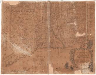
DescriptionMap of Connecticut, with New York to the west, Massachusetts to the north, Rhode Island to the east, and Long Island Sound and Long Island to the south. Towns, counties, some rivers, and some roads are shown. The map is surrounded by a long descriptive text in German.
Object number1912.6.1
InscribedOn recto, upper center, in black ink, "Geographisch-statistische und historische Charte von Connecticut"On verso, upper center, in red ink, "23425"; upper right, in pencil, "254"NotesCartographic Note: 15 miles to a degree
Collections
- Maps and Charts: Finding Your Place in Connecticut History
On View
Not on view


H. F. Sumner & Co.
1833


Joel Knott Allen
1792
Joel Knott Allen
1791 or 1792