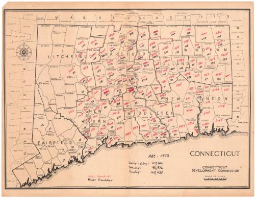
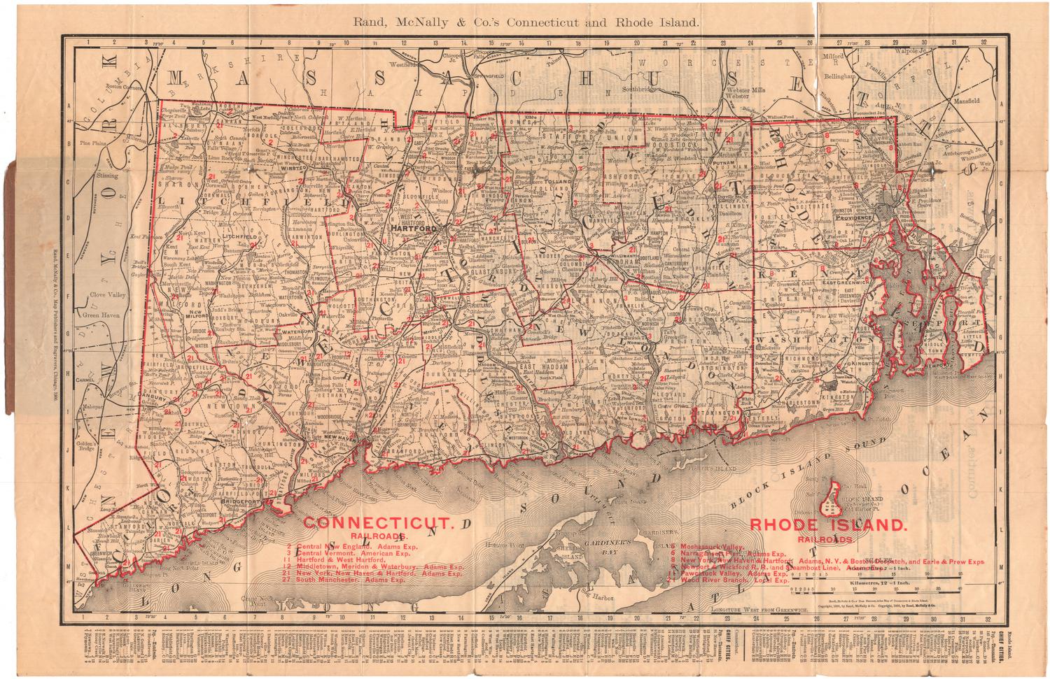
Connecticut
PublisherPublished by
Connecticut Development Commission
American, founded 1939
Datepossibly 1973
MediumLithograph; black printer's ink on wove paper
DimensionsPrimary Dimensions (image height x width): 15 5/8 x 21 1/4in. (39.7 x 54cm)
Sheet (height x width): 17 x 22in. (43.2 x 55.9cm)
Sheet (height x width): 17 x 22in. (43.2 x 55.9cm)
ClassificationsGraphics
Credit LineConnecticut Museum of Culture and History collection
DescriptionMap of Connecticut, with Massachusetts to the north, Rhode Island to the east and New York to the west. The Long Island Sound is not labeled. The state is divided into counties and towns, all of which are labeled. The Housatonic, Connecticut and Thames Rivers are depicted. Many of the towns have been annotated with numbers in red and black representing the number of households and "circulation."
Object number2007.79.0
MarkingsVerso, center, stamped in red ink: "CtHi"InscribedRecto, bottom right, printed in black ink: "CONNECTICUT"Bottom right, printed in black ink: "CONNECTICUT / DEVELOPMENT COMMISSION"
Bottom center, handwritten in black ink: "ABC = 1973 / Daily = 5 Day = 107, 542 / SAtuRdAy = 95, 976 / SuNdAy = 108, 438"
Bottom left, handwritten in red and black ink: "Red = Households [in red] / BlAck = CiRculAtioN [in black]"
Most of the towns have two numbers written on them, one in red and one in black, representing households and circulation
Verso, center, handwritten in pencil: "99697"NotesCartographic Note: Scale: 1 7/8 inches equals 10 miles
Date Note: The number "1973" which appears on the map may not be a date; the map may actually date from much earlier. The Connecticut Devlopment Commission, which issued the map became the Connecticut Development Authority in 1973.
Collections
- Maps and Charts: Finding Your Place in Connecticut History
On View
Not on view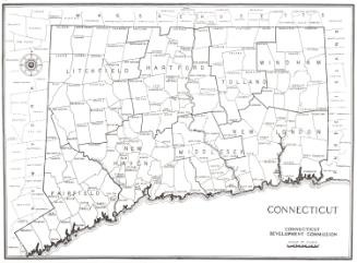


Object/Object