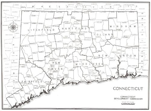
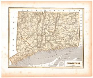
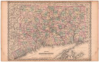
Connecticut
DistributorDistributed by
Connecticut Development Commission
American, founded 1939
Datebefore 1973
MediumLithography; black printer's ink on wove paper
DimensionsPrimary Dimensions (image height x width): 15 5/8 x 21 1/4in. (39.7 x 54cm)
Sheet (height x width): 16 1/8 x 21 7/8in. (41 x 55.6cm)
Sheet (height x width): 16 1/8 x 21 7/8in. (41 x 55.6cm)
ClassificationsGraphics
Credit LineGift of Connecticut National Bank
DescriptionMap of Connecticut, with Massachusetts to the north, Rhode Island to the east, and New York to the west. The coastline of Connecticut is shown, but the Long Island Sound is not identified. The state is divided into counties, outlined in thick solid lines and labeled, and towns, outlined in thin solid lines and labeled. The Housatonic, Connecticut, Naugatuck and Thames Rivers are depicted and labeled.
Object number1992.141.0
MarkingsRecto, top left, printed in black ink on sticker: "MAPS / Box / 214"Verso, center, stamped in blue ink: "CtHi"InscribedRecto, bottom right, printed in black ink: "CONNECTICUT / CONNECTICUT / DEVELOPMENT COMMISSION"
Verso, top left, handwritten in pencil: "Maps / Flat / 124"
Center, handwritten in pencil: "91290"NotesCartographic Note: Scale: 1 7/8 inches equals 10 miles
Collections
- Maps and Charts: Finding Your Place in Connecticut History
On View
Not on view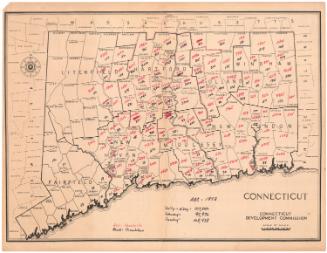


Object/Object