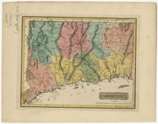
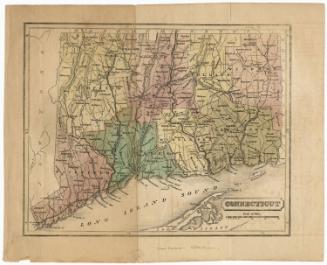
Connecticut
PrintmakerEngraved by
George W. Boynton
1809 - 1884
PublisherPublished by
Samuel G. Goodrich
American, 1793 - 1860
Date1835
MediumEngraving; black printer's ink on paper
DimensionsPrimary Dimensions (image height x width): 4 1/4 x 5 7/8in. (10.8 x 14.9cm)
Sheet (height x width): 5 x 7in. (12.7 x 17.8cm)
Sheet (height x width): 5 x 7in. (12.7 x 17.8cm)
ClassificationsGraphics
Credit LineGift of William C. Conklin
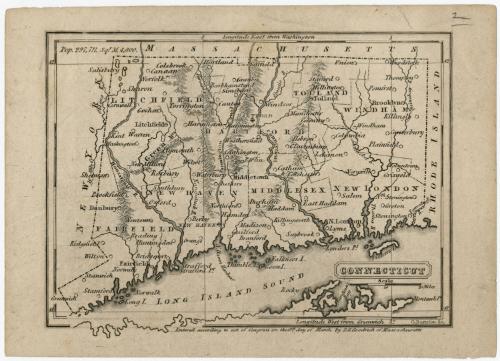
DescriptionMap of Connecticut, with Massachusetts to the north, Rhode Island to the east, part of Long Island and the Long Island Sound to the south, and New York to the west. The state is divided into counties, labeled and delineated with dotted lines. Population centers appear to be marked with circles, and New Haven and Hartford with circles inscribed with crosses, denoting capital cities. Elevation is depicted with hachure marks. Rivers, lakes and ponds, points and islands are depicted and most of them are labeled.
Object number1971.71.12
MarkingsVerso, center, stamped in blue ink: "CtHi"InscribedRecto, top left, printed in black ink: "Pop. 297,711 Sqr. M. 4,800."Bottom right, printed in black ink: "CONNECTICUT"
Bottom right, printed in black ink: "G. Boynton, Sc."
Bottom right, printed in black ink: "Entered according to act of Congress on this 9th day of March by S.G. Goodrich of Massachusetts"
Verso, top left, handwritten in pencil: "1 [circled]"
Center, handwritten in pencil: "82343"
Bottom left, handwritten in pencil: "Map Box / 148"
Bottom right, handwritten in pencil: "82343"
NotesCartographic Note: Scale: 1/2 inch equals 10 miles
Collections
- Maps and Charts: Finding Your Place in Connecticut History
On View
Not on view
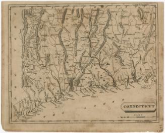


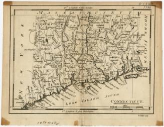

H. F. Sumner & Co.
1833