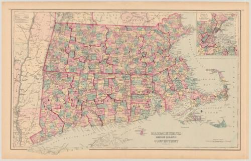
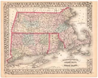
Massachusetts, Rhode Island and Connecticut
PrintmakerEngraved by
J. M. Atwood
American, active about 1840 - 1875
PublisherPublished by
Frank A. Gray
American, 1852 - 1886
Date1875
MediumLithography; black and colored printer's inks on wove paper
DimensionsPrimary Dimensions (image height x width): 15 3/8 x 25 3/8in. (39.1 x 64.5cm)
Sheet (height x width): 17 1/4 x 27 1/8in. (43.8 x 68.9cm)
Sheet (height x width): 17 1/4 x 27 1/8in. (43.8 x 68.9cm)
ClassificationsGraphics
Credit LineMuseum purchase
DescriptionMap of Massachusetts, Rhode Island, and Connecticut, with part of New York to the west, parts of Vermont and New Hampshire to the north, the Atlantic Ocean to the east, and the Atlantic Ocean, Block Island, Long Island Sound and part of Long Island to the south. Counties, cities, towns, major rivers, and railroads are shown. The locations of light ships and lighthouses are indicated. An inset map of the Environs of Boston is at the upper right.
Object number1982.129.4
MarkingsOn verso, stamped in purple ink, "THE CONNECTICUT / 82005 / HISTORICAL SOCIETY" "CtHi"InscribedOn recto, lower right, printed in black ink, "MASSACHUSETTS / RHODE ISLAND / AND / CONNECTICUT"On verso, upper center, in pencil, "Map Box / 136"; lower left, in pencil, "Map Box / 136"; lower right, in pencil, "1072: :1982.129.4"NotesCartographic Note: 1 inch = 9 miles
Medium Note: Although J. M. Atwood appears as the engraver of this map, Atwood's engraving would have been reproduced using transfer lithography.
Collections
- Maps and Charts: Finding Your Place in Connecticut History
On View
Not on view


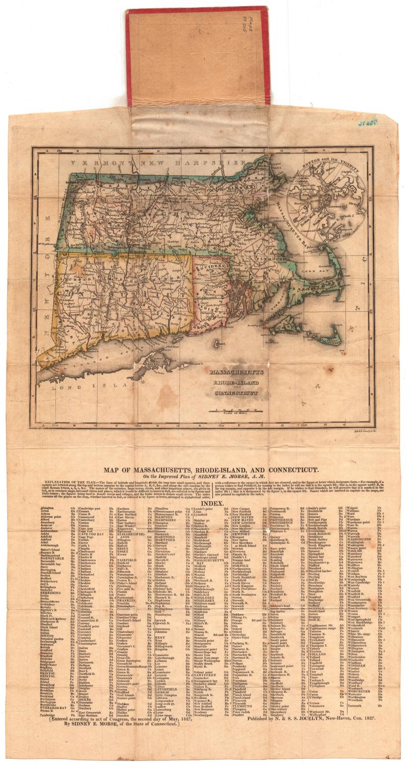
H. F. Sumner & Co.
1833