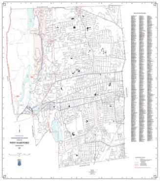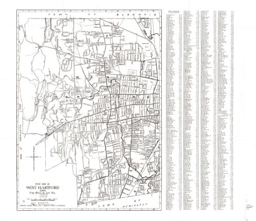
New map of West Hartford, Conn.
PublisherPublished by
Price & Lee Co.
American
DateProbably 1966
MediumLithography; printer's ink on wove paper
DimensionsPrimary Dimensions (West Hartford height x width): 19 x 13 3/4in. (48.3 x 34.9cm)
Primary Dimensions (Farmington height x width): 13 1/2 x 19 3/8in. (34.3 x 49.2cm)
Sheet (height x width): 21 x 24in. (53.3 x 61cm)
Primary Dimensions (Farmington height x width): 13 1/2 x 19 3/8in. (34.3 x 49.2cm)
Sheet (height x width): 21 x 24in. (53.3 x 61cm)
ClassificationsGraphics
Credit LineConnecticut Museum of Culture and History collection
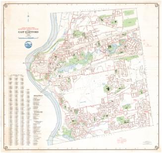
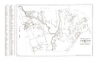
DescriptionMap of West Hartford, Connecticut with Bloomfield to the north, Farmington to the west, and Newington to the south. A "West Hartford Street Finder" at the right provides a key for locating streets. Map shows "Passable Streets Only - Proposed Street Eliminated." A four-point compass rose is at the lower left.
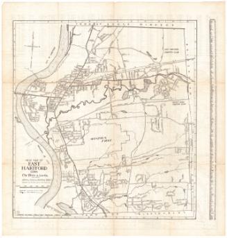
On verso: Map of Farmington, Connecticut with Avon to the north, West Hartford to the east, New Britain and Plainville to the south, and Bristol and Burlington to the west. A "Farmington Street Finder" at the left provides a key for locating streets. Map shows "Passable Streets Only - Proposed Street Eliminated." A four-point compass rose is at the left.
On verso: Map of Farmington, Connecticut with Avon to the north, West Hartford to the east, New Britain and Plainville to the south, and Bristol and Burlington to the west. A "Farmington Street Finder" at the left provides a key for locating streets. Map shows "Passable Streets Only - Proposed Street Eliminated." A four-point compass rose is at the left.
Object number2012.312.238
InscribedOn recto, lower left, printed in black ink, "NEW MAP OF / WEST HARTFORD / CONN."On verso, lower right, "NEW MAP OF / FARMINGTON / CONN."NotesCartographic Note: 2 1/8 inches = 4000 feet
Collections
- Maps and Charts: Finding Your Place in Connecticut History
On View
Not on view