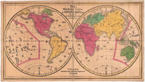
Eastern and Western Hemispheres
PrinterPrinted by
Mather, Case, Tiffany & Burnham
American, active 1841
Date1841
MediumLithography; black printer's ink and watercolors on paper, lined with linen
DimensionsPrimary Dimensions (image height x width): 27 1/8 x 48 3/4in. (68.9 x 123.8cm)
Sheet (height x width): 28 1/2 x 50in. (72.4 x 127cm)
Mount (height x width): 29 x 50 1/4in. (73.7 x 127.6cm)
Sheet (height x width): 28 1/2 x 50in. (72.4 x 127cm)
Mount (height x width): 29 x 50 1/4in. (73.7 x 127.6cm)
ClassificationsGraphics
Credit LineConnecticut Museum of Culture and History collection
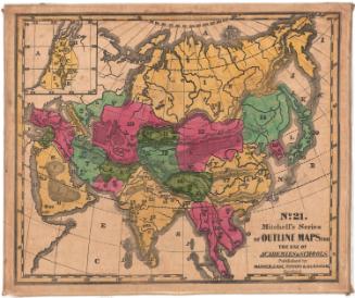
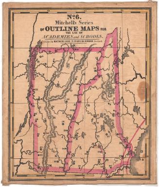
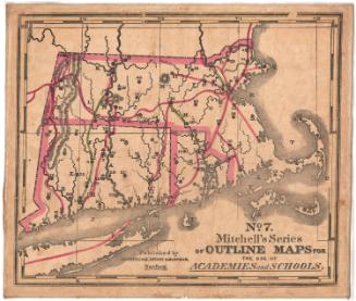
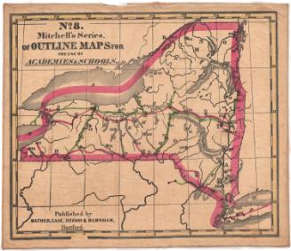
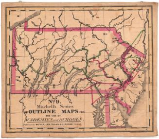
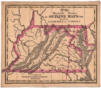
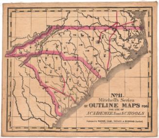
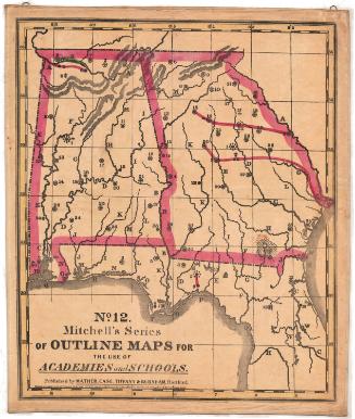
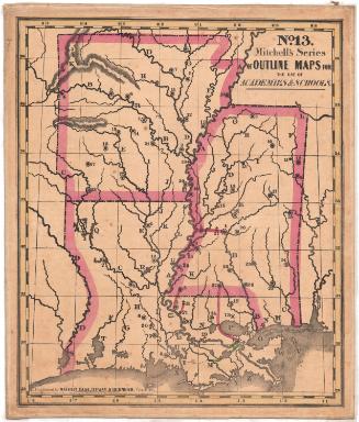
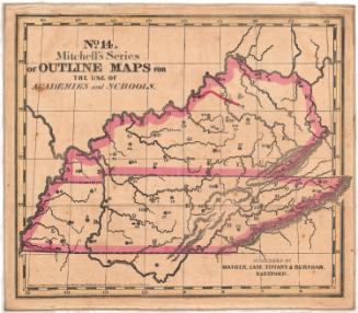
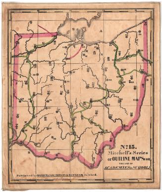
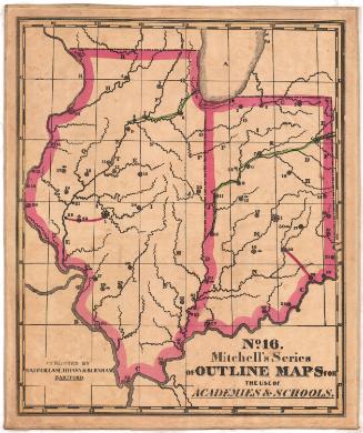
DescriptionMap of the world, divided into the western and eastern hemispheres.The continents are outlined and colored. There are numbers and letters on the land and water areas that correspond with information in the key, published separately from the map.
Object number2012.312.222.1
InscribedRecto, top center, printed in black ink: "No. 1 / Mitchell's Series / OF OUTLINE MAPS FOR / THE USE OF / ACADEMIES AND / SCHOOLS."Bottom center, printed in black ink: "Published by / MATHER, CASE, TIFFANY & BURNHAM. / Hartford."
Bottom center, printed in black ink: "Entered according to Act of Congress in the year 1841 by S. Augustus Mitchell, in the Clerk's Office of the district court of the eastern district of Pennsylvania"NotesCartographic Note: No scale
Subject Note: In 1845, Second North School in Hartford, Connecticut, had a set Mitchell's Series of Outline Maps for use in the teaching of geography. In 1858, five Hartford school districts had outline maps, but it is not clear if these were Mitchell's maps or the products of some other map publisher. These maps appear to have been commonly used and it seems like that many other Hartford and Connecticut schools of this period had and used them.
Subject Terms
Collections
- Maps and Charts: Finding Your Place in Connecticut History
On View
Not on view