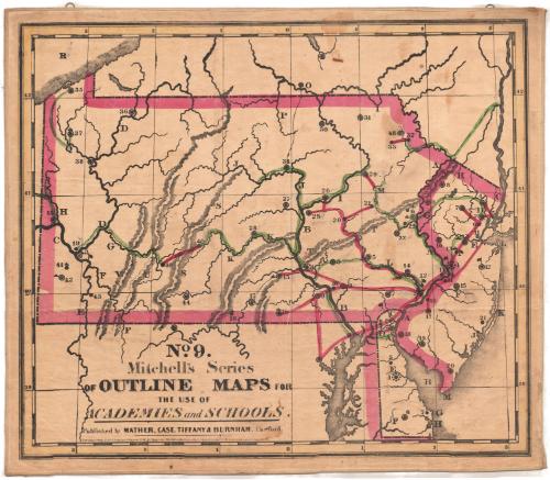
New Jersey / Pennsylvania / Delaware
PrinterPrinted by
Mather, Case, Tiffany & Burnham
American, active 1841
Date1841
MediumLithography; black printer's ink and watercolor on paper, lined with linen
DimensionsPrimary Dimensions (image height x width): 23 1/4 x 27 1/2in. (59.1 x 69.9cm)
Sheet (height x width): 24 1/2 x 28 3/8in. (62.2 x 72.1cm)
Mount (height x width): 24 7/8 x 28 7/8in. (63.2 x 73.3cm)
Sheet (height x width): 24 1/2 x 28 3/8in. (62.2 x 72.1cm)
Mount (height x width): 24 7/8 x 28 7/8in. (63.2 x 73.3cm)
ClassificationsGraphics
Credit LineConnecticut Museum of Culture and History collection
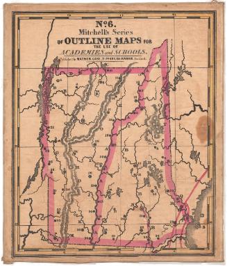
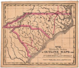
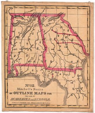
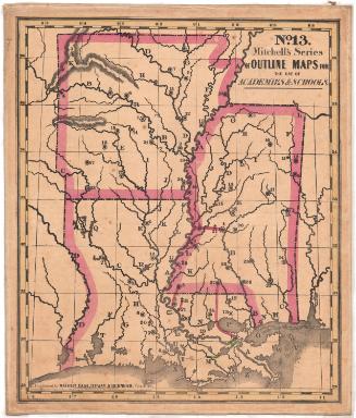
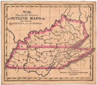
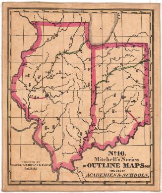
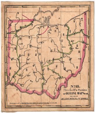
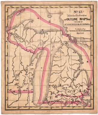
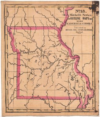
DescriptionMap of New Jersey, Pennsylvania and Delaware. The boundary lines are marked with broken solid lines and pink watercolor. There are several solid black lines that have been colored red or green. None of the places on the map are labeled; instead, there are numbers and letters, some marked with circles, that correspond with information in the key, published separately from the map. Natural features include elevation, conveyed with hachure marks, and rivers.
Object number2012.312.222.7
InscribedRecto, bottom left, printed in black ink: "No. 9. / Mitchell's Series / OF OUTLINE MAPS FOR / THE USE OF / ACADEMIES and SCHOOLS. / Published by MATHER, CASE, TIFFANY & BURNHAM. Hartofrd. / Entered according to Act of Congress, in the year 1841, by S. Augustus Mitchell in the Clerk's office of the district court of the eastern district of Pennsylvania."Various inscriptions in pencil across the map, mostly near the letters and numbers
Bottom right, handwritten in pencil: "Jason"
Bottom right, handwritten in pencil: "Jason Hatch"
Bottom right corner, handwritten in pencil: "Hatch"NotesCartographic Note: No scale
Collections
- Maps and Charts: Finding Your Place in Connecticut History
On View
Not on view