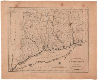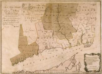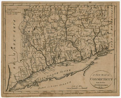
A New Map of Connecticut from the best Authorities
PrintmakerEngraved on wood by
Alexander Anderson
American, 1775 - 1870
PublisherPublished by
John Low
American, 1763 - 1809
Date1799
MediumEngraving; black printer's ink on laid paper
DimensionsPrimary Dimensions (image height x width): 7 7/16 x 9 1/4in. (18.9 x 23.5cm)
Sheet (height x width): 7 7/8 x 9 3/4in. (20 x 24.8cm)
Sheet (height x width): 7 7/8 x 9 3/4in. (20 x 24.8cm)
ClassificationsGraphics
Credit LineConnecticut Museum of Culture and History collection
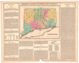
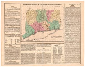
DescriptionMap of Connecticut, with the border of Massachusetts to the north, Rhode Island to the east, the Long Island Sound to the south, and New York to the west. Connecticut's counties are labeled and outlined in broken solid lines, while towns, also labeled, are outlined in dotted lines. Between New York and Connecticut, there is a piece of land separated by broken solid lines marked "Oblong." Elevation is conveyed through small triangle-shaped peaks, and many of the bays, harbors and points along the shoreline are labeled. Symbols denote the locations of court houses and churches and other places of public worship, as defined by the Explanation, found in the top left corner.
Object number2012.312.73
MarkingsRecto, top left, printed in black ink on sticker: "Map Box / 236 / c. 2"Verso, center, stamped in blue ink: "CtHi"InscribedRecto, top left, printed in black ink: "Explanation / Court Houses / Churches and other houses / of public worship."
Bottom right, printed in black ink: "A NEW MAP OF / CONNECTICUT / from the best / AUTHORITIES. / 1799"
Bottom left, printed in black ink: "A. Anderson, del."
Bottom center, printed in black ink: "Engraved for New Encyclopaedia, Published by J. Low, N. York."NotesCartographic Note: 1 5/8" equals 20 miles
Collections
- Maps and Charts: Finding Your Place in Connecticut History
On View
Not on view