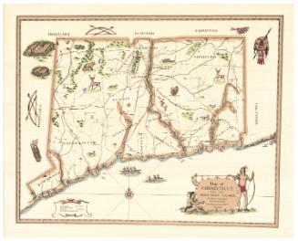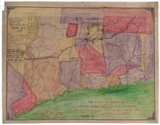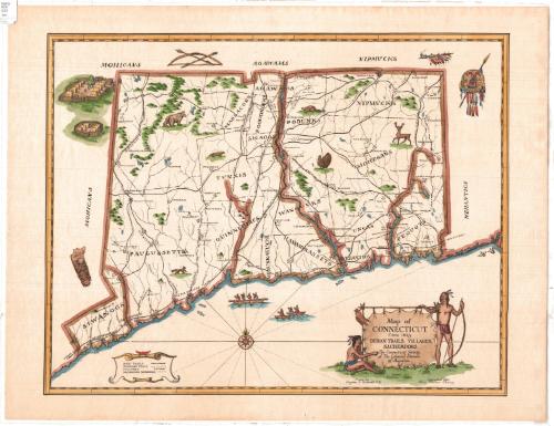
Map of Connecticut circa 1625: Indian Trails, Villages, Sachemdoms
MakerCompiled by
Mathias Spiess
American, 1873 - 1959
DraftsmanDrawn by
Hayden L. Griswold
American, 1892 - 1985
MakerCopyrighted by
Mary Caroline Ogden Pierson
American, 1874 - 1949
Date1930
MediumDrawing; ink and watercolor on wove paper
DimensionsPrimary Dimensions (image height x width): 17 3/8 x 22in. (44.1 x 55.9cm)
Sheet (height x width): 19 7/8 x 25 3/4in. (50.5 x 65.4cm)
Sheet (height x width): 19 7/8 x 25 3/4in. (50.5 x 65.4cm)
ClassificationsGraphics
Credit LineConnecticut Museum of Culture and History collection
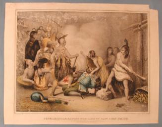
DescriptionManuscript map of Connecticut circa 1625, divided into Native American sachemdoms and showing trails and villages. The tribes whose names appear on the map are the Siwanogs, Paugussetts, Quinnipiacs, Tunxis, Massacoes, Agawams, Sicaogs, Poquonocks, Podunks, Wangunks, Menunkatucks, Hammonassetts, Nipmucks, Mohegans, Uncas, Nehantics and Pequots. Elevation is conveyed through drawings of groups of hills. A bear, beaver, turkey, deer, fox and what appears to be an otter are depicted on the map. Around it are a baby on a cradleboard, fenced-in clusters of wigwams, a bow and two arrows, a pipe decorated with feathers, and a decorated shield and spear. Tribal names also appear outside of the borders of Connecticut, and probably refer to the tribes that lived in what is now New York, Massachusetts and Rhode Island: Mohicans, Agawams, Nipmucks and Nehantics. Native Americans in three dugout canoes appear below the landmass, in what is unlabeled Long Island Sound. The cartouche depicts the title on a stretched skin, with two Native Americans on either side, dressed in loinclothes and wearing feathers in their hair. The one on the right is standing and holds a bow. In the lower left corner is a legend that explains the lines and symbols representing main and secondary trails, villages and sachemdom boundaries.
Object number2012.312.54
MarkingsRecto, top left corner, printed in black ink on sticker: "MAPS / Box / 233"InscribedRecto, bottom right, handwritten in black ink: "Map of / CONNECTICUT / Circa 1625 / INDIAN TRAILS, VILLAGES, / SACHEMDOMS / The Connecticut Society / of The Colonial Dames / of America / Compiled by / Mathias Spiess / Drawn by / Hayden L. Griswold C.E. / Copyrighted 1930 / Mary Pierson Cheney"NotesCartographic Note: No scaleCollections
- Maps and Charts: Finding Your Place in Connecticut History
On View
Not on view