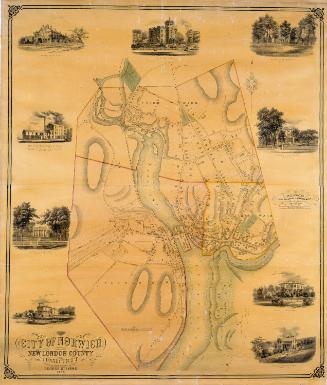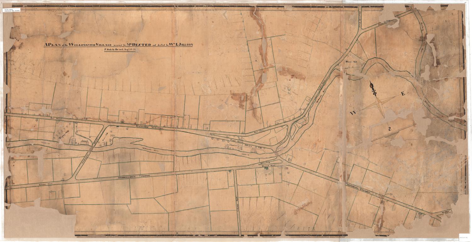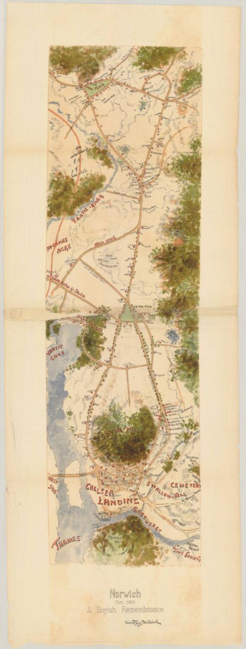
Norwich, circa 1830: A Boyish Remembrance
DraftsmanBased on writings by
Donald Grant Mitchell
American, 1822 - 1908
PrinterPrinted by
Heliotype Printing Co.
American, 1872 - 1908
Dateafter 1872
MediumPhotomechanical prints; heliotype on paper
DimensionsPrimary Dimensions (image height x width): 20 13/16 x 6 1/8in. (52.9 x 15.6cm)
Sheet (height x width): 25 3/4 x 9 7/16in. (65.4 x 24cm)
Sheet (height x width): 25 3/4 x 9 7/16in. (65.4 x 24cm)
ClassificationsGraphics
Credit LineConnecticut Museum of Culture and History collection
DescriptionMap of Norwich, Connecticut, with "Up-Town Plain" to the north, a stand of trees to the east, the Thames and Shetucket rivers to the south, and Yantic Cove to the west. The names of villages and physical features such as hills and rivers, and local roads with red squares on them indicating residences, public buildings and businesses are marked on the map in red. Notable landmarks include "an interloping r.r. of late date," "No-Mans Acre," "Savin-Hill," and "Chelsea Landing." Elevation is conveyed with hachure marks.
Object number2012.312.37
MarkingsRecto, top left, printed in black ink on sticker: "MAPS / Box / 265"Verso, bottom, handwritten on sticker: "1064"InscribedRecto, bottom, in black ink: "Norwich / Circ. 1830 / A Boyish Remembrance / Don [illegible] Mitchell"NotesCartographical Note: No scale
Collections
- Maps and Charts: Finding Your Place in Connecticut History
On View
Not on view