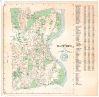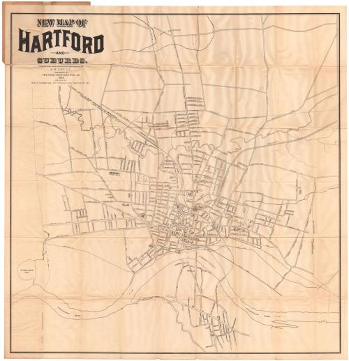
New Map of Hartford and Suburbs
MakerPossibly compiled by
Luther W. Burt
(American, 1848 - 1921)
PublisherPublished by the
New York Map Publishing Company
(American, 1896 - 1898)
Date1898
MediumLithography; black printer's ink on wove paper in paper covers
DimensionsPrimary Dimensions (image height x width): 31 1/2 x 30 3/4in. (80 x 78.1cm)
Sheet (height x width): 32 3/4 x 31 3/4in. (83.2 x 80.6cm)
Sheet (height x width): 32 3/4 x 31 3/4in. (83.2 x 80.6cm)
ClassificationsGraphics
Credit LineConnecticut Museum of Culture and History collection
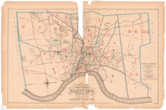
DescriptionMap of the city of Hartford, oriented east-west on the sheet so that the Connecticut River appears at the bottom. City streets are labeled, as are some buildings, shown as shaded rectangles. Most of the buildings are hospitals, schools, hotels, churches, and libraries. The New York and New England and New York, New Haven and Hartford Railroad lines run through the center of town. The Park River, Connecticut River and Wethersfield Cove are the physical features depicted.
Object number1985.214.0
NotesCartographic Note: No scale
Constituent Note: Although the name "G. W. Burt" appears on the map itself, the name "L. W. Burt" appears on the printed covers. Luther W. Burt was a civil engineer active in Hartford. No trace of G. W. Burt has been found, so it is possible that name is in error.On View
Not on view