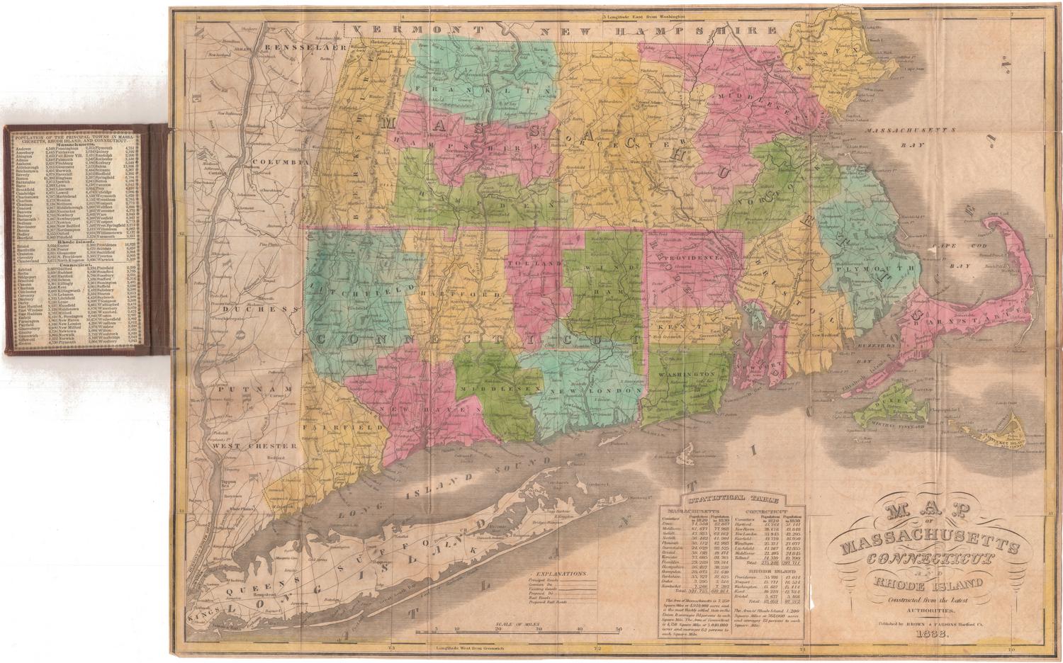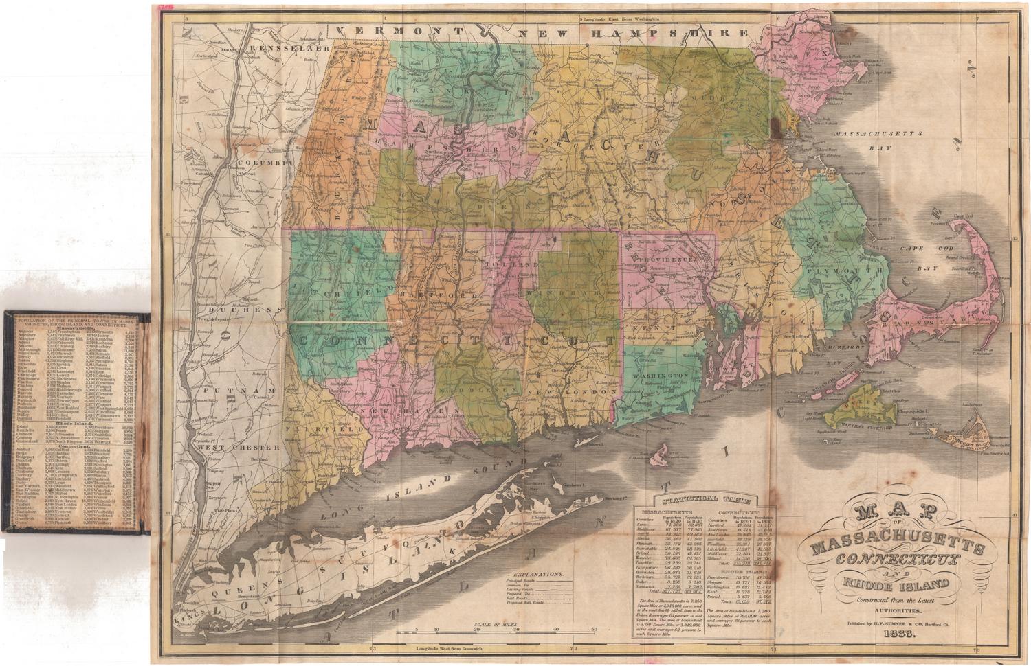
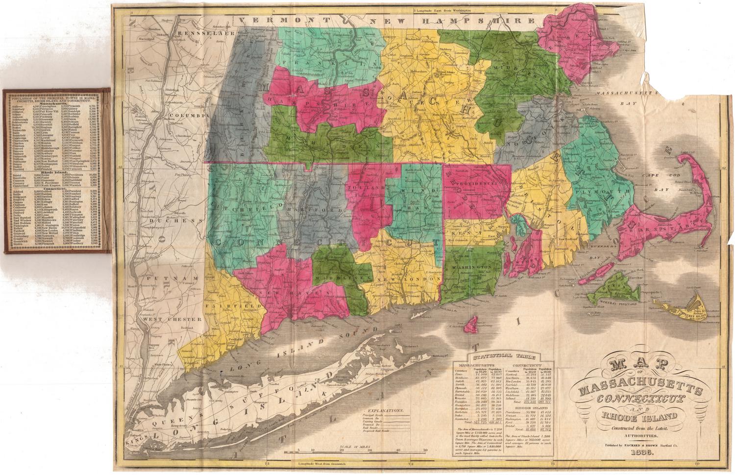
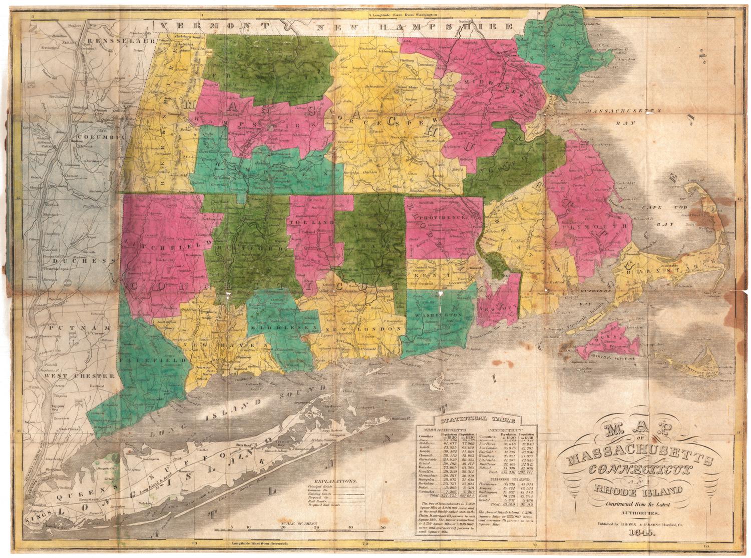
Map of Massachusetts, Connecticut and Rhode Island, Constructed from the Latest Authorities
PublisherPublished by
H. F. Sumner & Co.
(American, active 1832 - 1848)
Date1833
MediumEngraving; black printer's ink and watercolor on wove paper, lined with tissue, in cardboard covers
DimensionsPrimary Dimensions (image height x width): 15 1/8 x 19 7/8in. (38.4 x 50.5cm)
Sheet (height x width): 15 1/4 x 20 1/8in. (38.7 x 51.1cm)
Mount (height x width): 15 1/4 x 20 1/8in. (38.7 x 51.1cm)
ClassificationsGraphics
Credit LineConnecticut Museum of Culture and History collection
Object number1949.20.1
DescriptionPocket map of Massachusetts, Connecticut and Rhode Island, with parts of Vermont and New Hampshire to the north, the Massachusetts Bay to the east, Long Island and the Long Island Sound to the south, and part of New York to the west. The states are divided into counties, which are colored blue, green, pink or peach. Main and common roads, existing and proposed canals, and existing and proposed railroads are shown. The Farmington, Hampshire and Hampden, Blackstone, and Middlesex Canals are the existing canals depicted on the map, with one proposed canal between Weymouth and Taunton, Massachusetts. Although existing railroads are listed in the Explanations, there do not appear to be any shown on the map. There is a proposed railroad between Albany, New York, and Boston, Massachusetts. Physical features depicted include elevation, conveyed through hachure marks; rivers; and lakes. At the bottom of the sheet is a statistical table containing population information for counties in the three states for 1820 and 1830. The inside front cover also contains population information, for the towns.
Label TextH. F. Sumner & Co. was a printer, publisher, and bookseller active in Hartford, Connecticut from 1832 to 1834. Sumner was one of several Hartford firms publishing maps as well as prints and books at this time. Folding pocket maps like this one were frequently issued by booksellers and stationers and were presumably sold in the booksellers' own shops to local customers.
NotesCartographic Note: Scale: 1 inch equals about 10 1/2 milesStatus
Not on view
H. F. Sumner & Co.
1833