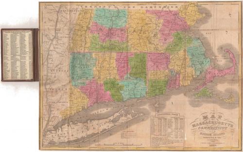
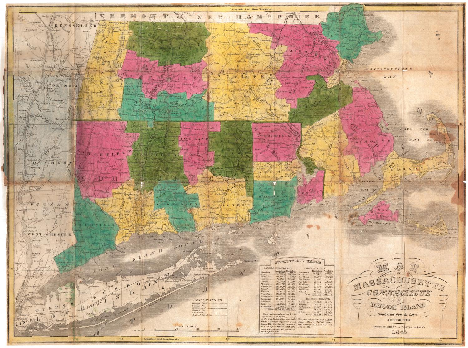
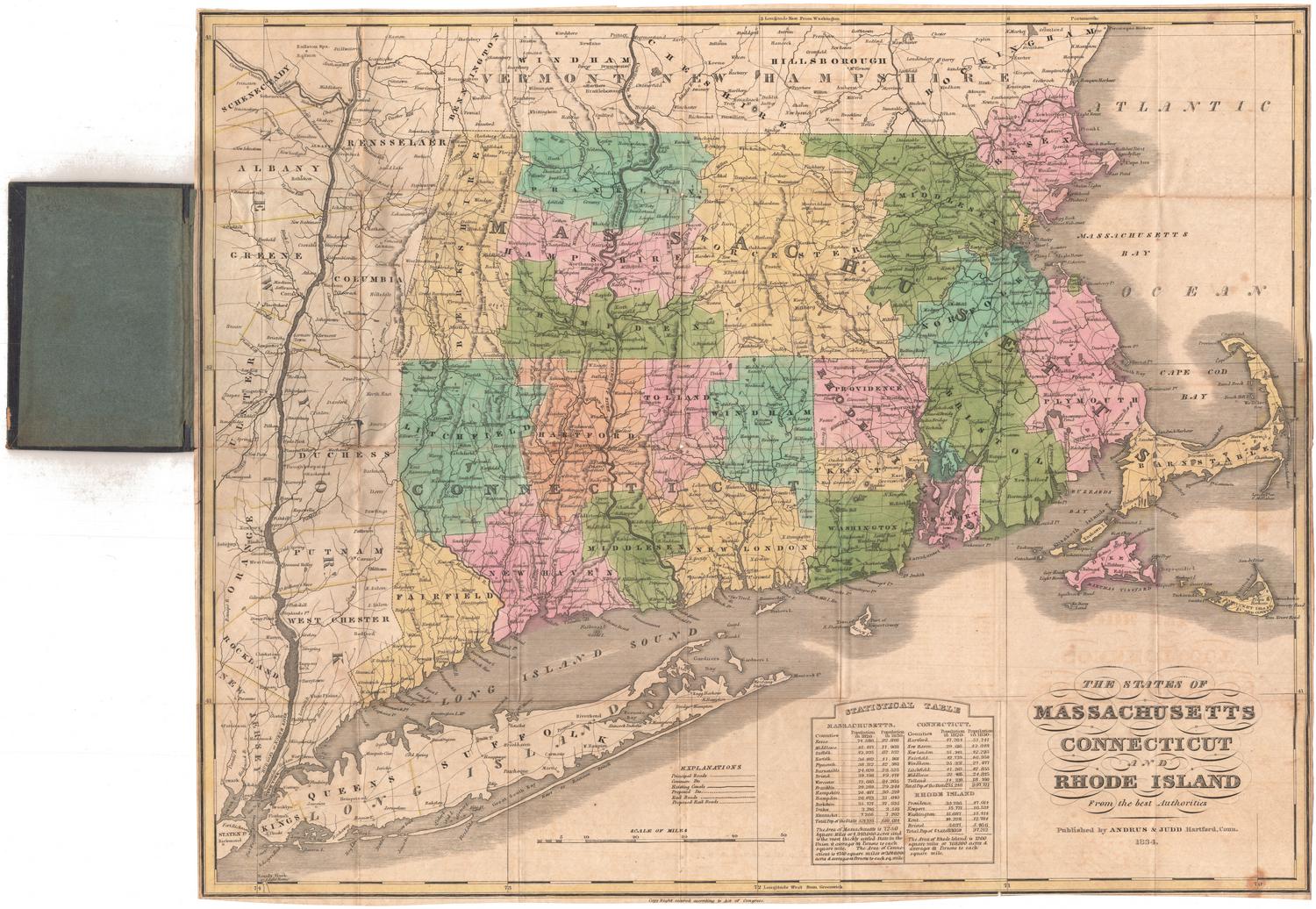
Map of Massachusetts, Connecticut and Rhode Island
PublisherPublished by
Brown and Parsons
(American, 1838 - 1851)
Date1838
MediumEngraving; black printer's ink and watercolor on wove paper, in cardboard covers
DimensionsPrimary Dimensions (image height x width): 14 3/4 x 20in. (37.5 x 50.8cm)
Sheet (height x width): 14 7/8 x 20 1/8in. (37.8 x 51.1cm)
ClassificationsGraphics
Credit LineMuseum purchase
Object number1986.289.0
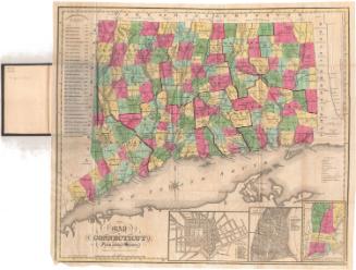
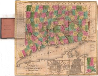
DescriptionPocket map of the states of Massachusetts, Connecticut and Rhode Island, with Vermont and New Hampshire to the north, the Massachusetts Bay to the east, Long Island and the Long Island Sound to the south, and New York to the west. The states are divided into counties, colored pink, yellow, green and blue. The map shows mostly transportation infrastructure: principal and common roads, existing and proposed canals, and existing and proposed railroads.The Farmington, Blackstone and Middlesex Canals are shown, as are two railroads, one between New Haven and Hartford, Connecticut, and the other between Stonington, Connecticut and Boston. Physical features depicted include elevation, conveyed with hachure marks; rivers; and lakes. At the bottom is a population table for each county in the states. On the inside front cover is a population table of the main towns in each state.
Label TextThe Hartford booksellers Brown and Parsons are best-known for their map of Connecticut, which they probably re-issued annually. They also published a map of Massachusetts, Connecticut and Rhode Island that also enjoyed considerable success and which may have reached a wider audience. This 1838 edition was issued the year that the firm was established. Other editions at the Connecticut Historical Society are dated 1845 and 1847, suggesting that Brown and Parsons frequently re-issued it as well. In addition to maps of the New England states, the firm also published maps of Ohio and of Maryland, Virginia, and Delaware.
NotesCartographic Note: Scale: 1 inch equals about 10 1/2 milesStatus
Not on view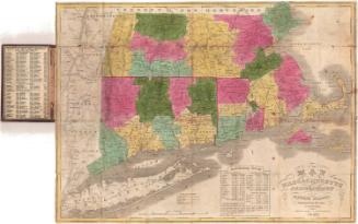
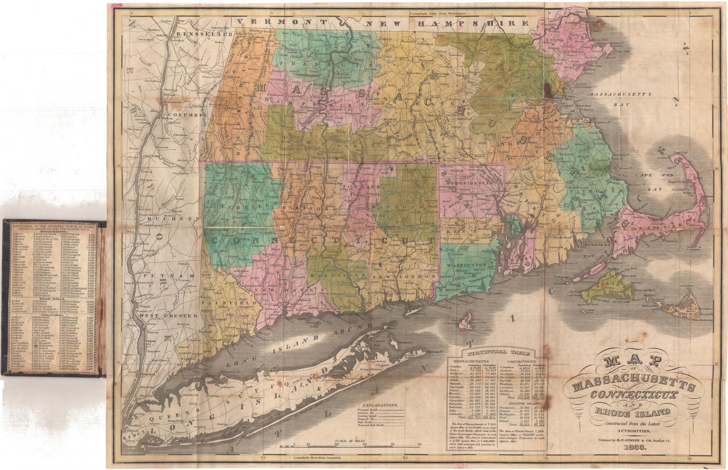

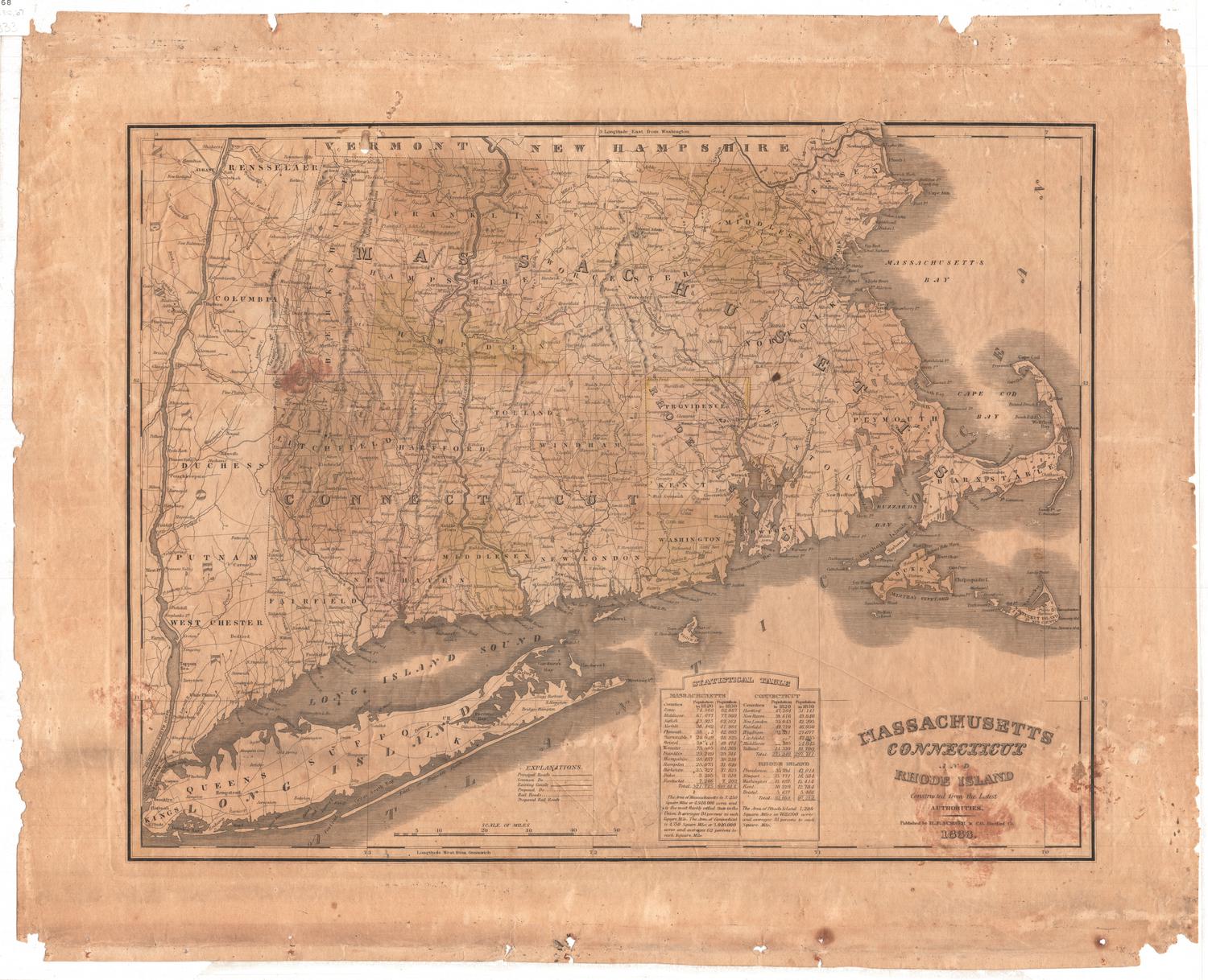
H. F. Sumner & Co.
1833