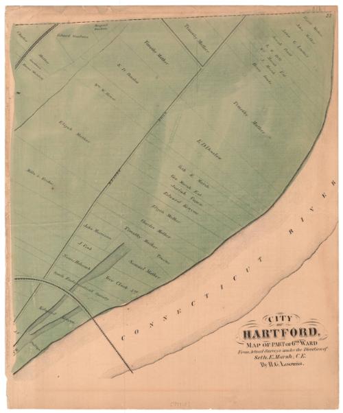
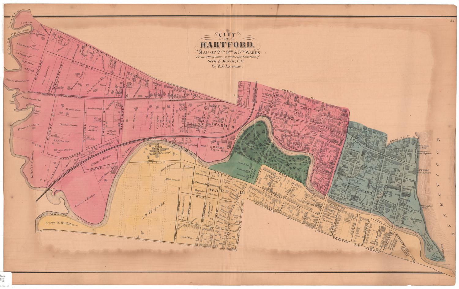
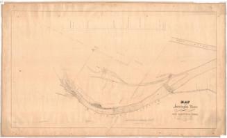
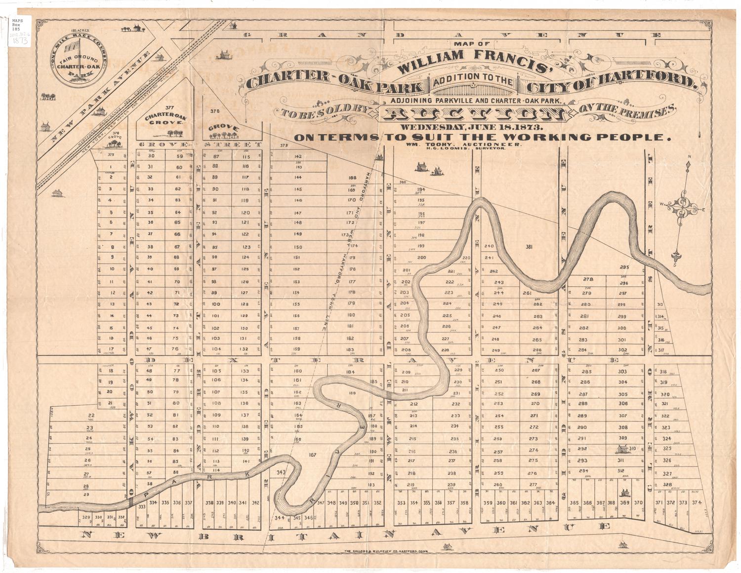
City of Hartford, Map of Part of 6th Ward
MakerMade by
Hiram G. Loomis
(American, 1834 - 1911)
SurveyorSurveyed by
Seth E. Marsh
(American, about 1823 - 1878)
Date1869
MediumLithography; black printer's ink and watercolor on wove paper
DimensionsPrimary Dimensions (image height x width): 15 5/8 x 14 1/4in. (39.7 x 36.2cm)
Sheet (height x width): 17 5/8 x 14 5/8in. (44.8 x 37.1cm)
Sheet (height x width): 17 5/8 x 14 5/8in. (44.8 x 37.1cm)
ClassificationsGraphics
Credit LineConnecticut Museum of Culture and History collection
DescriptionMap of part of Hartford's Sixth Ward along the Connecticut River, with Meadow Road running parallel to the river. On either side of the road are lots of land, labeled with the owner's name. Two railroad lines are visible at the top and bottom left corners and are unlabeled. On the back of the map is an incomplete Hartford business directory.
Object number2006.132.0
NotesCartographic Note: No scaleOn View
Not on view


Silvermine Production
1973