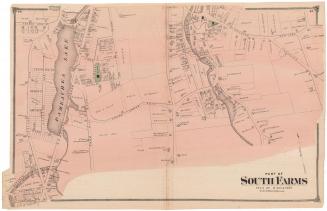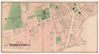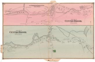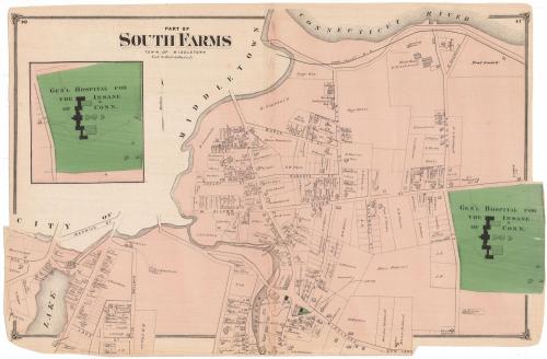
Part of South Farms, Town of Middletown
PublisherPublished by
F. W. Beers & Co.
(American)
Date1874
MediumLithography; black printer's ink and watercolor on wove paper
DimensionsPrimary Dimensions (image height x width): 15 x 23 1/2in. (38.1 x 59.7cm)
Sheet (height x width): 15 3/8 x 23 1/2in. (39.1 x 59.7cm)
ClassificationsGraphics
Credit LineMuseum purchase
Object number1980.100.6
DescriptionMap of South Farms in Middletown, Connecticut, oriented on the map so that the Connecticut River is at the top. The map depicts land lots, labeled with the owner's name. Buildings are indicated with closed black squares. The General Hospital for the Insane of Connecticut, colored green, is located in the lower right corner of the main map and in an inset map on the left. Natural features depicted include a lake and the unlabeled Long Hill Brook.
Label TextAs early as 1784, the central portion of Middletown was incorporated as a city, while outlying areas of the township retained their separate identities. Some of these areas such as Cromwell and Middlefield later became separate towns. The Hospital for the Insane, which opened in 1868 in the part of Middletown known as South Farms, figures prominently in this 1874 map. The area was still largely undeveloped in the third quarter of the nineteenth century; the rural nature of the surroundings may have been a factor in the choice of the site for the hospital, which included a farm where some of the patients worked. Some small farms persisted in this part of Middletown well into the twentieth century. This map was originally part of an atlas published by F. W. Beers & Co.
NotesCartographic Note: Scale: 1 inch equals 20 rodsStatus
Not on view