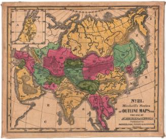
Europe
PrinterPrinted by
Bingham & Kelly
(American, 1857 - 1859)
PublisherPublished by
O. D. Case
(American, 1826 - 1903)
Date1857
MediumLithograph; black printer's ink and watercolor on paper, lined with linen
DimensionsPrimary Dimensions (image height x width): 47 x 56 1/2in. (119.4 x 143.5cm)
Sheet (height x width): 49 3/4 x 58 1/4in. (126.4 x 148cm)
Mount (height x width): 50 1/8 x 59in. (127.3 x 149.9cm)
ClassificationsGraphics
Credit LineMuseum purchase
Object number1972.36.55.6
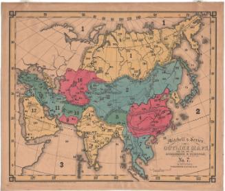
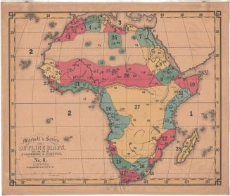
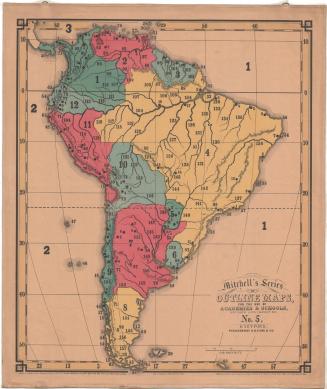
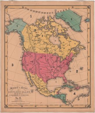
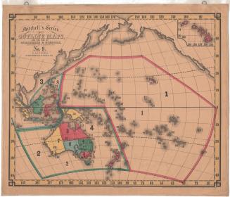
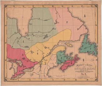
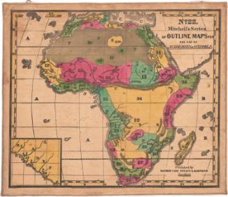
DescriptionMap of Europe. The countries are not labeled; instead, they are numbered. There are also smaller numbers and circles that correspond with a key published separately from the map. Natural features include elevation, depicted with hachure marks, and rivers.
Label TextThe large size of this map of Europe indicates the importance of the study of European geography for American schoolchildren. Mitchell's series of outline maps was intended for use in schools, and the maps appear to have been widely popular. This 1857 edition of the map of Europe differs significantly form the earlier edition, published in 1841, reflecting the turbulent politics of the 1840s and 1850s. Compare especially the boundaries of France, Germany, and Italy as they appear in the two maps.
NotesCartographic Note: Scale: 2 inches equals about 150 milesConstituent Note: Mitchell's Series of Outline Maps were first issued in 1841 by Mather, Case, Tiffany & Burnham of Hartford, Connecticut and Augustus Mitchell of Philladelphia.. In 1857, the maps were updated and resissued. This time the printing was done by a new lithography firm, Bingham & Kelly and the maps and the accompanying key were published by O.D. Case & Co., both in Hartford.
Status
Not on view