United States
PrinterPrinted by
Bingham & Kelly
(American, 1857 - 1859)
PublisherPublished by
O. D. Case
(American, 1826 - 1903)
Date1857
MediumLithograph; black printer's ink and watercolor on paper, lined with linen
DimensionsPrimary Dimensions (image height x width): 47 x 56 3/4in. (119.4 x 144.1cm)
Sheet (height x width): 49 x 58 1/2in. (124.5 x 148.6cm)
Mount (height x width): 49 1/2 x 59in. (125.7 x 149.9cm)
ClassificationsGraphics
Credit LineMuseum purchase
Object number1972.36.55.4
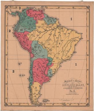
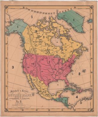
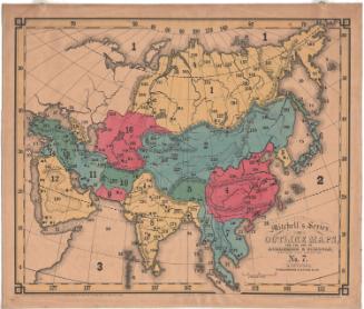
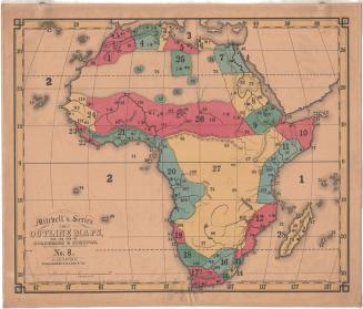
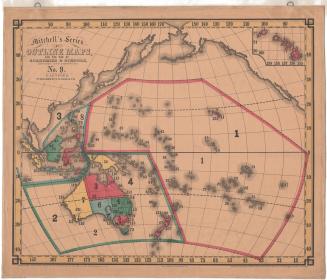
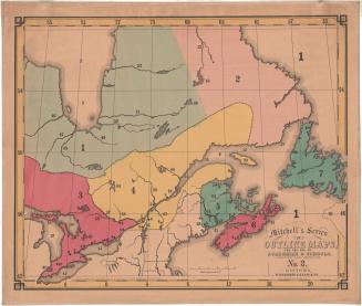
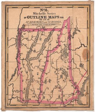
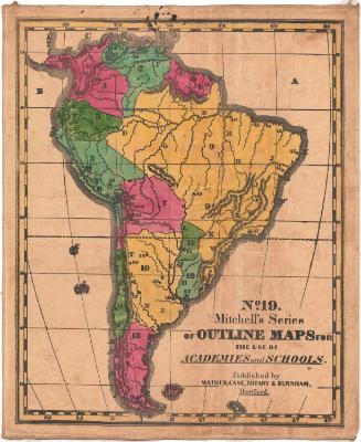
DescriptionMap of the United States, Mexico and part of the Caribbean. The countries and states are outlined but not labeled. There are circles and numbers instead that correspond with a key published separately from the map. Natural features depicted include elevation, conveyed through hachure marks, and rivers.
Label TextNational pride is very evident in the Key that accompanied this map of the United States. Mitchell's Outline Maps were intended to be used in the teaching of geography to school children, and teachers were clearly expected to instill this sense of pride in their students. For example, according to the Key, "No other nation has so many steam and canal boats traversing its waters, or so many miles of telegraph lines and railroad, either finished, or in course of construction." Canals and railroads figure prominently in all of Mitchell's maps of the individual states.
NotesCartographic Note: Scale: About 2 inches equals 100 milesConstituent Note: Mitchell's Series of Outline Maps were first issued in 1841 by Mather, Case, Tiffany & Burnham of Hartford, Connecticut and Augustus Mitchell of Philladelphia.. In 1857, the maps were updated and resissued. This time the printing was done by a new lithography firm, Bingham & Kelly and the maps and the accompanying key were published by O.D. Case & Co., both in Hartford.
Status
Not on view