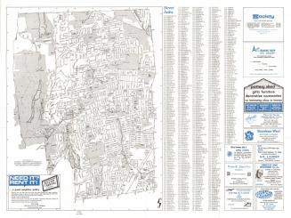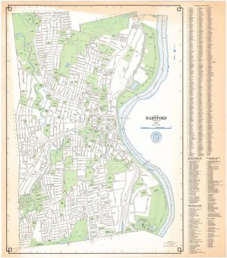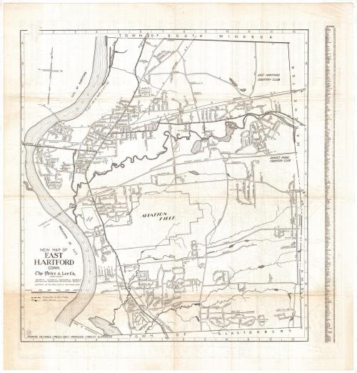
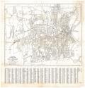
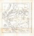
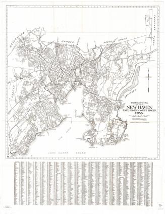
New Map of Hartford and West Hartford, Connecticut
PublisherPublished by
Price & Lee Co.
(American)
Dateabout 1954
MediumPhoto offset lithography; black printer's ink on wove paper
DimensionsPrimary Dimensions (front image (a) height x width): 20 1/8 x 24 7/8in. (51.1 x 63.2cm)
Primary Dimensions (back image (b) height x width): 23 3/4 x 22 1/8in. (60.3 x 56.2cm)
Sheet (height x width): 28 x 27in. (71.1 x 68.6cm)
ClassificationsGraphics
Credit LineConnecticut Museum of Culture and History collection
Object number2012.312.218
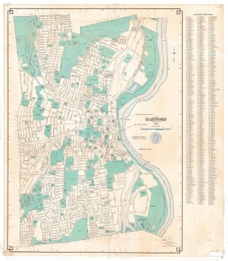
DescriptionTwo-sided map shows Hartford and West Hartford on the front (side a), and East Hartford on the back (side b). The map of Hartford and West Hartford extends to the town lines of Bloomfield and Windsor to the north, the Connecticut River and town line of East Hartford to the east, the town lines of Newington and Wethersfield to the south, and the town lines of Farmington and Avon to the west. The map of East Hartford extends from the town line of South Windsor to the north, the town line of Manchester to the east, the town line of Glastonbury to the south, and the Connecticut River and boundary of Hartford to the west.
Both maps have street indexes and show the local roads, bus and trolley routes, railroads, parks, hospitals, reservoirs and rivers.
Both maps have street indexes and show the local roads, bus and trolley routes, railroads, parks, hospitals, reservoirs and rivers.
Label TextThe prominence of the bus lines and railroad lines and the absence, not only of any interstate highways, but even of any very obvious routes leading through the city are immediately striking when one looks at the this 1954 map of Hartford, Connecticut. The main route to Springfield and New Haven winds through the city streets; the main route to Providence and Worcester crosses the Connecticut River on the Bulkeley Bridge (unnamed). The road leading to the Charter Oak Bridge, which had been constructed in the 1940s, is identified as the "Hartford cut-off." The Founders Bridge was yet to be built. The map of East Hartford on the other side of the sheet shows roads leading to Glastonbury, South Windsor, and Manchester, but leaves it unclear which way a motorist trying to get to Providence or Worcester should go.
NotesCartographic Note: Scale, front (a): 1 7/8 inches equals 3200 feet. Scale, back (b): About 3 1/2 inches equals 4000 feetStatus
Not on view
R. A. Welcke Offset Co.
probably 1967