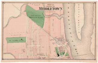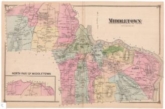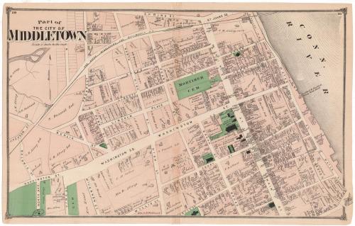
Part of the City of Middletown
PublisherPublished by
F. W. Beers & Co.
(American)
Date1874
MediumLithography; black printer's ink and watercolor on wove paper
DimensionsPrimary Dimensions (image height x width): 14 1/4 x 23 1/8in. (36.2 x 58.7cm)
Sheet (height x width): 14 3/4 x 23 3/8in. (37.5 x 59.4cm)
Sheet (height x width): 14 3/4 x 23 3/8in. (37.5 x 59.4cm)
ClassificationsGraphics
Credit LineMuseum purchase
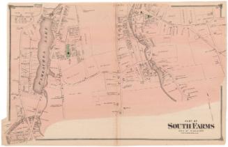
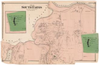
DescriptionMap of part of Middletown, Connecticut, with Spring Street to the north, the Connecticut River to the east, College Street to the south, and Baldwin Street to the west. The map depicts local roads and land lots, labeled with the owner's name and rectangles indicating the existence of buildings. Schools, churches, cemeteries and a library are depicted in green. The New Haven, Middletown and Willimantic Railroad and Connecticut Valley Railroad run through town.
Object number1980.100.16
NotesCartographic Note: Scale: 1 inch equals 15 rodsOn View
Not on view