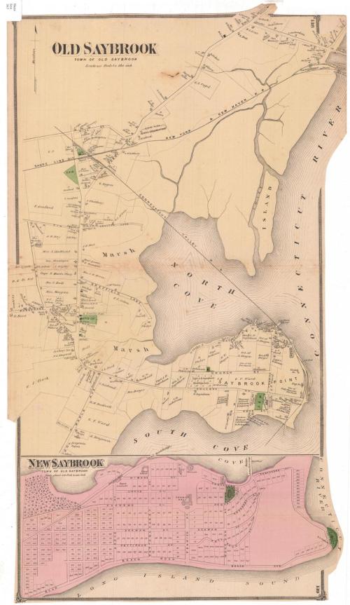
Old Saybook, Town of Old Saybrook
PublisherPublished by
F. W. Beers & Co.
(American)
Date1874
MediumLithography; black printer's ink and watercolor on wove paper
DimensionsPrimary Dimensions (image height x width): 27 x 15 1/8in. (68.6 x 38.4cm)
Sheet (height x width): 27 1/8 x 15 1/2in. (68.9 x 39.4cm)
Sheet (height x width): 27 1/8 x 15 1/2in. (68.9 x 39.4cm)
ClassificationsGraphics
Credit LineMuseum purchase
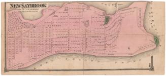
DescriptionMap of Old Saybrook, Connecticut, with the Shore Line division of the New York and New Haven Railroad to the north, the Connecticut River to the east, the South Cove to the south and Main Street to the west. The Connecticut Valley Railroad runs northwest through the town. Buildings are depicted as squares and are labeled with the name of the property owner or occupant. Roads are shown and labeled. At the bottom of the sheet is a map of New Saybrook (Fenwick), depicting local roads, numbered lots, and the Connecticut Valley Railroad line and station.
Object number1980.100.14
NotesCartographic Note: Scale, Old Saybrook: 1 inch equals 40 rods; New Saybrook: 1 inch equals 420 feetOn View
Not on view