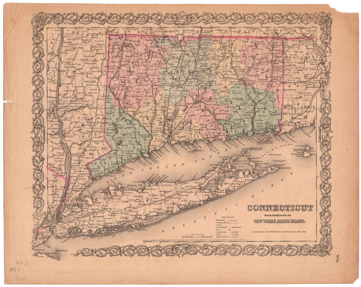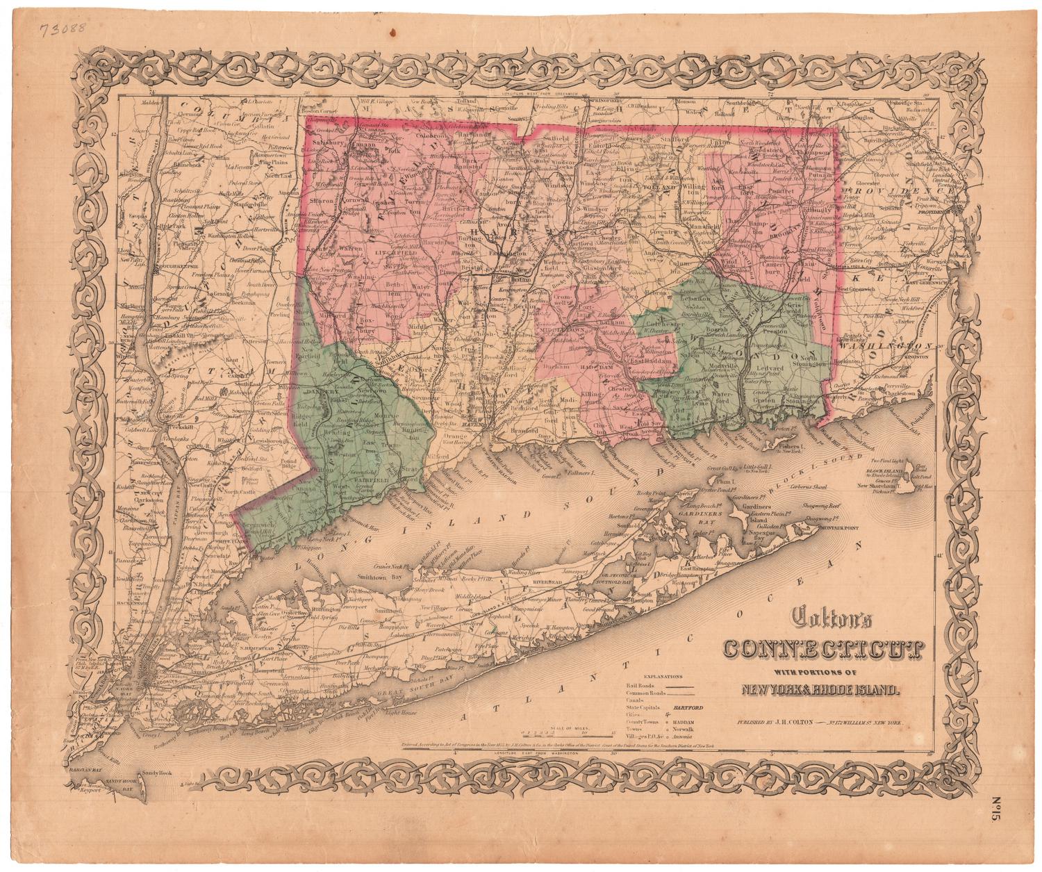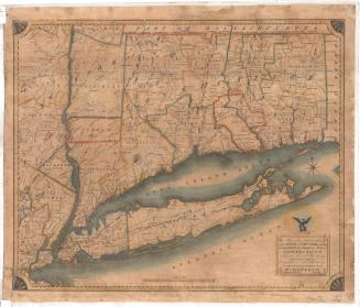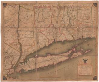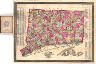
The State of Connecticut Including Parts of New York and New Jersey
PrinterPrinted by
Roderick Nevers
(American, 1808 - 1888)
Date1851
MediumEngraving; black printer's ink and watercolor on paper, lined with linen
DimensionsPrimary Dimensions (image height x width): 23 1/4 x 28 3/8in. (59.1 x 72.1cm)
Sheet (height x width): 27 1/2 x 31 3/4in. (69.9 x 80.6cm)
Mount (height x width): 27 1/2 x 31 3/4in. (69.9 x 80.6cm)
ClassificationsGraphics
Credit LineMuseum purchase
Object number1982.133.0
DescriptionMap of Connecticut with parts of New York State and New Jersey, from the border of Massachusetts to the north; the border of Rhode Island to the east; the Atlantic Ocean to the south; and Orange County, New York, to the west. The state borders between Connecticut, New York and New Jersey are outlined in red, and the states are divided into counties and towns. Physical features include rivers; mountains, depicted with clusters of peaks; lakes; and islands. Several railroad lines are displayed, including the Long Island; New York and New Haven; Housatonic; Naugatuck; New Haven, Hartford and Springfield; Canal; New Haven and New London; Norwich and Worcester; New York and Erie; and Harlem Railroads. Several proposed railroad lines are depicted, as well. Above the title, in the lower right corner, is the depiction of an eagle, wings outstretched, perched atop a globe and surrounded by stars.
Label TextRoderick Nevers evidently used poor paper for his maps. Both maps by this printer in the Connecticut Historical Society collection are in extremely poor condition compared to other maps from the same time period. Nevers was a local Hartford printer who was in business from 1841 to 1887. During a period when most printers were using lithography to produce their maps, Nevers clung to older the older technique of copper engraving. His map of Connecticut is a reissue of William Damerum's 1815 map, apparently printed from the original plate,which Nevers had re-engraved and updated. He printed several editions in the 1850s, so his map must have enjoyed some popularity. This is the first edition of Nevers's map, printed in 1851.
NotesCartographic Note: Scale: 1 inch equals 5 milesStatus
Not on view

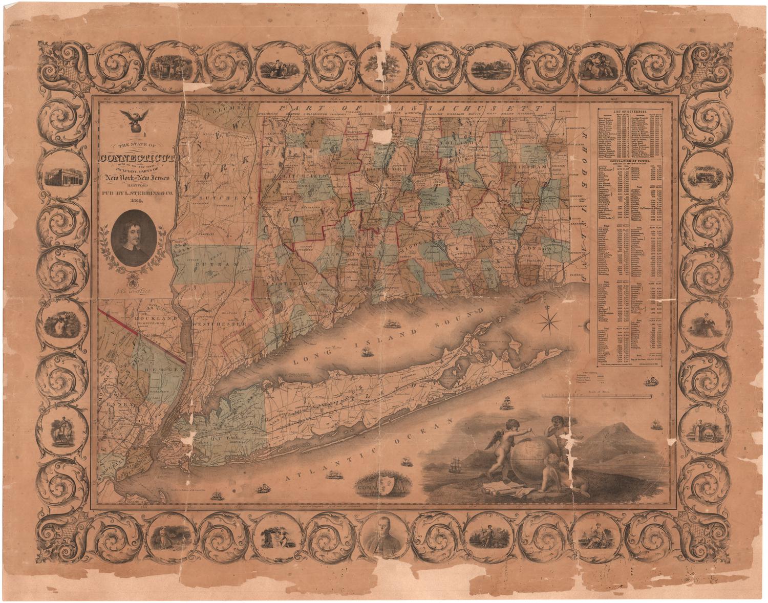
Lucius Stebbins & Co.
1859