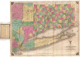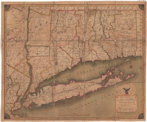
Map of the Southern Part of the State of New York including Long Island, the Sound, the State of Connecticut, part of the State of New Jersey and Islands adjacent
DesignerDesigned by
William Damerum
(American)
DraftsmanDrawn by
William Damerum
(American)
PublisherPublished by
William Damerum
(American)
PrintmakerEngraved by
Peter Maverick
(1780 - 1831)
Date1815
MediumEngraving; black printer's ink and watercolor on paper, lined with linen
DimensionsPrimary Dimensions (image height x width): 23 1/4 x 28 1/8in. (59.1 x 71.4cm)
Sheet (height x width): 24 1/4 x 29in. (61.6 x 73.7cm)
Mount (height x width): 24 1/4 x 29in. (61.6 x 73.7cm)
ClassificationsGraphics
Credit LineMuseum purchase
Object number1982.130.0
DescriptionMap of parts of New York State and New Jersey, as well as all of Connecticut, from the border with Massachusetts to the north, the border with Rhode Island to the east, Long Island to the south, and parts of New Jersey and New York to the west. The states are divided into counties, which are outlined with color. Counties, towns and cities are labeled, as are geographic features such as rivers, mountains and islands. Elevation is conveyed with clusters of peaks. Roads are depicted but not labeled. Directly above the cartouche is a globe with an eagle perched on it, surrounded by stars.
Label TextAlthough a peace treaty between Great Britain and the United States was signed on 24 December 1814, the War of 1812 did not actually end until the treaty was ratified by the United States Congress in February 1815. Isolated fighting, at sea and along the frontier, continued well into 1815. This map shows Connecticut and adjoining parts of New York state at this moment in time. The American eagle above the map's title may reflect patriotic pride in successfully weathering the conflict. It is interesting to speculate the reason for the prominence of New York state in the title of the map, since it focuses Connecticut, with only small portions of New York to the west and south. Perhaps since mapmaker William Damerum was a New Yorker, he expected his primary audience to be citizens of that state.
NotesCartographic Note: Scale: 5 7/8 inches equals 30 milesStatus
Not on view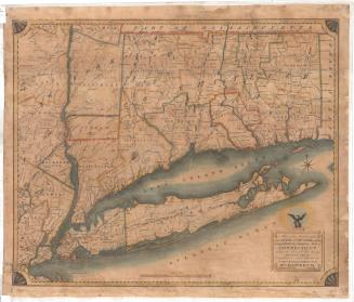
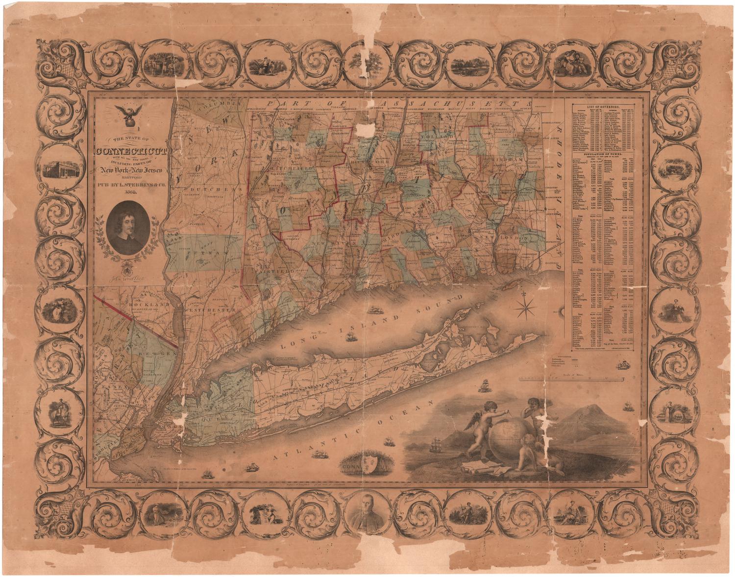
Lucius Stebbins & Co.
1859