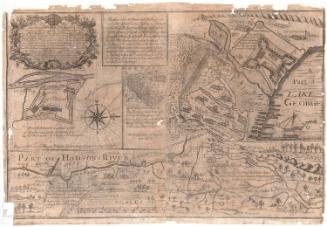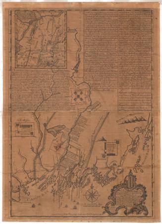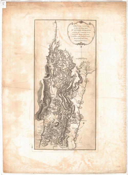
A map of the Country in which the Army under Lt. General Burgoyne acted in the Campaign of 1777, shewing the Marches of the Army & the Places of the principal Actions
DraftsmanDrawn by
Mr. Medcalfe
(British, active 1777)
PublisherPublished by
William Faden
(British, 1750 - 1836)
Date1780
MediumEngraving; black printer's ink on wove paper
DimensionsPrimary Dimensions (image height x width): 22 5/8 x 10 3/4in. (57.5 x 27.3cm)
Platemark (height x width): 23 1/2 x 11 1/2in. (59.7 x 29.2cm)
Sheet (height x width): 29 7/8 x 21 3/4in. (75.9 x 55.2cm)
ClassificationsGraphics
Credit LineConnecticut Museum of Culture and History collection
Object number2012.312.77
DescriptionRelief map of parts of New York and Vermont, with Lake Champlain to the north, the Connecticut River to the east, Albany to the south, and Fort William to the west. Relief is conveyed with hachure marks. Routes are marked on the map with dotted and broken parallel lines, and dates that probably refer to "principal actions" are marked with Xs. Farms, mills, towns and forts are labeled. The forts include Fort William Henry/Fort George, Fort Miller, Fort Hardy, Massachusetts Fort, Fort Ticonderoga, Fort Arm, and at least one unnamed fort along Otter Creek.
Label TextBritish Lieutenant-General John Burgoyne used this map to help explain the failure of his 1777 Hudson River campaign. It was published in his book, A State of the Expedition from Canada, as Laid before the House of Commons (1780). Burgoyne hoped to divide the American colonies in two, but was soundly defeated in the Battle of Saratoga and on October 17 surrendered his army to the Americans under General Horatio Gates. Burgoyne's book was an attempt to justify himself. The draughtsman Mr. Medcalfe, who was probably attached to Burgoyne's staff, did a superb job of conveying the difficulty of the terrain and clearly laid out the positions of the troops and indicated their movements; however, Burgoyne complained of the accuracy of some of his troop placements, a reminder that such maps are, to some extent, subjective documents.
NotesCartographic Note: Scale: 1 inch equals 10 statute milesStatus
Not on view