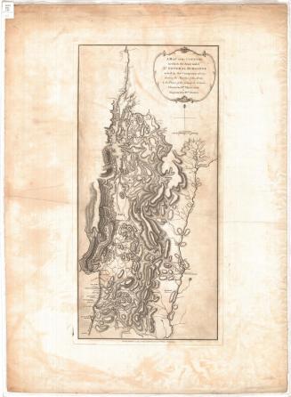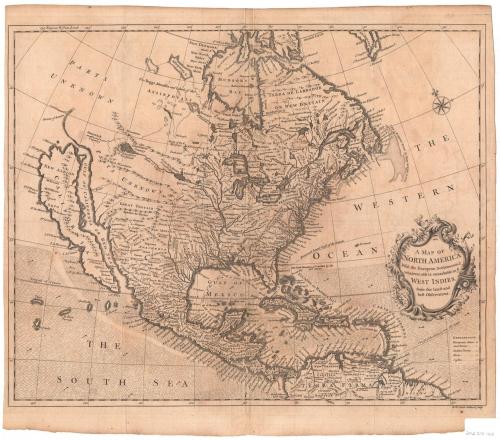
A Map of North America With the European Settlements & whatever else is remarkable in ye West Indies from the latest and best Observations
PrintmakerEngraved by
Richard William Seale
(English, 1703 - 1762)
Date1745
MediumEngraving; black printer's ink on laid paper
DimensionsPrimary Dimensions (image height x width): 14 3/4 x 18 3/8in. (37.5 x 46.7cm)
Sheet (height x width): 16 1/2 x 19in. (41.9 x 48.3cm)
ClassificationsGraphics
Credit LineConnecticut Museum of Culture and History collection
Object number2012.312.102
DescriptionMap of North America, Central America and the Caribbean, with Hudsons Bay to the north, the Atlantic, or "Western," Ocean to the east, the "Terra Firma" of South America to the south, and the Pacific Ocean or "South Sea" to the west. The locations of European cities, towns, Native American towns, forts and castles are marked with symbols as listed in the explanation, which is found in the lower right corner. Rivers, lakes, islands, capes and waterfalls are labeled, and mountains are depicted in relief. Sailing and exploration water routes are marked with dotted lines and three of them are marked with descriptions of the route. What appear to be land exploration routes are marked with the same dotted lines, but are not labeled. There are arrows, probably indicating the trade winds or other wind patterns, in the oceans, gulfs and seas south of the 30th parallel north.
Label TextEuropean notions of North America were still extremely vague as late as the middle of the eighteenth century. This curious map, which was pubished in Tindal's Continuation of Rapin's History of England in 1745, shows California as an island and the source of the Mississippi River as a lake in western Canada. Large areas of the continent are simply left blank and labeled "Parts Unknown." Connecticut is given short shrift, subsumed into what appears to be a single province labeled "New England." The Connecticut River is labeled, but illogically appears to have a direct connection with Casco Bay.
NotesCartographic Note: No scaleStatus
Not on view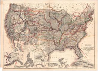
Ithamar P. Berthrong
1908