Map of the First Ward, Hartford, Connecticut
MakerMade by the
Hartford Water Company
American, founded 1851
Date1866
MediumDrawing; black, blue and red ink on wove paper on fabric
DimensionsPrimary Dimensions (height x width): 52 1/4 x 69 1/2in. (132.7 x 176.5cm)
Sheet (height x width): 54 x 70 3/4in. (137.2 x 179.7cm)
Sheet (height x width): 54 x 70 3/4in. (137.2 x 179.7cm)
ClassificationsGraphics
Credit LineConnecticut Museum of Culture and History collection
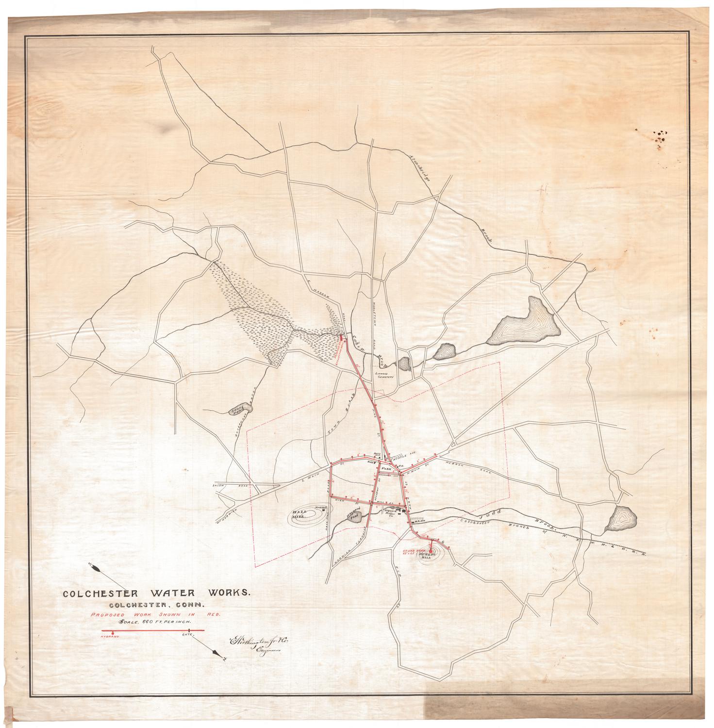
DescriptionMap of part of the city of Hartford from just north of Albany Avenue to the north to Church Street to the south. Garden Street and several unnamed streets are to the west and Windsor Street and Village Street are to the east. An arrow at lower left points to magnetic north. Water mains run along Myrtle Street, Church Street, a portion of Windsor Street, portions of Spring Street and Spruce Street, Village Street, Morgan Street, Talcott Street, Main Street, Ann Street, High Street, Pleasant Street, Ely Street, and Walnut Street. The Almshouse, Union Depot and associated tracks and buildings, and the State Arsenal are shown. The locations of hydrants and stop cocks are indicated.
Object number1970.27.1
MarkingsOn verso, lower right, stamped in black ink, "206 11"Lower left, stamped in black ink, "206 11" "206 11"
Upper right, stamped in black ink, "206 11:; stamped in blue ink, "CtHi"InscribedOn recto, lower left, in black ink, "MAP / of the / FIRST WARD / Hartford, Conn. / Scale 1 inch = 125 feet / 1866"
On verso, lower right, in black ink, "088113" "1970-27-1"
Upper right, in black ink, "acc. 088113" "1970-27-1:; in pencil, "206"NotesCartographic Note: One inch equals 125 feet
Collections
- Maps and Charts: Finding Your Place in Connecticut History
On View
Not on view