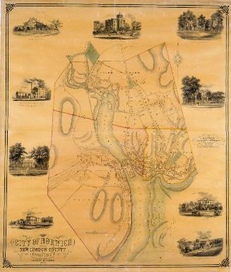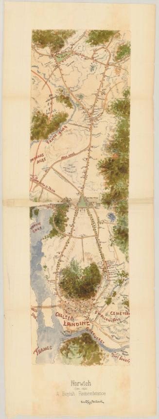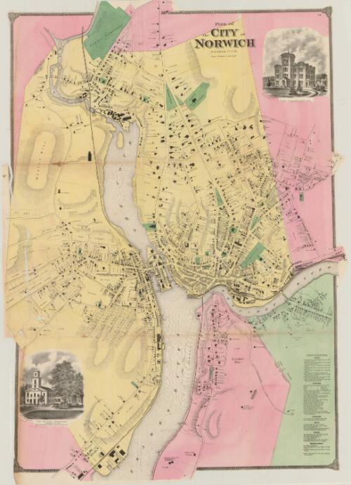
Plan of the City of Norwich
PublisherPublished by
Beers, Ellis & Soule
American, active 1865 - 1868
Date1868
MediumLithography; black printer's ink and watercolor on wove paper
DimensionsPrimary Dimensions (image height x width): 41 x 29 3/8in. (104.1 x 74.6cm)
Sheet (height x width): 41 1/8 x 29 1/2in. (104.5 x 74.9cm)
Sheet (height x width): 41 1/8 x 29 1/2in. (104.5 x 74.9cm)
ClassificationsGraphics
Credit LineMuseum purchase
DescriptionMap of Norwich, Connecticut, situated on the Yantic, Thames and Shetucket Rivers, depicting roads, residences and businesses. The roads are labeled and the buildings are shown as black squares labeled with the owner's name. In the bottom right corner is a references list ofbanks, churches, libraries, halls, hotels and miscellaneous. In the top right corner is a vignette of the Norwich Free Academy, and in the bottom left is a vignette of the First Congregational Church. Physical features include elevation, conveyed with hachure marks, and rivers.
Object number1980.102.2
MarkingsRecto, top and bottom left corners, printed in black ink on stickers: "MAPS / Drawer / 81"Verso, right side, stamped in blue ink: "THE CONNECTICUT / 80774 / HISTORICAL SOCIETY"
Bottom, handwritten in pencil on sticker: "1091"InscribedRecto, top, printed in black ink: "Plan of / the CITY of / NORWICH / New London Co. Conn."
Top right corner, printed in black ink: "14"NotesCartographic Note: Scale: 1 inch equals 18 rods
Collections
- Maps and Charts: Finding Your Place in Connecticut History
On View
Not on view