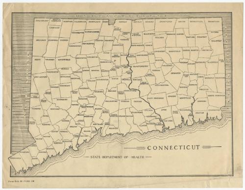
Connecticut
MakerMade by
State Department of Health
American, 1919 - 1979
Dateafter 1921
MediumLithography; black printer's ink on wove paper
DimensionsPrimary Dimensions (image height x width): 7 1/2 x 10 1/8in. (19.1 x 25.7cm)
Sheet (height x width): 8 1/2 x 11in. (21.6 x 27.9cm)
Sheet (height x width): 8 1/2 x 11in. (21.6 x 27.9cm)
ClassificationsGraphics
Credit LineConnecticut Museum of Culture and History collection
DescriptionMap of Connecticut, with Massachusetts to the north, Rhode Island to the east, the Long Island Sound to the south, and New York to the west. The state is divided into towns, each one labeled with its name. No physical features are identified.
Object number2012.312.57
MarkingsVerso, center, stamped in blue ink: "CtHi"InscribedRecto, bottom, printed in black ink: "CONNECTICUT"Bottom, printed in black ink: "STATE DEPARTMENT OF HEALTH"
Bottom left corner, printed in black ink: "Form O-A 43 (7-34) 1M"
Verso, top left, handwritten in pencil: "1934???"NotesCartographic note: No scale
Date Note: The last town in Connecticut to be incorporated was West Haven, which separated from Orange in 1921. Since West Haven appears on this map, it date from 1921 or later.
Collections
- Maps and Charts: Finding Your Place in Connecticut History
On View
Not on view
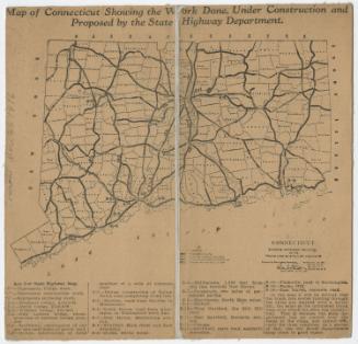
Connecticut State Highway Department
1916


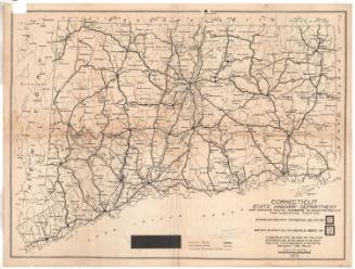
Connecticut State Highway Department
1923