Skip to main content
Collections
Objects
People
Thesaurus
Favorites
Advanced Search
Home
Works
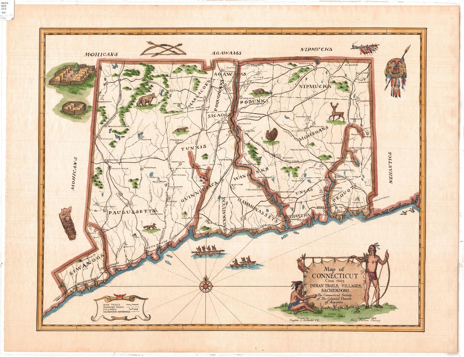
Map of Connecticut Circa 1625: Indian Trails, Villages
Related by Object/Object
Close
Refine Results
Artist / Maker / Culture
Hayden L. Griswold
(2)
Mathias Spiess
(2)
Connecticut Society of the Colonial Dames of America
(1)
Mary Caroline Ogden Pierson
(1)
Classification(s)
Graphics
(2)
Collections
Maps and Charts: Finding Your Place in Connecticut History
(2)
Date
to
Department
Visual Collections
(2)
Image Available
On View
Sort:
Title (A–Z)
Title (Z–A)
Date (Older First)
Object number (Ascending)
Primary Maker (A-Z)
Last Updated (Ascending)
Images
List
Table
Filters
View PDF
2 results
Map of Connecticut circa 1625: Indian Trails, Villages, Sachemdoms
Mathias Spiess
1930
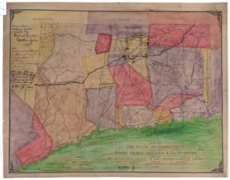
Map of the State of Connecticut showing Indian Trails, Villages, & Sachemdoms
Mathias Spiess
1930
Next Page