Skip to main content
Collections
People
Favorites
Advanced Search
Currently indexing
Search
Objects
(27,946)
People
(7,650)
Close
Refine Results
Classification(s)
Graphics
(19,757)
Costume
(2,619)
Information Artifacts
(1,387)
Ceramics
(911)
Born Digital
(855)
Equipment
(846)
Painting
(676)
Textiles
(478)
Glassware
(347)
Furniture
(339)
Load all
Classification(s)
Collections
DeMars Photographs
(3,742)
Richard Welling Collection
(1,206)
Kellogg Brothers Lithographs
(1,151)
Maps and Charts: Finding Your Place in Connecticut History
(807)
G. Fox & Co.
(516)
Women Photographers
(328)
Clifford Mitchell: Architect, Artist, and Teacher
(169)
Connecticut Needlework: Women, Art, and Family, 1740-1840
(84)
West End Architecture
(70)
Tavern and Inn Signs
(65)
Load all
Collections
Date
to
Department
Visual Collections
(20,472)
Costume and Textiles
(3,212)
Home Life
(1,851)
Ephemera
(937)
Technology
(566)
Social Life
(310)
Commercial Life
(248)
Audio Collections
(202)
Native American
(148)
Geography
Hartford
(1)
New Britain
(1)
Image Available
On View
Sort:
Relevance
Title (A–Z)
Date (Older First)
Object number (Ascending)
Last Updated (Ascending)
List
Images
Table
Filters
View PDF
27946 results for
*
Result type
Objects
People
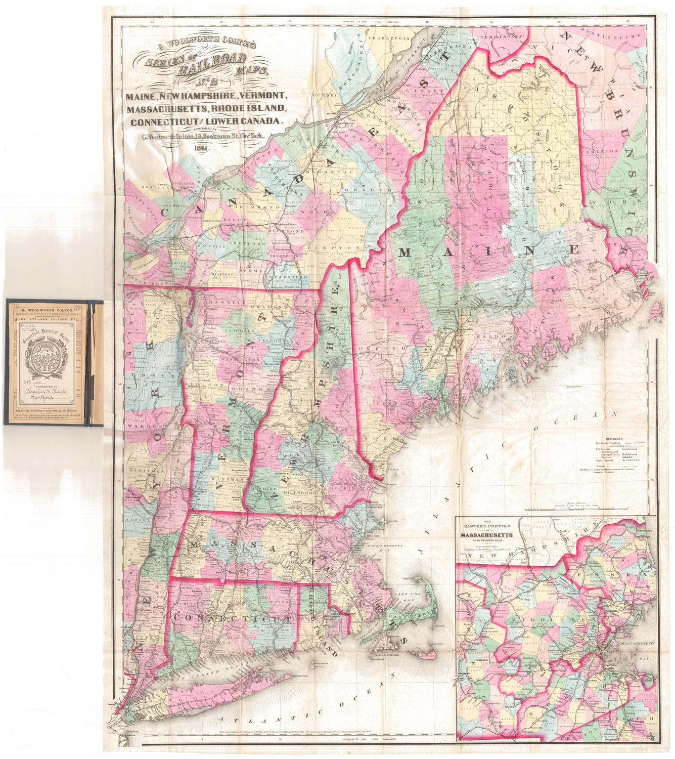
Maine, New Hampshire, Vermont, Massachusetts, Rhode Island, Connecticut and Lower Canada
George W. Colton
1861
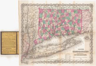
Colton's Connecticut, with portions of New York and Rhode Island
J. H. Colton & Co.
1869
Image Not Available
for Connecticut
Connecticut
John Warner Barber
Probably 1852
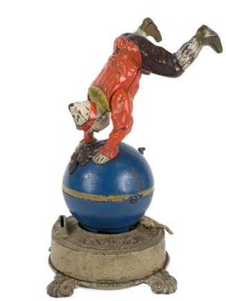
Funny Clown Bank
J. & E. Stevens Co.
1890
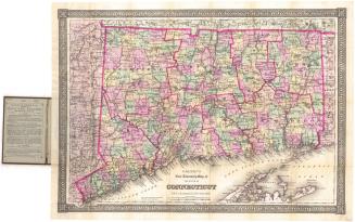
Colton's New Township Map of the State of Connecticut
G.W. & C.B. Colton & Co.
1886
Image Not Available
for Map of Connecticut
Map of Connecticut
Kellogg & Bulkeley
1875-1877
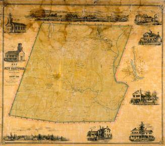
Map of the Town of New Hartford, Litchfield County, Connecticut
Lawrence Fagan
1852
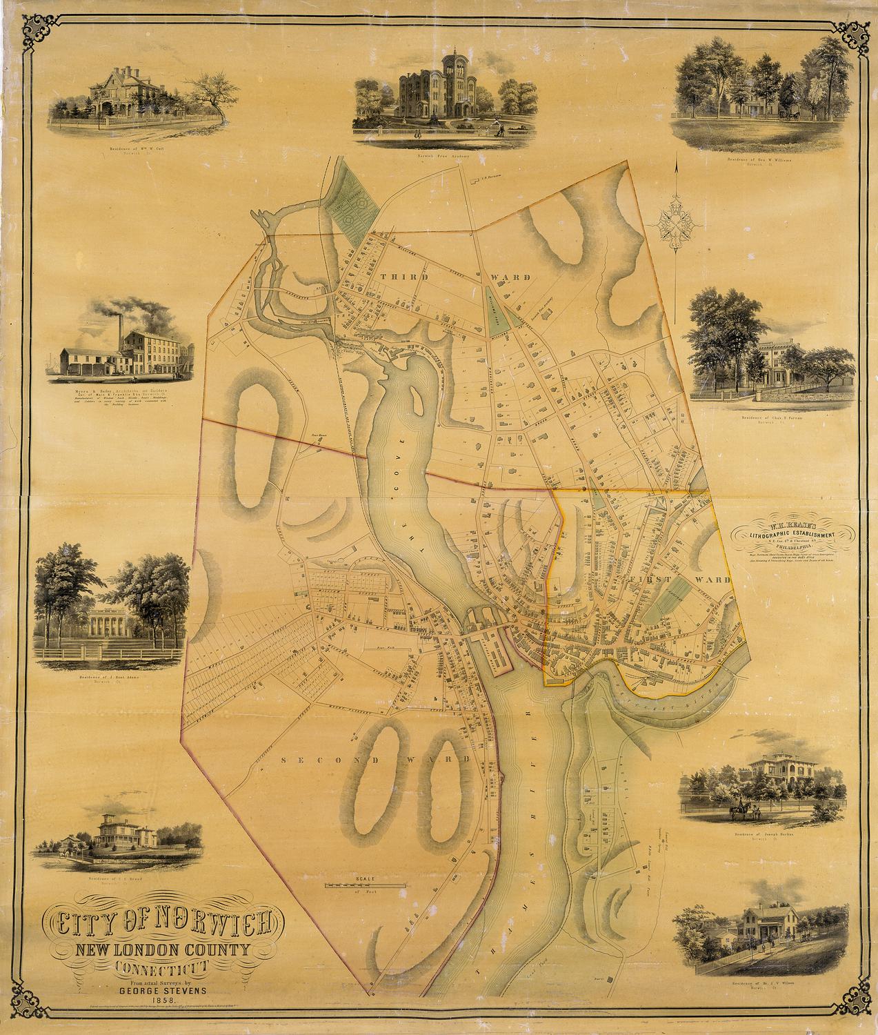
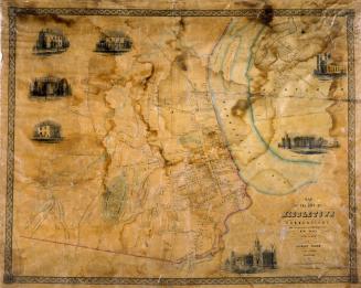
City of Norwich, New London County, Connecticut
George Stevens
1858
Image Not Available
for A Distance Map of the Town of Franklin
A Distance Map of the Town of Franklin
Andrew B. Smith
1858
Colton's Connecticut, with portions of New York and Rhode Island
G.W. & C.B. Colton & Co.
1877
Image Not Available
for Map of Central Part of Hartford County, Conn.
Map of Central Part of Hartford County, Conn.
F. J. Miller
1954-1956
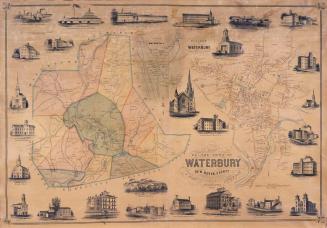
Map of the Town of Waterbury, New Haven County, Connecticut
H. Irvine
1852
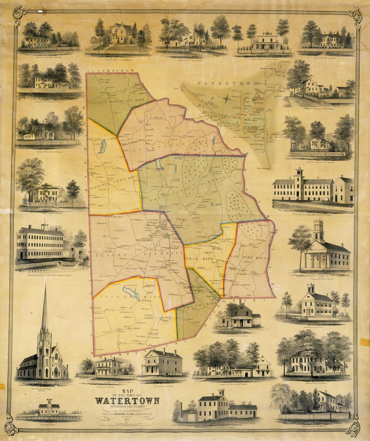
Map of the Town of Watertown, Litchfield County, Conn.
E. M. Woodford
1853
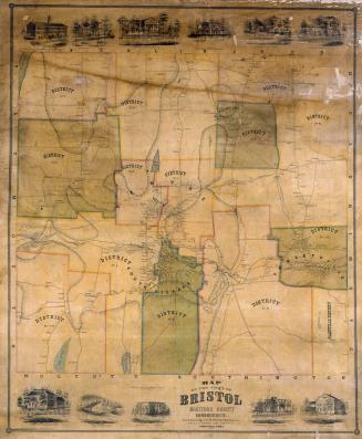
Map of the Town of Bristol, Hartford County, Connecticut
E. M. Woodford
1852
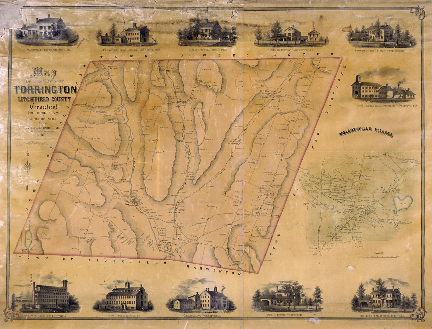
Map of the Town of Torrington, Litchfield, County, Connecticut
John Houston
1852
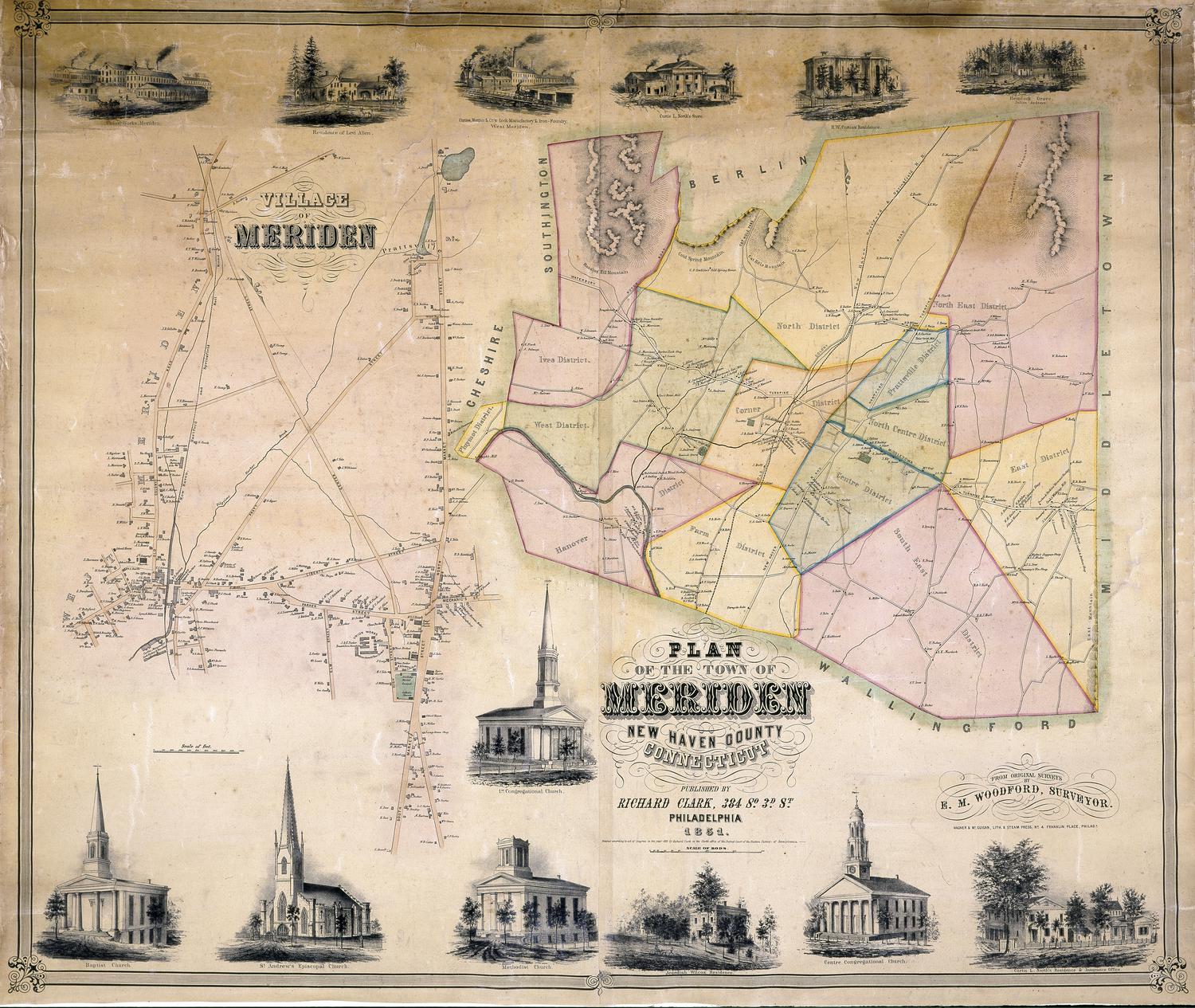
Plan of the Town of Meriden, New Haven County, Connecticut
E. M. Woodford
1851
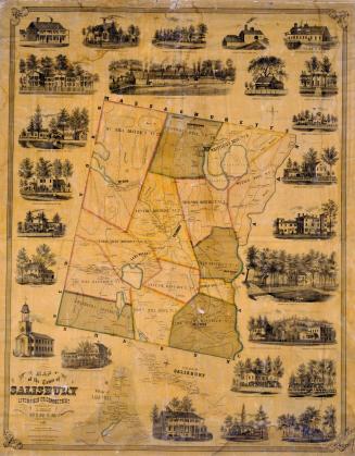
Map of the Town of Salisbury, Litchfield, Co., Connecticut
Lawrence Fagan
1853
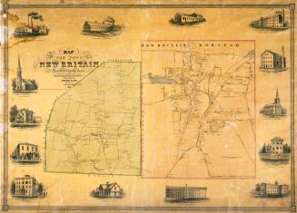
Map of the Town of New Britain, Hartford County, Conn.
E. M. Woodford
1851
Map of the City of Middletown, Connecticut
R. Whiteford
1851
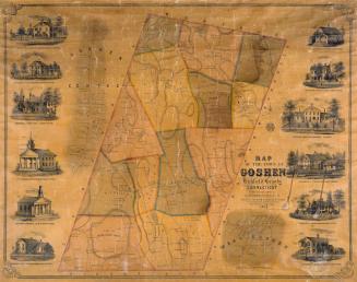
Map of the Town of Goshen, Litchfield County, Connecticut
E. M. Woodford
1852
Image Not Available
for Map of the Shore Line Rail Road route Between New York and Boston, showing it's Rail Road and Steamboat Connection with New York, New Haven, New London, Stonington, Providence, Newport and Boston
Map of the Shore Line Rail Road route Between New York and Boston, showing it's Rail Road and Steamboat Connection with New York, New Haven, New London, Stonington, Providence, Newport and Boston
H. F. Walling's Map Establishment
1860
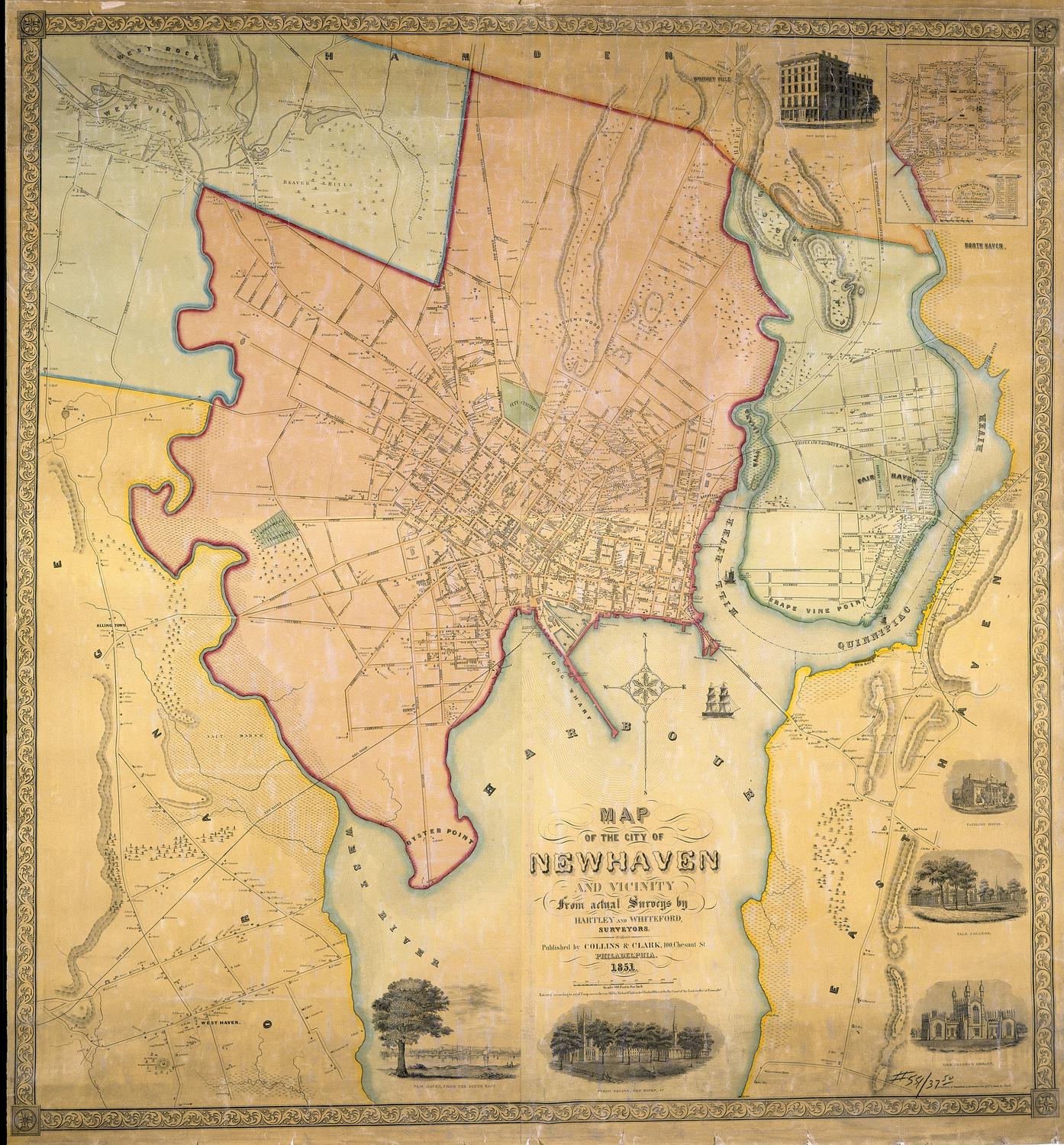
Map of the City of New Haven and Vicinity
Hartley and Whiteford
1851
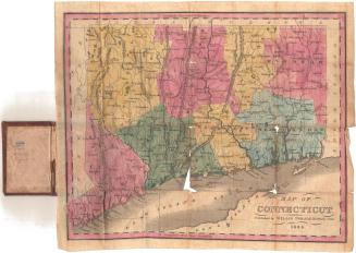
Map of Connecticut
Willis Thrall
1834
Image Not Available
for Colton's Vermont
Colton's Vermont
J. H. Colton & Co.
1860
Next Page