Skip to main content
Collections
People
Favorites
Advanced Search
Search
Objects
(28,178)
People
(7,702)
Close
Refine Results
Classification(s)
Graphics
(19,906)
Costume
(2,620)
Information Artifacts
(1,478)
Ceramics
(911)
Born Digital
(900)
Equipment
(850)
Painting
(689)
Textiles
(478)
Glassware
(347)
Furniture
(339)
Load all
Classification(s)
Collections
DeMars Photographs
(3,742)
Richard Welling Collection
(1,206)
Kellogg Brothers Lithographs
(1,151)
Maps and Charts: Finding Your Place in Connecticut History
(807)
G. Fox & Co.
(544)
Women Photographers
(328)
Clifford Mitchell: Architect, Artist, and Teacher
(169)
Connecticut Needlework: Women, Art, and Family, 1740-1840
(84)
West End Architecture
(70)
COVID-19 Pandemic Oral History Interviews (Community History Project), 2022-2023
(69)
Load all
Collections
Date
to
Department
Visual Collections
(20,613)
Costume and Textiles
(3,213)
Home Life
(1,851)
Ephemera
(956)
Technology
(569)
Social Life
(310)
Audio Collections
(268)
Commercial Life
(250)
Native American
(148)
Geography
Hartford
(1)
New Britain
(1)
Image Available
On View
Sort:
Relevance
Title (A–Z)
Date (Older First)
Object number (Ascending)
Last Updated (Ascending)
List
Images
Table
Filters
View PDF
28178 results for
*
Result type
Objects
People
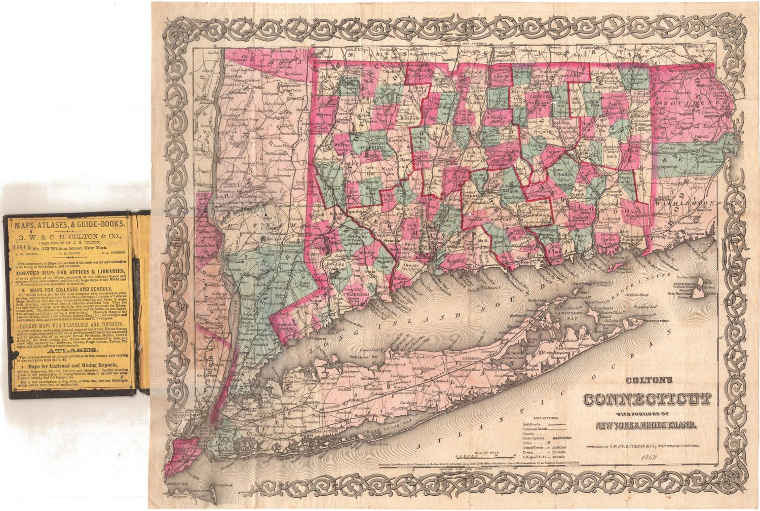
Colton's Connecticut, with portions of New York and Rhode Island
G.W. & C.B. Colton & Co.
1868
Image Not Available
for Sword with Scabbard
Sword with Scabbard
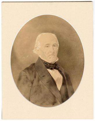
Governor Jonathan Trumbull
about 1760
Image Not Available
for Map of Connecticut, Issued in Commemoration of the State's Tercentenary
Map of Connecticut, Issued in Commemoration of the State's Tercentenary
John Held Jr.
1935
Map of Maryland, Virginia, and Delaware
Brown and Parsons
1838
Connecticut, Eastern Part
Geo. H. Walker & Co.
1893
Image Not Available
for Connecticut
Connecticut
Unknown
Probably 1807
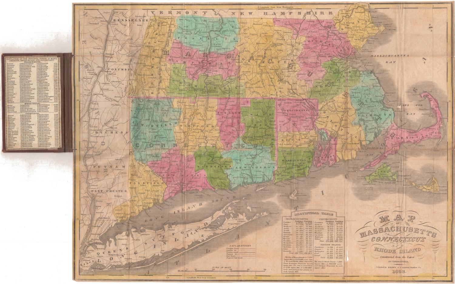
Map of Massachusetts, Connecticut and Rhode Island
Brown and Parsons
1838
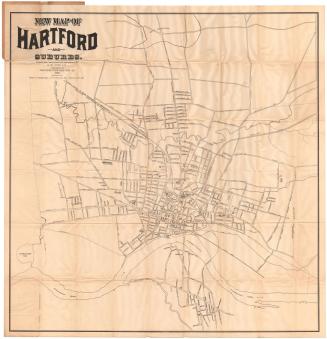
New Map of Hartford and Suburbs
Luther W. Burt
1898
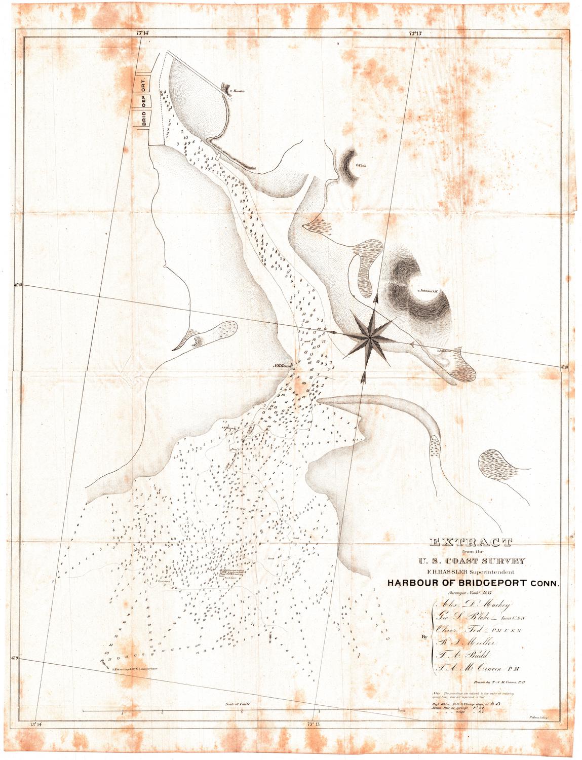
Harbour of Bridgeport, Connecticut
George S. Blake
1835
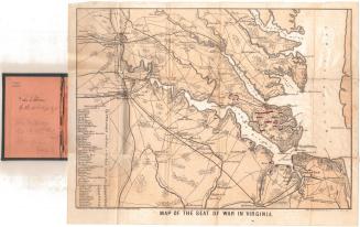
Map of the Seat of War in Virginia
E. Sachse & Co.
1861
Post Route Map of the States of New Hampshire, Vermont, Massachusetts, Rhode Island, Connecticut and parts of New York and Maine
William L. Nicholson
1882
Image Not Available
for Smith's Railroad, Steamboat & Stage Route Map of New England, New-York and Canada
Smith's Railroad, Steamboat & Stage Route Map of New England, New-York and Canada
John Calvin Smith
1858
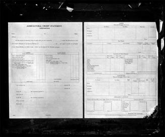
Agricultural Credit Statement
William G. Dudley
1916-1927
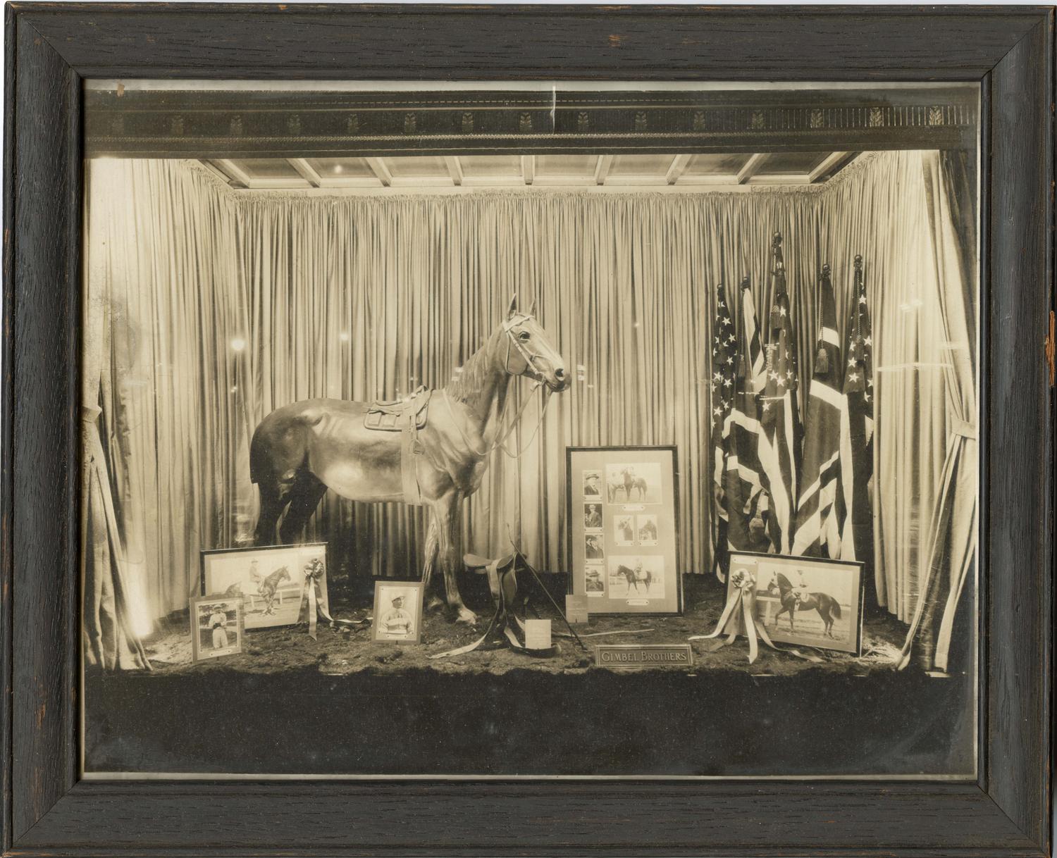
Smith-Worthington Saddlery Co. Store Window Display
Smith-Worthington Saddlery Company
Connecticut
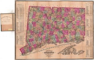
George F. Cram & Co.
about 1909
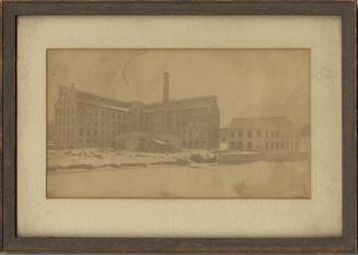
Smith-Worthington Saddlery Co. Building, Sigourney Street, Hartford
Smith-Worthington Saddlery Company
c. 1882-1961
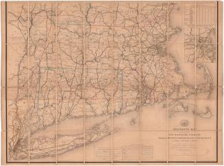
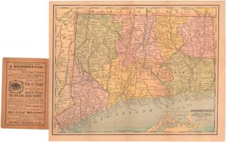
New Map of Connecticut
Samuel D. Tilden
1882
Image Not Available
for Vermont
Vermont
Moody M. Peabody
before 1824
Image Not Available
for The State of Connecticut with all the New Towns Including Parts of New York and New Jersey
The State of Connecticut with all the New Towns Including Parts of New York and New Jersey
Lucius Stebbins & Co.
1859
Smith, Bourn & Co. Building, Sigourney Street, Hartford
Smith-Worthington Saddlery Company
before 1893
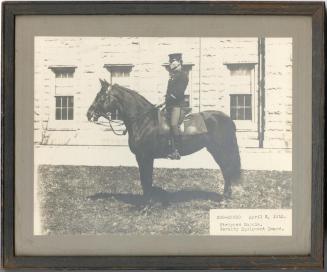
Normand Smith
Normand Smith
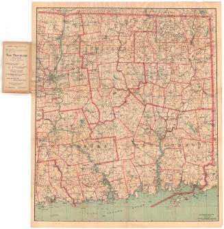
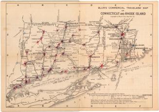
Blum's Commerical Travelers' Map of Connecticut and Rhode Island
Blum's Commercial Map Publishing Company
1927-1928
Stripped Saddle, Cavalry Equipment Board, 1912
Smith-Worthington Saddlery Company
1912
Image Not Available
for New Map of Hartford from the Latest Surveys
New Map of Hartford from the Latest Surveys
Kellogg & Bulkeley
1877
Next Page