Skip to main content
Collections
People
Favorites
Advanced Search
Currently indexing
Search
Objects
(28,138)
People
(7,691)
Close
Refine Results
Classification(s)
Graphics
(805)
Equipment
(1)
Hardware
(1)
Collections
*
Maps and Charts: Finding Your Place in Connecticut History
(807)
Kellogg Brothers Lithographs
(1)
Date
to
Department
Visual Collections
(807)
Image Available
On View
Sort:
Relevance
Title (A–Z)
Date (Older First)
Object number (Ascending)
Last Updated (Ascending)
List
Images
Table
Filters
View PDF
807 results for
*
Result type
Objects
People
Maps and Charts: Finding Your Place in Connecticut History
Clear All Filters
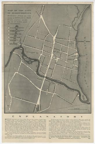
Map of the City of Hartford, Connecticut
Daniel Saint John
1935
Map of Connecticut Showing the System of Trunk Line Highways and Connecting State Aid Roads
Connecticut State Highway Department
1930
Map of the Mattutuck State Forest
State Forester
1929
Image Not Available
for Map of Valuable Building Lots Situated on Main Street Continued
Map of Valuable Building Lots Situated on Main Street Continued
Unknown
1852
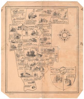
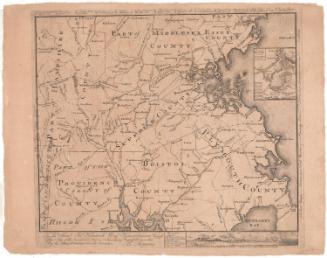
Map of Tolland County, Connecticut
S. Jerome Hoxie
1934
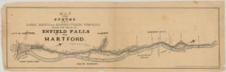
Map of the Survey for a Canal Route for Manufacturing Purposes from the Head of Enfield Falls to Hartford
Philander Anderson
1847
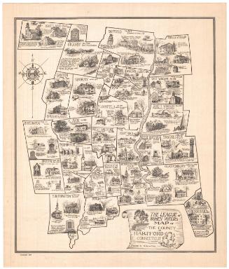
The League of Women Voters Map of the County of Hartford Connecticut
S. Jerome Hoxie
1934
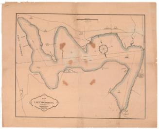
Map of Lake Waramaug, Litchfield County, Connecticut
W. Hager & Co.
1875
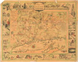
The Commonwealth of Connecticut
Amy Drevenstedt
1926
To the Honl. Jno. Hancock, Esqre, President of Ye Continental Congress, This Map of the Seat of Civil War in America is Respectfully Inscribed
Bernard Romans
1775
Map of Lands and Water Power for sale by Oliver and James Moore Erving and Montague, Mass.
James Stevens
1856
Copy of E. M. Woodford map of 1856 with Additions
Unknown
1928
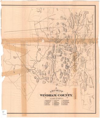
Ancient Windham County
J. H. Bufford's Sons
1874
Vermont from Actual Survey
Amos Doolittle
1795
Conneticut with Portions of New York and Rhode Island
J. H. Colton & Co.
1855
Image Not Available
for Map of Middlesex County
Map of Middlesex County
S. Jerome Hoxie
1934
Tunxis Trail
Romeyn A. Spare
1955
Granger Mills on the Connecticut River
Unknown
1794
Survey of Hartford and Springfield Rail Road
James N. Palmer
1841
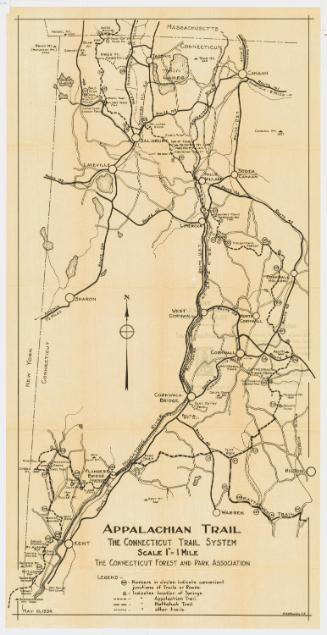
Appalachian Trail: The Connecticut Trail System
Connecticut Forest and Park Association
1934
Image Not Available
for Historical Map of New London County, 1666-1933
Historical Map of New London County, 1666-1933
S. Jerome Hoxie
1934
Connecticut
Moses Warren Jr.
1820
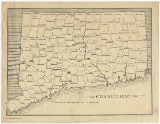
Connecticut
State Department of Health
after 1921
Map of Connecticut Showing the Work Done, Under Construction and Proposed by the State Highway Department
Connecticut State Highway Department
1916
Next Page