Skip to main content
Collections
People
Favorites
Advanced Search
Search
Objects
(28,050)
People
(7,658)
Close
Refine Results
Classification(s)
Graphics
(805)
Equipment
(1)
Hardware
(1)
Collections
*
Maps and Charts: Finding Your Place in Connecticut History
(807)
Kellogg Brothers Lithographs
(1)
Date
to
Department
Visual Collections
(807)
Image Available
On View
Sort:
Relevance
Title (A–Z)
Date (Older First)
Object number (Ascending)
Last Updated (Ascending)
List
Images
Table
Filters
View PDF
807 results for
*
Result type
Objects
People
Maps and Charts: Finding Your Place in Connecticut History
Clear All Filters
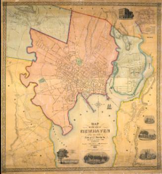
Map of the City of New Haven and Vicinity
Hartley and Whiteford
1851
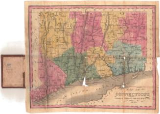
Map of Connecticut
Willis Thrall
1834
Image Not Available
for Colton's Vermont
Colton's Vermont
J. H. Colton & Co.
1860
Price, Lee & Co.'s New Map of the City of New Haven
Silus W. Searle
after 1873
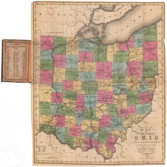
Map of the State of Ohio From the latest and best Authorities; Including the Census of 1830
Abner Reed
1831
Image Not Available
for Colton's Railroad and Township Map of Massachusetts, Rhode Island and Connecticut
Colton's Railroad and Township Map of Massachusetts, Rhode Island and Connecticut
J. H. Colton & Co.
1854
Map of Connecticut from actual Survey
Brown and Parsons
1848
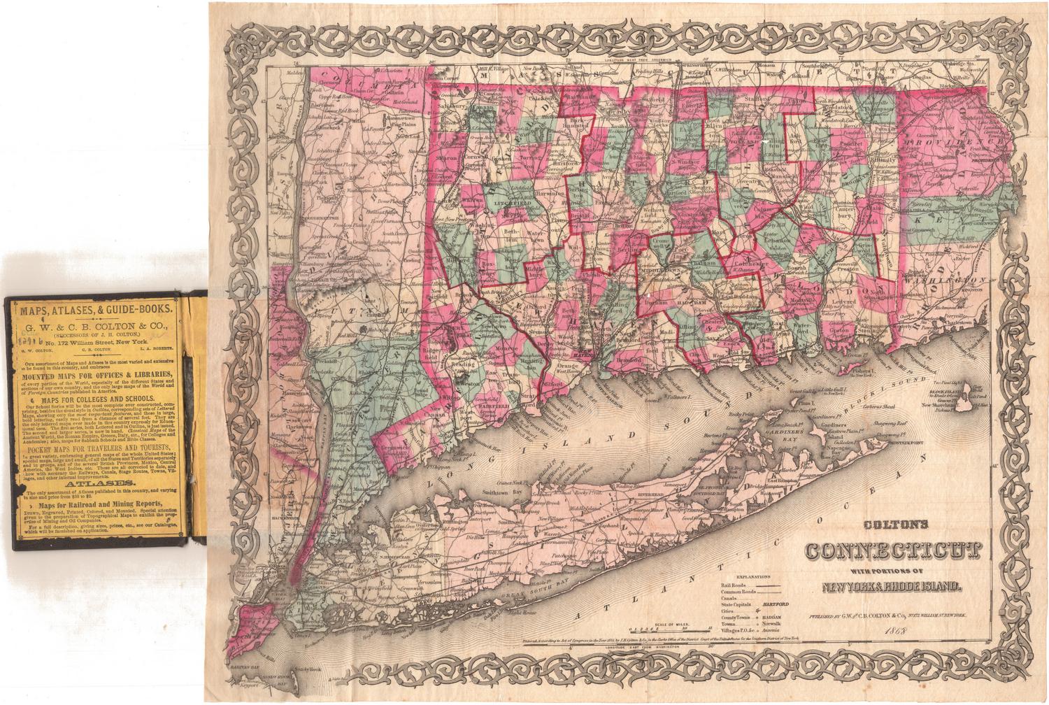
Colton's Connecticut, with portions of New York and Rhode Island
G.W. & C.B. Colton & Co.
1868
Image Not Available
for Map of Connecticut, Issued in Commemoration of the State's Tercentenary
Map of Connecticut, Issued in Commemoration of the State's Tercentenary
John Held Jr.
1935
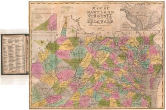
Map of Maryland, Virginia, and Delaware
Brown and Parsons
1838
Connecticut, Eastern Part
Geo. H. Walker & Co.
1893
Image Not Available
for Connecticut
Connecticut
Unknown
Probably 1807
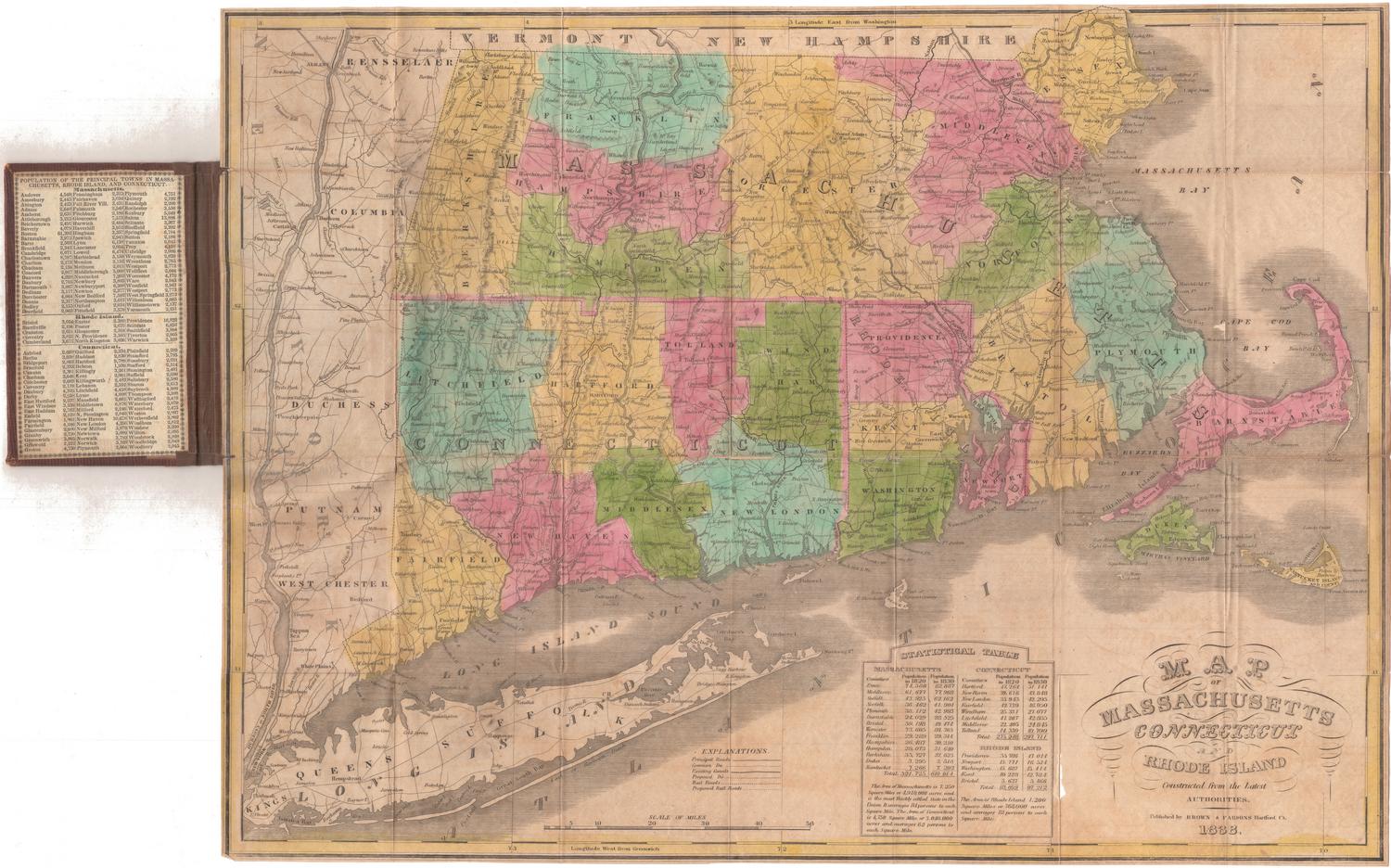
Map of Massachusetts, Connecticut and Rhode Island
Brown and Parsons
1838
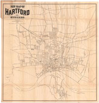
New Map of Hartford and Suburbs
Luther W. Burt
1898
Harbour of Bridgeport, Connecticut
George S. Blake
1835
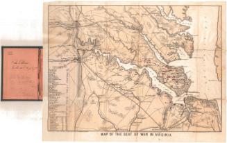
Map of the Seat of War in Virginia
E. Sachse & Co.
1861
Post Route Map of the States of New Hampshire, Vermont, Massachusetts, Rhode Island, Connecticut and parts of New York and Maine
William L. Nicholson
1882
Image Not Available
for Smith's Railroad, Steamboat & Stage Route Map of New England, New-York and Canada
Smith's Railroad, Steamboat & Stage Route Map of New England, New-York and Canada
John Calvin Smith
1858
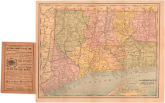
Connecticut
George F. Cram & Co.
about 1909
New Map of Connecticut
Samuel D. Tilden
1882
Image Not Available
for Vermont
Vermont
Moody M. Peabody
before 1824
Image Not Available
for The State of Connecticut with all the New Towns Including Parts of New York and New Jersey
The State of Connecticut with all the New Towns Including Parts of New York and New Jersey
Lucius Stebbins & Co.
1859
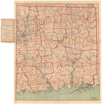
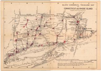
Blum's Commerical Travelers' Map of Connecticut and Rhode Island
Blum's Commercial Map Publishing Company
1927-1928
Image Not Available
for New Map of Hartford from the Latest Surveys
New Map of Hartford from the Latest Surveys
Kellogg & Bulkeley
1877
Next Page