Skip to main content
Collections
People
Favorites
Advanced Search
Currently indexing
Search
Objects
(28,070)
People
(7,659)
Close
Refine Results
Classification(s)
Graphics
(805)
Equipment
(1)
Hardware
(1)
Collections
*
Maps and Charts: Finding Your Place in Connecticut History
(807)
Kellogg Brothers Lithographs
(1)
Date
to
Department
Visual Collections
(807)
Image Available
On View
Sort:
Relevance
Title (A–Z)
Date (Older First)
Object number (Ascending)
Last Updated (Ascending)
List
Images
Table
Filters
View PDF
807 results for
*
Result type
Objects
People
Maps and Charts: Finding Your Place in Connecticut History
Clear All Filters
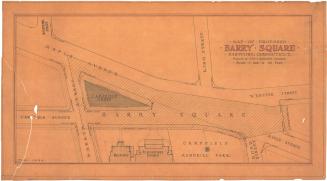
Map of Proposed Barry Square, Hartford, Connecticut
John J. McMahon
1934
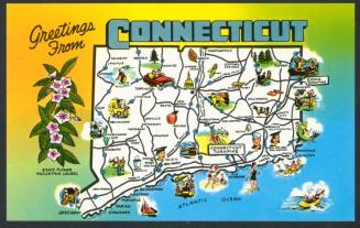
Greetings from Connecticut
Colourpicture Publishers, Inc.
1965-1969
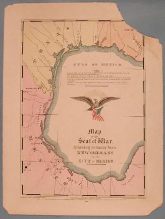
Map of the Seat of War, Embracing the Country from New Orleans to the City of Mexico.
E.B. & E.C. Kellogg
1846
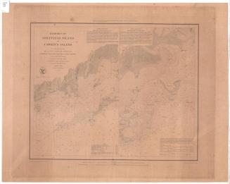
Harbors of Sheffield Island and Cawkins Island
United States Coast Survey
1848
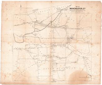
Map of Manchester, Conn.
Eli Bissell
1849
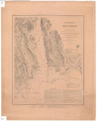
The Harbor of New London
United States Coast Survey
1848
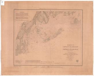
Harbors of Captain's Island East and Captain's Island West
United States Coast Survey
1849
Image Not Available
for Map of the State of Connecticut
Map of the State of Connecticut
J. B. Beers & Co.
1884
Image Not Available
for Railroad map of Massachusetts, Connecticut and Rhode Island
Railroad map of Massachusetts, Connecticut and Rhode Island
J. T. Powers & Co.
1852-1860
Image Not Available
for Hartford County, Connecticut
Hartford County, Connecticut
United States Geological Survey
1974
Image Not Available
for Talcott Mountain Forest Protective Association
Talcott Mountain Forest Protective Association
Talcott Mountain Forest Protective Association
1933
Image Not Available
for New London County, Connecticut
New London County, Connecticut
United States Geological Survey
1979
Image Not Available
for New Haven County, Connecticut
New Haven County, Connecticut
United States Geological Survey
1980
Image Not Available
for Litchfield County, Connecticut
Litchfield County, Connecticut
United States Geological Survey
1979
Image Not Available
for South half, Fairfield County, Connecticut
South half, Fairfield County, Connecticut
United States Geological Survey
1980
Image Not Available
for North half, Fairfield County, Connecticut
North half, Fairfield County, Connecticut
United States Geological Survey
1979
Image Not Available
for Map of the United States with its Territories.including also a part of Upper and Lower Canada and Mexico.
Map of the United States with its Territories.including also a part of Upper and Lower Canada and Mexico.
Reed & Barber
1854
Image Not Available
for Map of Tolland County Connecticut
Map of Tolland County Connecticut
W. C. Eaton
1857
Image Not Available
for Map of the United States of America with its Territories.including also a part of Upper and Lower Canada and Mexico.
Map of the United States of America with its Territories.including also a part of Upper and Lower Canada and Mexico.
Reed & Barber
1842
Image Not Available
for Map of Meriden
Map of Meriden
Stephen C. Pierson
1891
Image Not Available
for The Map of Pioneer Hartford, Showing Early Landmarks and the Locations of Historical Events
The Map of Pioneer Hartford, Showing Early Landmarks and the Locations of Historical Events
James Goldie
1927
Image Not Available
for New Haven, New Haven County, Connecticut
New Haven, New Haven County, Connecticut
American Guide Co.
probably before 1887
Image Not Available
for A Map of the New England States: Maine, New Hampshire, Vermont, Massachusetts, Rhode Island and Connecticut
A Map of the New England States: Maine, New Hampshire, Vermont, Massachusetts, Rhode Island and Connecticut
John Peter Van Ness Throop
1826
Image Not Available
for The "Good Roads" Survey of New England
The "Good Roads" Survey of New England
F. S. Blanchard and Company
1905
Next Page