Skip to main content
Collections
People
Favorites
Advanced Search
Currently indexing
Search
Objects
(23,008)
People
(7,717)
Close
Refine Results
Classification(s)
Graphics
(15,879)
Costume
(2,298)
Ceramics
(844)
Equipment
(603)
Painting
(568)
Information Artifacts
(549)
Textiles
(439)
Furniture
(295)
Glassware
(263)
Commercial Objects
(144)
Load all
Classification(s)
Collections
DeMars Photographs
(3,740)
Richard Welling Collection
(1,206)
Kellogg Brothers Lithographs
(852)
G. Fox & Co.
(507)
Maps and Charts: Finding Your Place in Connecticut History
(356)
Women Photographers
(317)
Clifford Mitchell: Architect, Artist, and Teacher
(169)
Connecticut Needlework: Women, Art, and Family, 1740-1840
(75)
West End Architecture
(67)
Tavern and Inn Signs
(64)
Load all
Collections
Date
to
Department
Visual Collections
(16,520)
Costume and Textiles
(2,728)
Home Life
(1,626)
Technology
(472)
Ephemera
(398)
Social Life
(256)
Commercial Life
(181)
Native American
(55)
Geography
New Britain
(1)
Image Available
On View
Sort:
Relevance
Title (A–Z)
Date (Older First)
Object number (Ascending)
Last Updated (Ascending)
List
Images
Table
Filters
View PDF
23008 results for
*
Result type
Objects
People
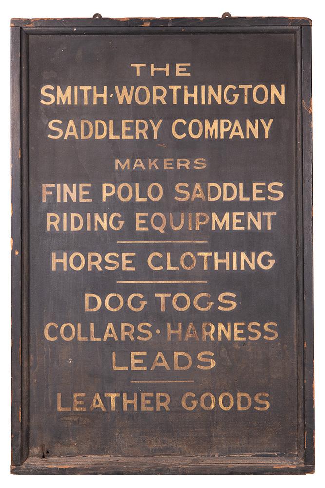
Smith-Worthington Saddlery Company Store Sign
Smith-Worthington Saddlery Company
c. 1842-1905
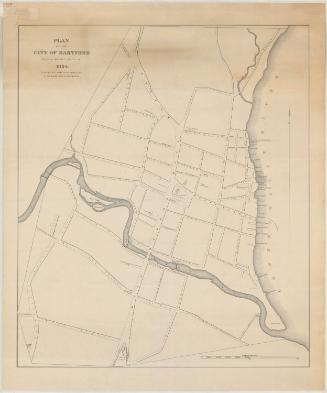
Plan of the City of Hartford from a Survey made in 1824
Nathaniel Goodwin
1824
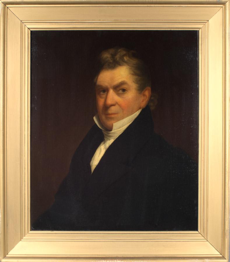
Judge Samuel Andrew Law
Judge Samuel A. Law
1831
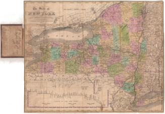
The State of New York from the Most Recent Surveys
Eleazer Huntington
1833
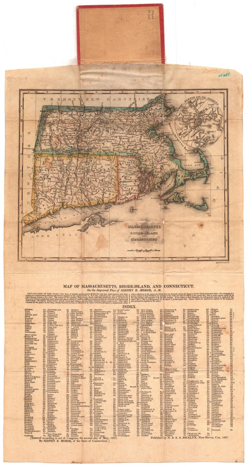
Massachusetts, Rhode-Island and Connecticut
N. & S. S. Jocelyn
1827
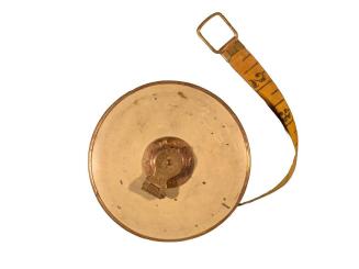
Tape Measure
Landers, Frary, and Clark
Maine, New Hampshire, Vermont, Massachusetts, Rhode Island, Connecticut and Lower Canada
George W. Colton
1861
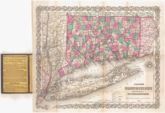
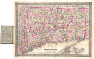
Colton's Connecticut, with portions of New York and Rhode Island
J. H. Colton & Co.
1869
Image Not Available
for Connecticut
Connecticut
John Warner Barber
Probably 1852
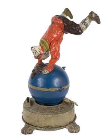
Funny Clown Bank
J. & E. Stevens Co.
1890
Colton's New Township Map of the State of Connecticut
G.W. & C.B. Colton & Co.
1886
Image Not Available
for Map of Connecticut
Map of Connecticut
Kellogg & Bulkeley
1875-1877
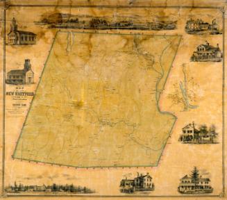
Map of the Town of New Hartford, Litchfield County, Connecticut
Lawrence Fagan
1852
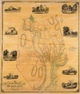
City of Norwich, New London County, Connecticut
George Stevens
1858
Image Not Available
for A Distance Map of the Town of Franklin
A Distance Map of the Town of Franklin
Andrew B. Smith
1858
Colton's Connecticut, with portions of New York and Rhode Island
G.W. & C.B. Colton & Co.
1877
Image Not Available
for Map of Central Part of Hartford County, Conn.
Map of Central Part of Hartford County, Conn.
F. J. Miller
1954-1956
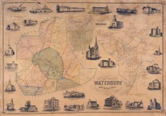
Map of the Town of Waterbury, New Haven County, Connecticut
H. Irvine
1852
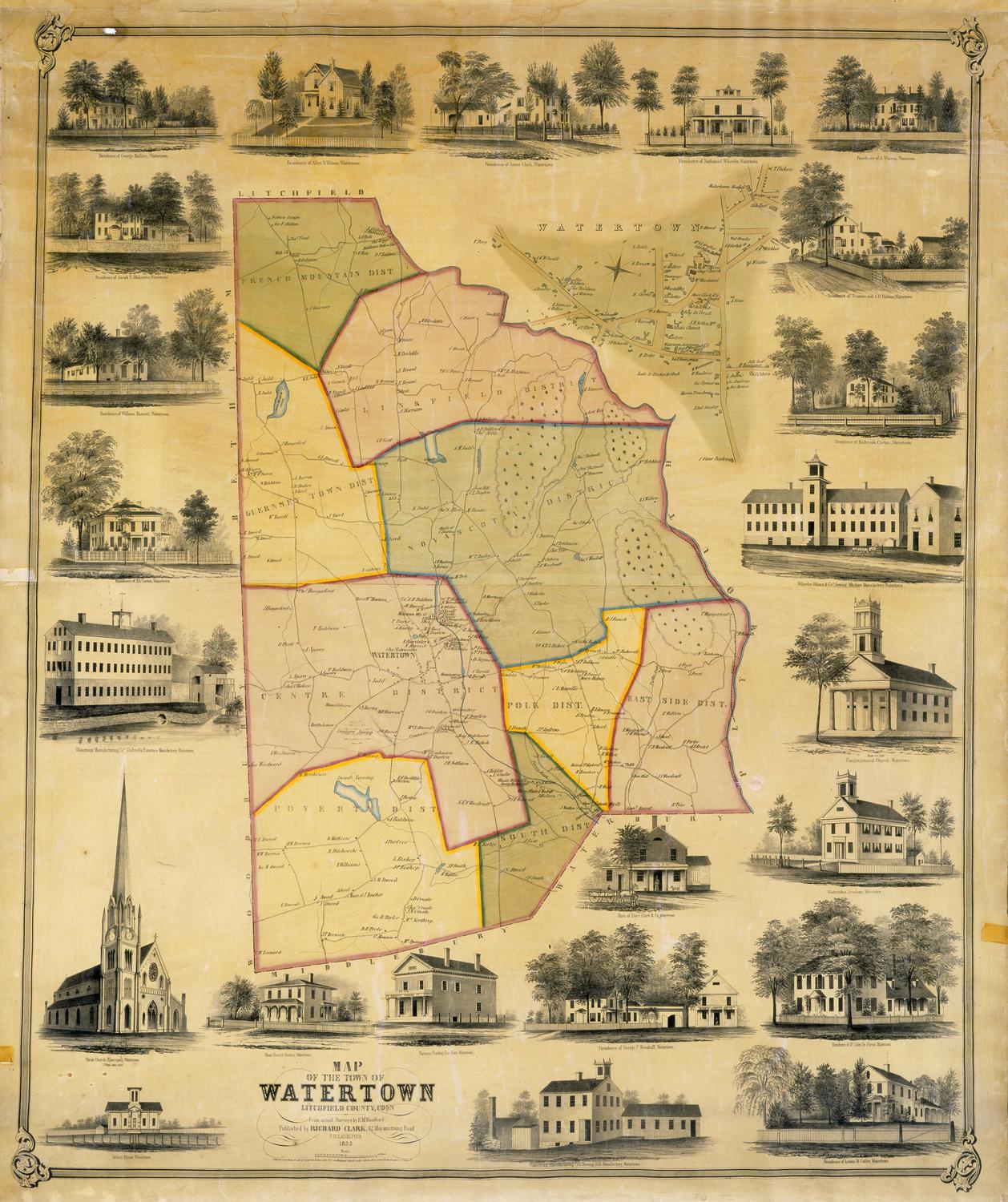
Map of the Town of Watertown, Litchfield County, Conn.
E. M. Woodford
1853
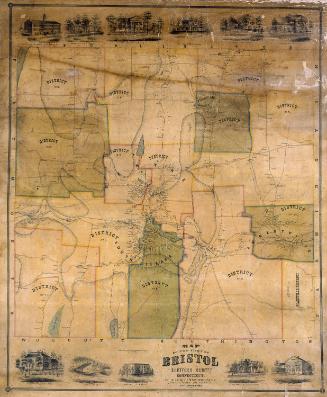
Map of the Town of Bristol, Hartford County, Connecticut
E. M. Woodford
1852
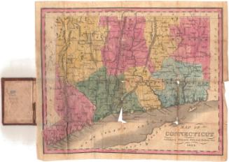
Map of Connecticut
Willis Thrall
1834
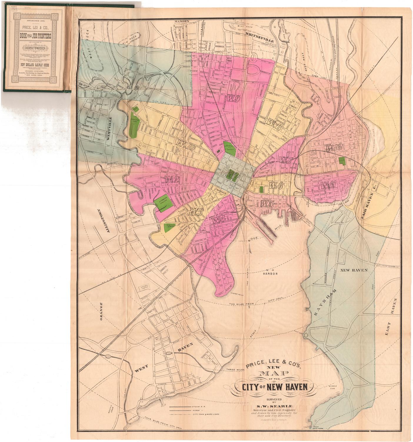
Price, Lee & Co.'s New Map of the City of New Haven
Silus W. Searle
after 1873
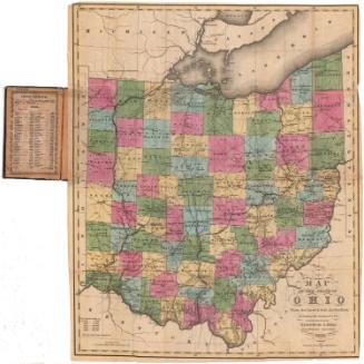
Map of the State of Ohio From the latest and best Authorities; Including the Census of 1830
Abner Reed
1831
Image Not Available
for Colton's Railroad and Township Map of Massachusetts, Rhode Island and Connecticut
Colton's Railroad and Township Map of Massachusetts, Rhode Island and Connecticut
J. H. Colton & Co.
1854
Next Page