Skip to main content
Collections
People
Favorites
Advanced Search
Currently indexing
Search
Objects
(28,144)
People
(7,691)
Close
Refine Results
Classification(s)
Graphics
(805)
Equipment
(1)
Hardware
(1)
Collections
*
Maps and Charts: Finding Your Place in Connecticut History
(807)
Kellogg Brothers Lithographs
(1)
Date
to
Department
Visual Collections
(807)
Image Available
On View
Sort:
Relevance
Title (A–Z)
Date (Older First)
Object number (Ascending)
Last Updated (Ascending)
List
Images
Table
Filters
View PDF
807 results for
*
Result type
Objects
People
Maps and Charts: Finding Your Place in Connecticut History
Clear All Filters
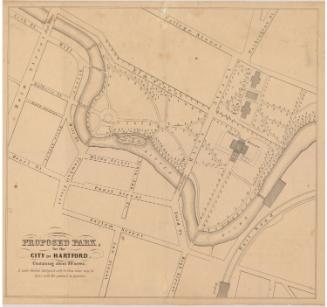
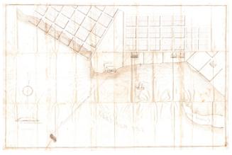
Proposed Park, for the City of Hartford, Containing about 30 acres
Seth E. Marsh
1858
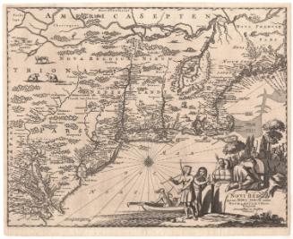
Novi Belgii, quod nunc Novi Jorck
Arnoldus Montanus
1671
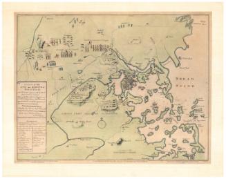
A Plan of the Town and Harbour of Boston
Meriden Gravure Company
1963
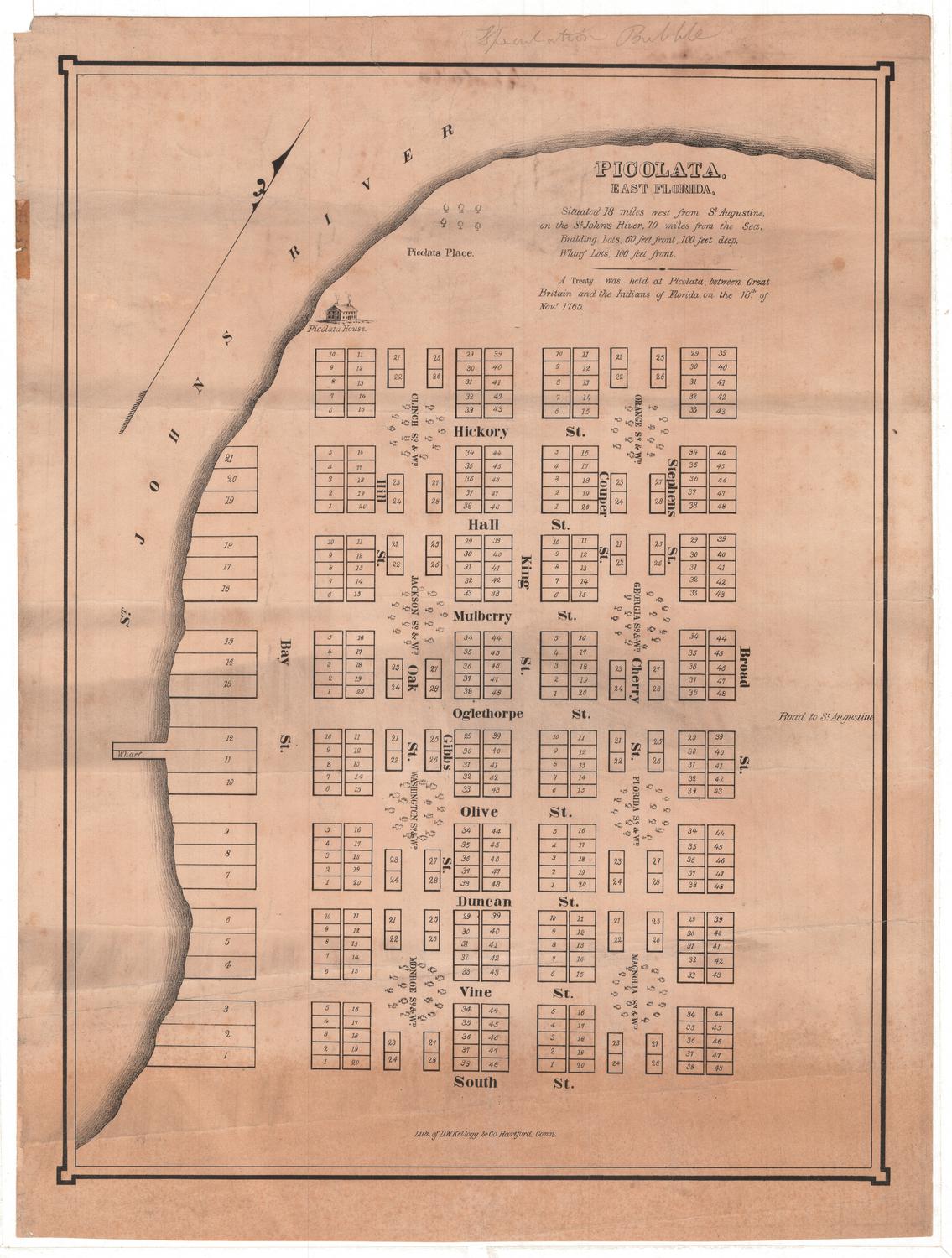
Picolata, East Florida
D. W. Kellogg & Co.
Probably 1830-1835
City of Hartford Map of 4th Ward
Hiram G. Loomis
1869
Connecticut
Hawthorn House
Probably 1942
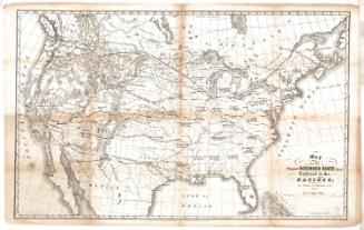
Map of the Proposed Northern Route for a Railroad to the Pacific
Edwin F. Johnson
1853
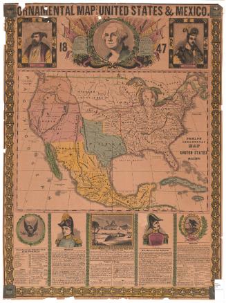
Ornamental Map of the United States & Mexico
Humphrey Phelps
1847
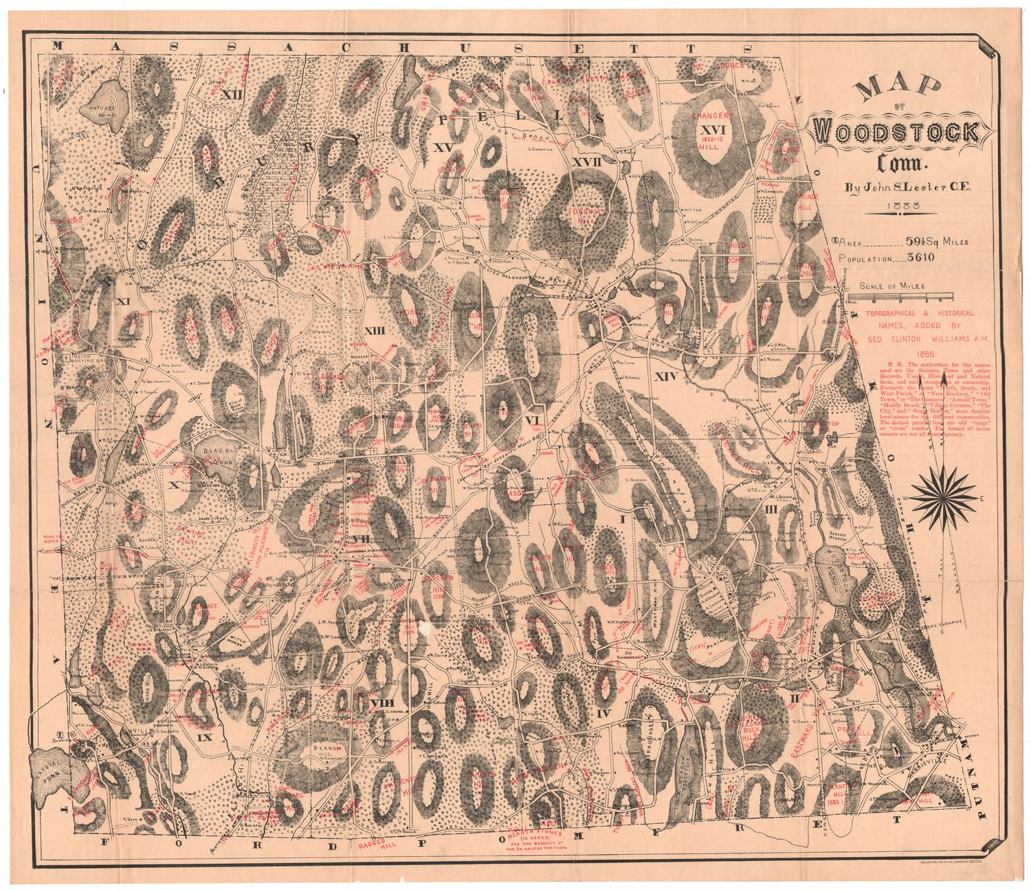
Map of Woodstock, Connecticut
John S. Lester
1883
Aransas Bay
R. F. Patton
1858
Building Lots on Estate of the late David Watkinson
Hiram G. Loomis
1858
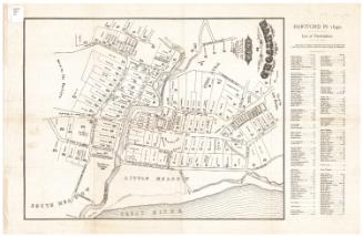
Hartford in 1640
William S. Porter
after 1851
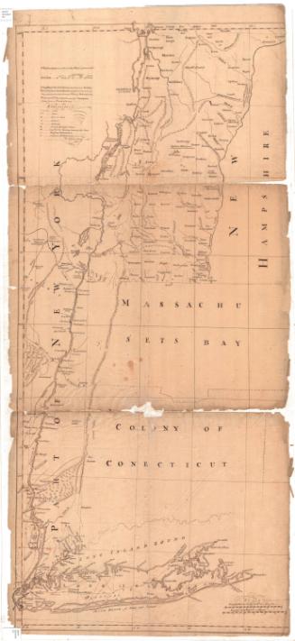
A map of the most inhabited part of New England
W. Dall
after 1777
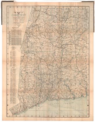
The Heart of the Connecticut
The Bullard Company
1913
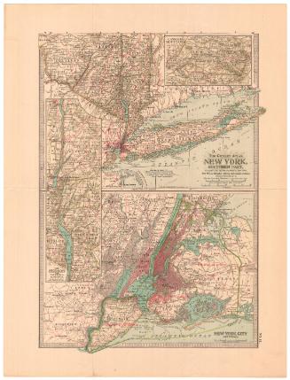
The Century Atlas. New York, Southern Part
Matthews-Northrup Company
1897
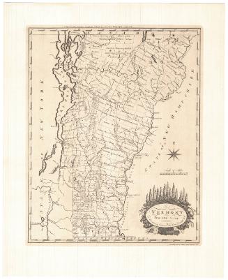
Vermont From actual Survey
Meriden Gravure Company
1957
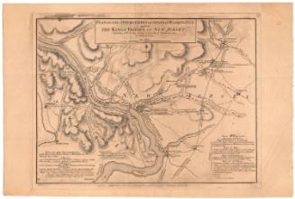
Plan of the Operations of General Washington against the Kings Troops in New Jersey from the 26th of December 1776 to the 3rd of January 1777
William Faden
1777
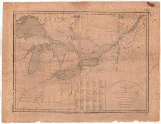
Map of Upper and Lower Canada and United States, contiguous
Thomas Kensett
1812
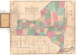
A Map of the State of New York
E.B. & E.C. Kellogg
probably between 1840 and1847
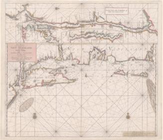
Pas-Kaart van de Zee kusten van Niew Nederland anders genaamt Niew York tusschen Renselaars Hoek en de Staaten Hoek
Johannes van Keulen
1687
Nova Belgica et Anglia Nova
Willem Janszoon Blaeu
1635
Colton's Tourist Guide Map of Massachusetts, Rhode Island and Connecticut, with Parts of Maine, New Hampshire, Vermont and New York
G.W. & C.B. Colton & Co.
1866
Tercentenary Map of Connecticut
John F. Butler
1935
The State of Connecticut including parts of New York and New Jersey
Roderick Nevers
1852
Next Page