Skip to main content
Collections
People
Favorites
Advanced Search
Search
Objects
(28,169)
People
(7,701)
Close
Refine Results
Classification(s)
Graphics
(19,901)
Costume
(2,620)
Information Artifacts
(1,470)
Ceramics
(911)
Born Digital
(896)
Equipment
(847)
Painting
(689)
Textiles
(478)
Glassware
(347)
Furniture
(339)
Load all
Classification(s)
Collections
DeMars Photographs
(3,742)
Richard Welling Collection
(1,206)
Kellogg Brothers Lithographs
(1,151)
Maps and Charts: Finding Your Place in Connecticut History
(807)
G. Fox & Co.
(544)
Women Photographers
(328)
Clifford Mitchell: Architect, Artist, and Teacher
(169)
Connecticut Needlework: Women, Art, and Family, 1740-1840
(84)
West End Architecture
(70)
COVID-19 Pandemic Oral History Interviews (Community History Project), 2022-2023
(65)
Load all
Collections
Date
to
Department
Visual Collections
(20,612)
Costume and Textiles
(3,213)
Home Life
(1,851)
Ephemera
(953)
Technology
(569)
Social Life
(310)
Audio Collections
(264)
Commercial Life
(249)
Native American
(148)
Geography
Hartford
(1)
New Britain
(1)
Image Available
On View
Sort:
Relevance
Title (A–Z)
Date (Older First)
Object number (Ascending)
Last Updated (Ascending)
List
Images
Table
Filters
View PDF
28169 results for
*
Result type
Objects
People
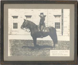
Stripped Saddle, Cavalry Equipment Board, 1912
Smith-Worthington Saddlery Company
1912
Image Not Available
for New Map of Hartford from the Latest Surveys
New Map of Hartford from the Latest Surveys
Kellogg & Bulkeley
1877
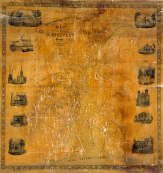
Map of the City of Bridgeport, Conn.
Sidney & Neff
1850
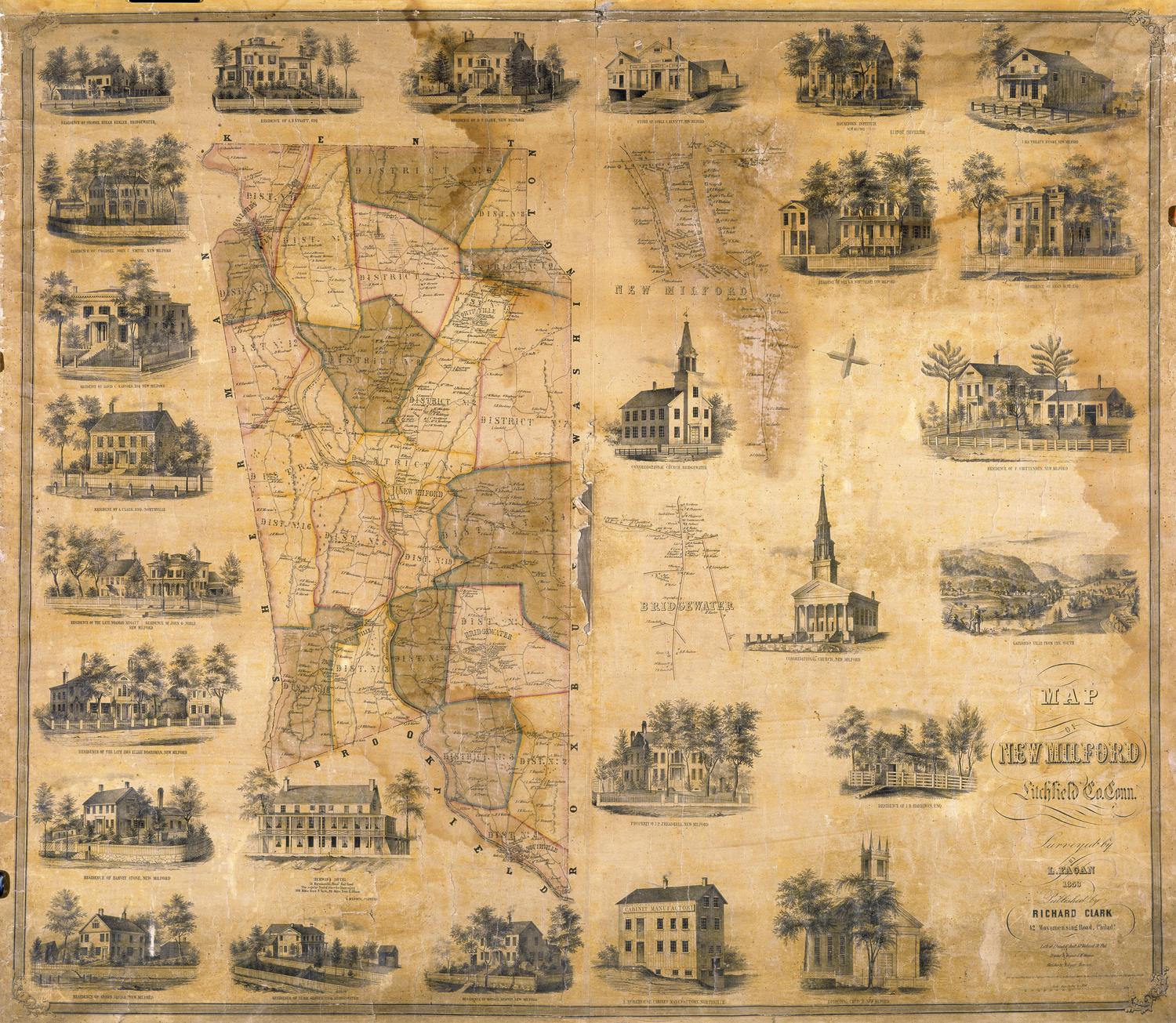
Map of New Milford, Litchfield, County, Connecticut
Lawrence Fagan
1853
Map of the Boroughs of Danbury and Bethel, Fairfield County, Conn.
D. McCarthy
about 1855
West Hartford, Connecticut, Town Map
West Hartford Chamber of Commerce
1976
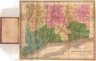
Map of Connecticut
Willis Thrall
1834
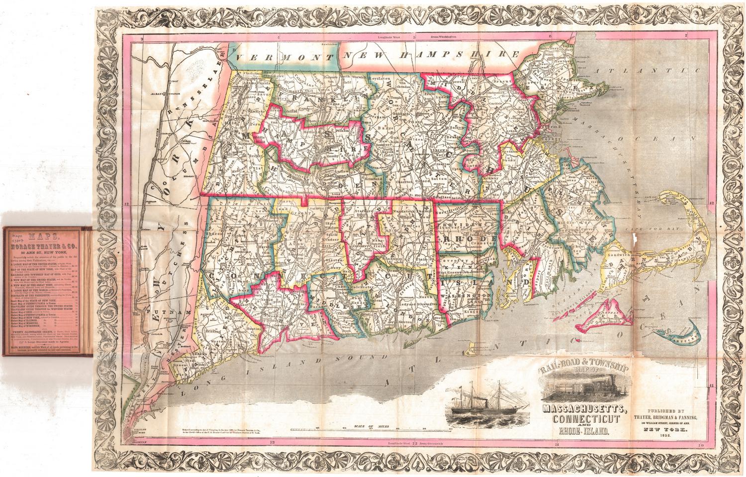
Rail-road and Township Map of Massachusetts, Connecticut and Rhode Island
Thayer, Bridgman & Fanning
1853
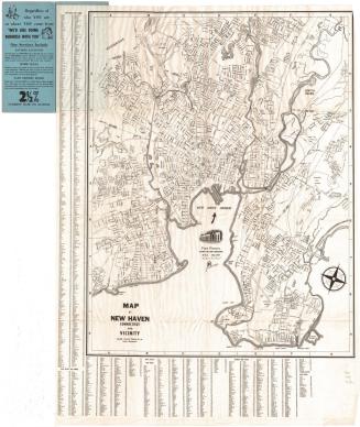
Map of New Haven, Connecticut, and Vicinity
Interstate Publishing Co., Inc.
before 1962
Image Not Available
for Hartford
Hartford
Guyde Publishing Company
1945
Champion Map of Hartford, Connecticut and vicinity
David J. Bennett
1972-1975
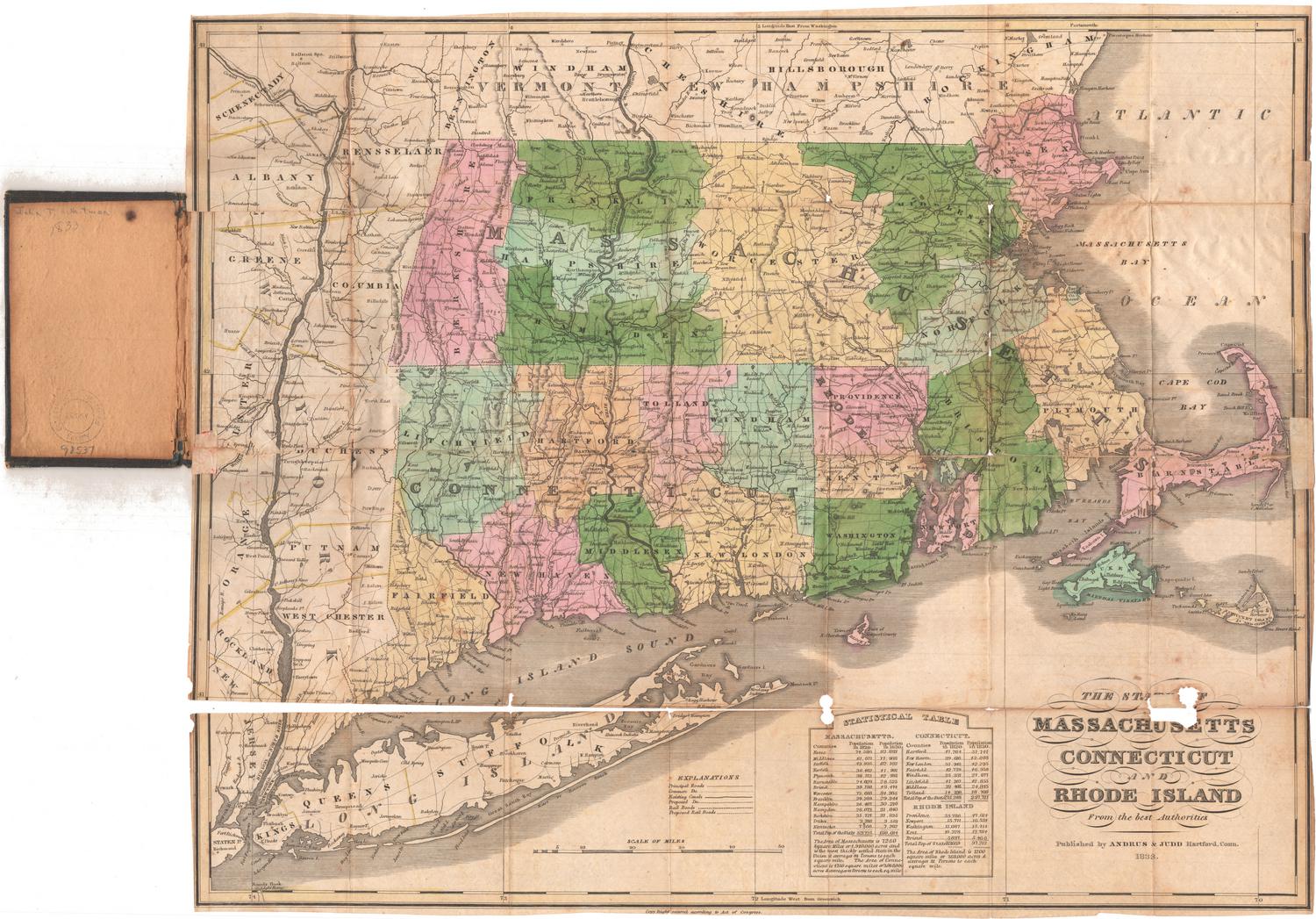
The States of of Massachusetts, Connecticut and Rhode Island, From the best Authorities
Andrus & Judd
1833
Image Not Available
for A Plan of the City of Philadelphia and Environs
A Plan of the City of Philadelphia and Environs
John Hills
1808
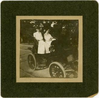
Carolyn Elsner in her Pope Hartford Electric Runabout
Unknown
about 1905
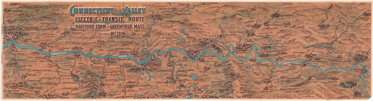
Connecticut Valley Electric Transit Route, Hartford, Connecticut to Greenfield, Massachusetts, Including Mt. Tom
Ernest A. Sherman
1905
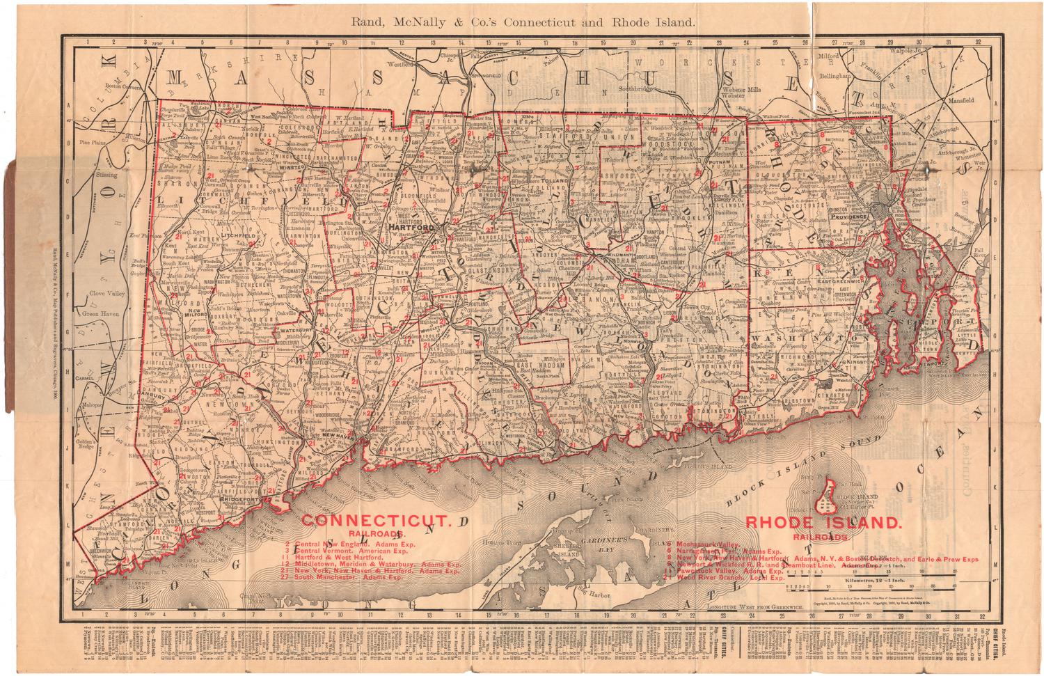
Rand, McNally & Co.'s Connecticut and Rhode Island
Rand, McNally & Co.
1900
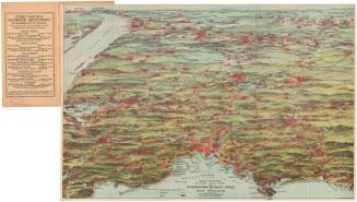
Trolley Pathfinder Birds Eye Map of Interurban Trolley Lines in New England
Geo. H. Walker & Co.
1905
Image Not Available
for Old Connecticut Path, from Larned's History Windham County
Old Connecticut Path, from Larned's History Windham County
Chauncey G. Keeney
after 1880
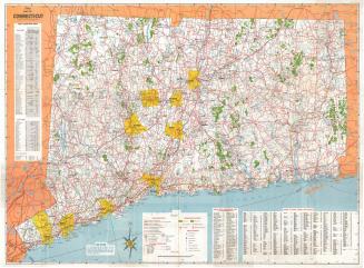
Map of Connecticut
Connecticut State Highway Department
1966
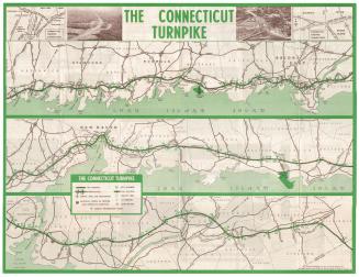
The Connecticut Turnpike
General Drafting Company
after 1961
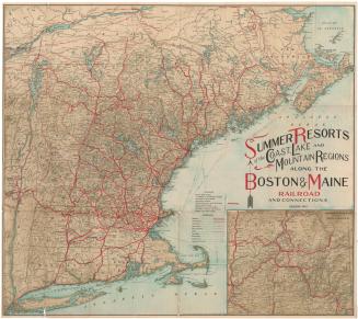
Summer Resorts of the Coast, Lake and Mountain Regions along the Boston & Maine Railroad and Connections
Matthews-Northrup Company
1913
Image Not Available
for Guide Book: Hartford, Connecticut to Burlington, Vermont
Guide Book: Hartford, Connecticut to Burlington, Vermont
H. P. C.
early 20th century
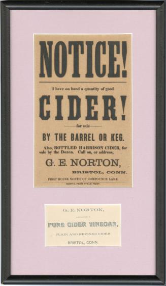
Broadside: G. E. Norton Cider, Bristol
Gilbert E. Norton
before 1926
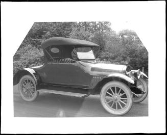
Two Seat Automobile
William G. Dudley
1916-1927
Next Page