Skip to main content
Collections
People
Favorites
Advanced Search
Currently indexing
Search
Objects
(28,058)
People
(7,659)
Close
Refine Results
Classification(s)
Graphics
(805)
Equipment
(1)
Hardware
(1)
Collections
*
Maps and Charts: Finding Your Place in Connecticut History
(807)
Kellogg Brothers Lithographs
(1)
Date
to
Department
Visual Collections
(807)
Image Available
On View
Sort:
Relevance
Title (A–Z)
Date (Older First)
Object number (Ascending)
Last Updated (Ascending)
List
Images
Table
Filters
View PDF
807 results for
*
Result type
Objects
People
Maps and Charts: Finding Your Place in Connecticut History
Clear All Filters
Plan of the Burial Ground
Unknown
1839
Map of the City of New Haven, From Actual Survey
David W. Buckingham
1849
Plan of the Town of New Haven With all the Buildings in 1748
Thomas Kensett
1806
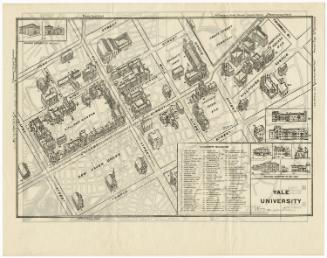
Yale University
Unknown
1928-1932
Map of William Francis' Charter-Oak Park Addition to the City of Hartford
Hiram G. Loomis
1873
Map of Bridgeport
Unknown
1872
Plan of the New-Haven Burying-Ground
Unknown
before 1839
Map of Hartford--1788
Unknown
1921
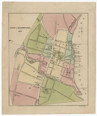
City of Hartford
Erastus B. Cunningham
1832
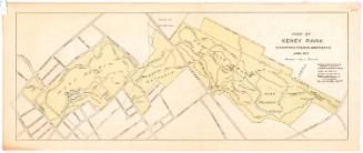
Map of Keney Park Showing Roads and Paths
Unknown
1911
Copy of Map of the City of Hartford
Marcus Smith
1902
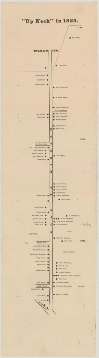
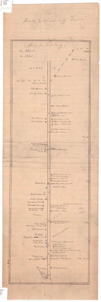
"Up Neck" in 1825.
Unknown
about 1890
Cedar Hill Cemetery
Unknown
about 1866
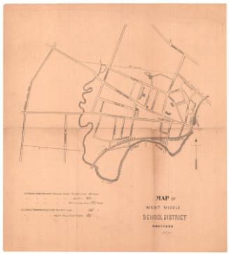
Map of West Middle School District, Hartford
Unknown
Possibly 1871
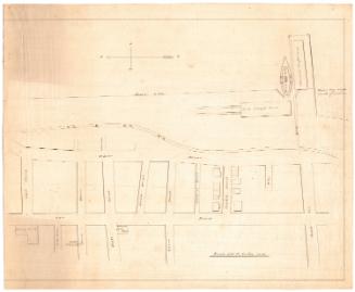
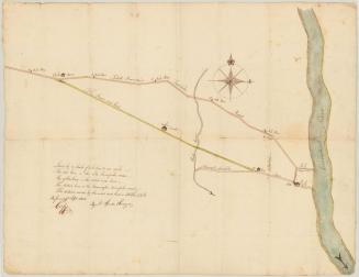
The Road Now Laid
Nathaniel Spencer
1802
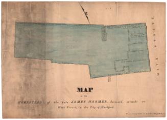
Map of the Homestead of James Hosmer, deceased, situate on Main Street, in the City of Hartford
Nathaniel Goodwin
1837
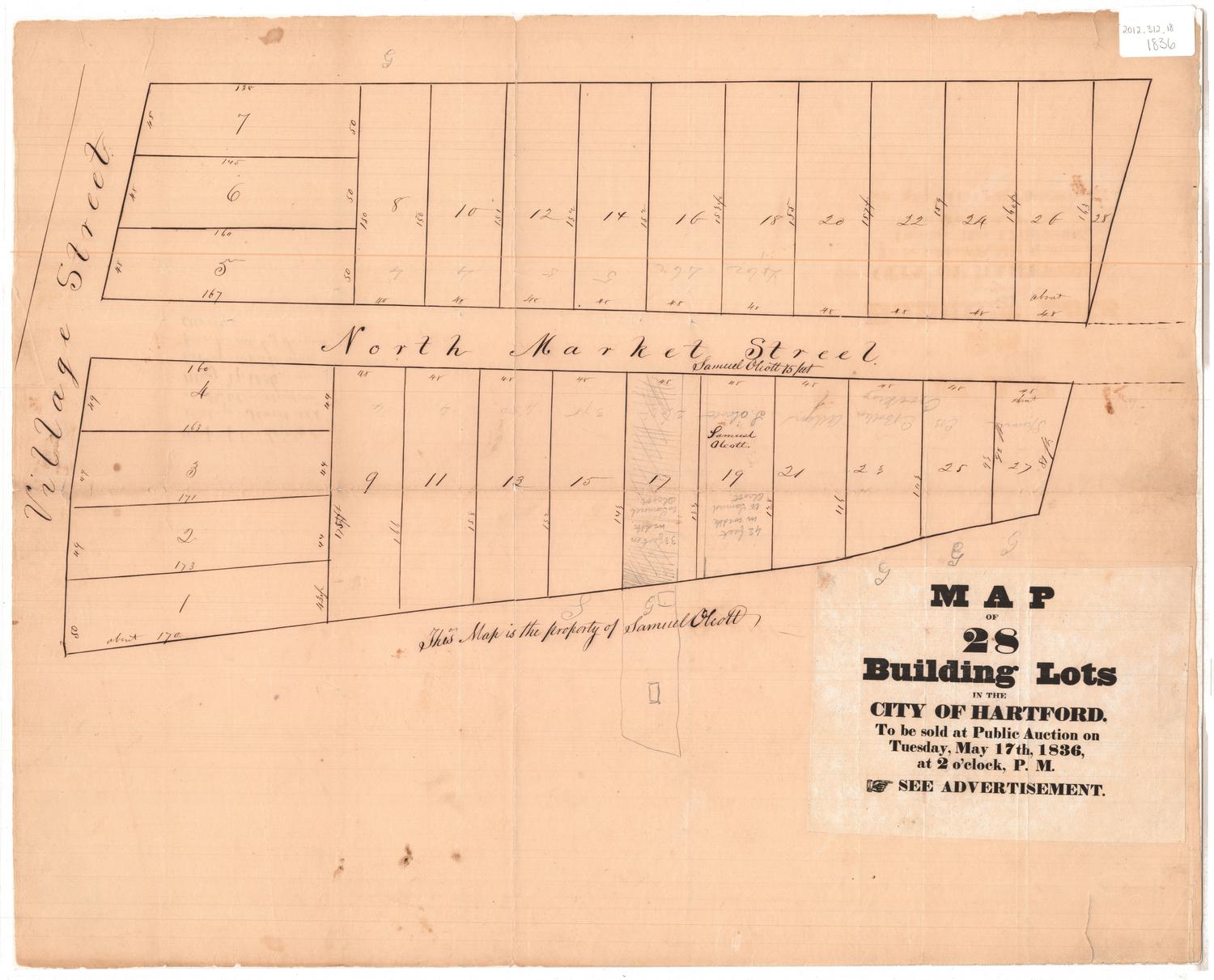
Map of 28 Building Lots in the City of Hartford
Unknown
1836
City of Hartford, Map of 2nd, 3rd & 5th Wards
Hiram G. Loomis
1869?
Up Neck in 1825
Unknown
about 1890
Map of the Town of Manchester
Herbert R. Fitch
1896
A Map of part of lot No. 92 in Oxford formerly Fayette
Unknown
1804
The Towne in 1647
Unknown
20th century
Thompsonville
Chauncey Barnard
1849
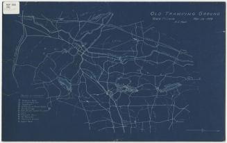
Old Tramping Ground
Amasa Clark Hall
1908
Next Page