Skip to main content
Collections
People
Favorites
Advanced Search
Richard Clark
Close
Refine Results
Artist / Maker / Culture
Richard Clark
(21)
Wagner & McGuigan
(15)
E. M. Woodford
(9)
Friend & Aub
(8)
Lawrence Fagan
(6)
John F. Watson
(3)
Edgar C. Beman
(3)
H. Irvine
(2)
John Houston
(1)
Rosenthal & Kraemer
(1)
Load all
Artist / Maker / Culture
Classification(s)
Graphics
(21)
Collections
Maps and Charts: Finding Your Place in Connecticut History
(21)
Date
to
Department
Visual Collections
(21)
Image Available
On View
Sort:
Title (A–Z)
Title (Z–A)
Date (Older First)
Object number (Ascending)
Primary Maker (A-Z)
Last Updated (Ascending)
List
Images
Table
Filters
View PDF
21 results
Map of the Town of Stamford, Fairfield County, Connecticut
E. M. Woodford
1851
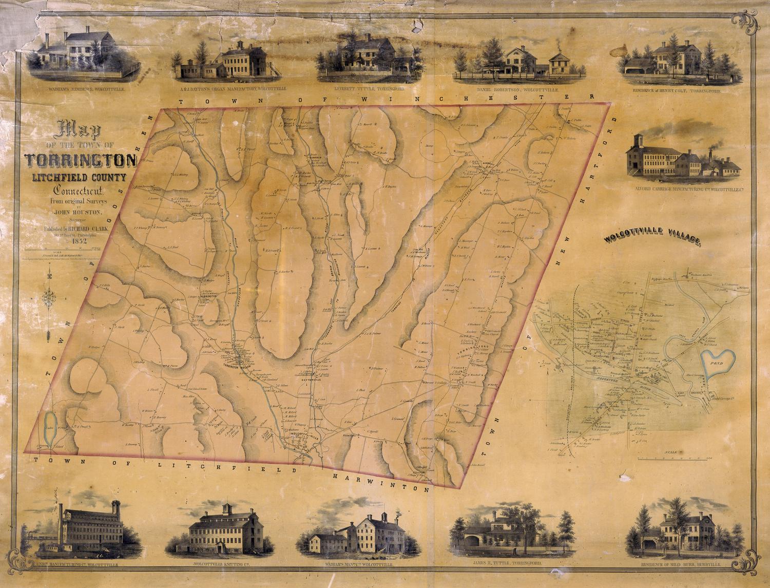
Map of the Town of Torrington, Litchfield, County, Connecticut
John Houston
1852
Map of the Town of Vernon, Tolland County, Conn.
E. M. Woodford
1853
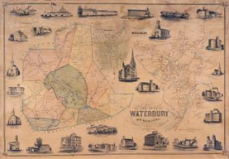
Map of the Town of Waterbury, New Haven County, Connecticut
H. Irvine
1852
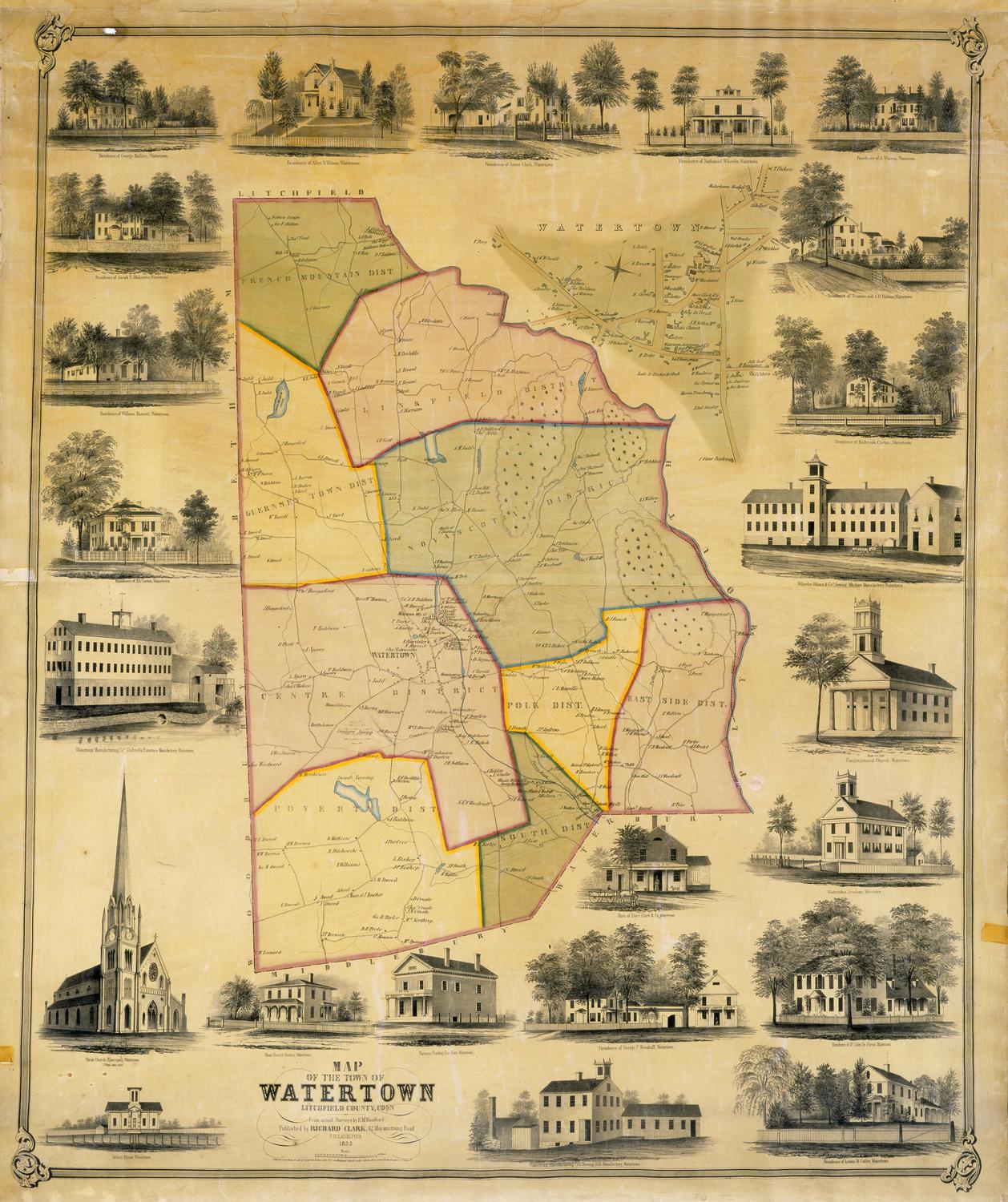
Map of the Town of Watertown, Litchfield County, Conn.
E. M. Woodford
1853
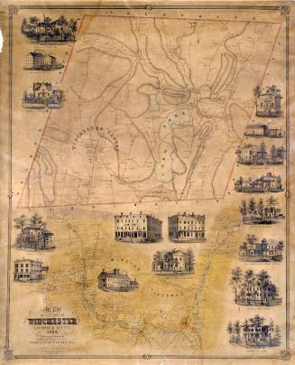
Map of the Town of Winchester, Litchfield County, Conn.
E. M. Woodford
1852
Image Not Available
for Map of the Town of Woodbury, Litchfield County, Connecticut, from actual Surveys by L. Fagan
Map of the Town of Woodbury, Litchfield County, Connecticut, from actual Surveys by L. Fagan
L. Fagan
1853
Map of the Towns of Saybrook and Old Saybrook, Middlesex County, Connecticut
E. M. Woodford
1853
Plan of the Town of Meriden, New Haven County, Connecticut
E. M. Woodford
1851
Next Page