Skip to main content
Collections
People
Favorites
Advanced Search
Works
Close
Refine Results
Classification(s)
Graphics
(805)
Equipment
(1)
Hardware
(1)
Collections
*
Maps and Charts: Finding Your Place in Connecticut History
(807)
Kellogg Brothers Lithographs
(1)
Date
to
Department
Visual Collections
(807)
Image Available
On View
Sort:
Title (A–Z)
Title (Z–A)
Date (Older First)
Object number (Ascending)
Last Updated (Ascending)
List
Images
Table
Filters
View PDF
807 results
Maps and Charts: Finding Your Place in Connecticut History
Clear All Filters
Image Not Available
for 12,000 Square Miles around New York City from New Haven to Trenton, from Long Branch to the Catskills
12,000 Square Miles around New York City from New Haven to Trenton, from Long Branch to the Catskills
H. H. Lloyd & Co.
1866
17th Century Wethersfield, Connecticut
Arthur C. Willard
1951
1974 Map of Connecticut
Connecticut Department of Transportation
1974
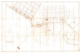
The above are plans of land lying in the town of Sterling belonging to the heirs of Archibald Gordon
George Cady
1834
Africa
Bingham & Kelly
1857
Africa
Mather, Case, Tiffany & Burnham
1841
Ancient Burying Ground, Hartford, Connecticut
1994
Ancient Burying Ground, Hartford, Connecticut
Ancient Burying Ground Association
1994
An Ancient or Bible Map
Eleazer Huntington
1831
Ancient Windham County
J. H. Bufford's Sons
1874
Appalachian Trail: The Connecticut Trail System
Connecticut Forest and Park Association
1934
Aransas Bay
R. F. Patton
1858
Areas Quarantined for Gypsy Moth and Brown-Tail Moth
United States Department of Agriculture
1938
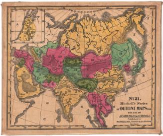
Asia
Bingham & Kelly
1857
Asia
Mather, Case, Tiffany & Burnham
1841
Atlantic Coast of the United States
United States Coast Survey
1863-1864
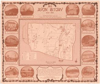
An Avon Story
Dorothy J. Anderson
1980
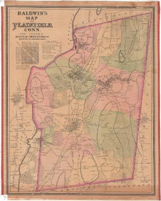
Baldwin's Map of Plainfield, Conn. and Vicinity
I. J. Baldwin
1892
Birds eye view of the Garrison &c of Ticonderoga (by the Indian name Tigrondergua the meeting of the waters)
Unknown
about 1860
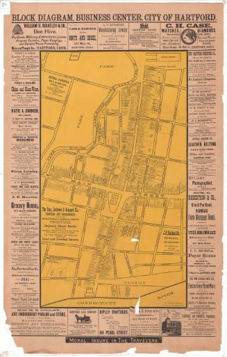
Block Diagram, Business Diagram, City of Hartford
Harry R. Williams
about 1896
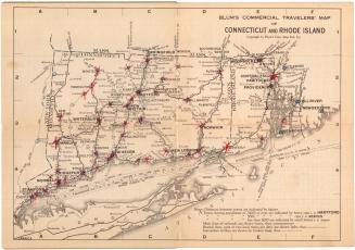
Blum's Commerical Travelers' Map of Connecticut and Rhode Island
Blum's Commercial Map Publishing Company
1927-1928
Image Not Available
for Blunt's New Chart of the North-Eastern Coast of North America
Blunt's New Chart of the North-Eastern Coast of North America
Edmund March Blunt
1819
Borough of Danielsonville in Towns of Killingly and Brooklyn
Ormando Willis Gray
1869
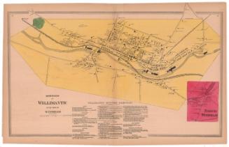
Borough of Willimantic in the Town of Windham
Ormando Willis Gray
1869
Next Page