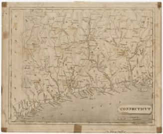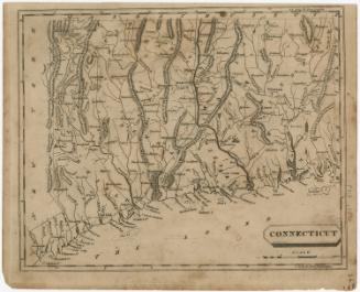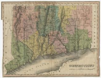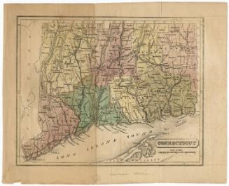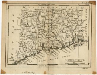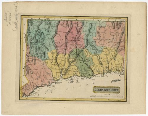
Connecticut
DraftsmanDrawn by
Samuel Lewis
(American, 1754 - 1822)
PrintmakerEngraved by
Henry Schenck Tanner
(American, 1786 - 1858)
Date1816
MediumEngraving; black printer's ink and watercolor on paper
DimensionsPrimary Dimensions (image height x width): 8 3/8 x 10 5/8in. (21.3 x 27cm)
Platemark (height x width): 8 3/4 x 11 3/8in. (22.2 x 28.9cm)
Sheet (height x width): 11 1/8 x 14 1/4in. (28.3 x 36.2cm)
Platemark (height x width): 8 3/4 x 11 3/8in. (22.2 x 28.9cm)
Sheet (height x width): 11 1/8 x 14 1/4in. (28.3 x 36.2cm)
ClassificationsGraphics
Credit LineHoadley Fund
DescriptionMap of the state of Connecticut, with Massachusetts to the north, Rhode Island to the east, the Long Island Sound to the south, and New York State to the west. The state is divided into counties, labeled, colored and delineated with dotted lines. Population centers appear to be denoted with open circles. Elevation is depicted with hachure marks. Local roads are shown. Many small rivers are shown in addition to the Connecticut, Stratford (Housatonic), Thames and Quinebaug Rivers. Harbors, points, islands, shoals and ponds are also depicted.
Object number1946.16.3
NotesCartographic Note: Scale: 1 1/8 inches equals 10 miles
Constituent Note: Although better known as cartographer, H.S. Tanner was the engraver of this map.On View
Not on view