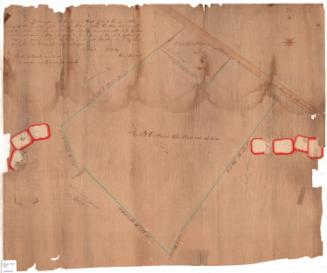
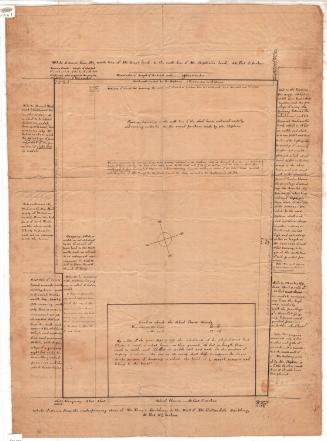
Plot plan of land in North Stonington
Dateabout 1927
Mediumpencil on onion skin paper
DimensionsSheet (height x width): 23 3/4 × 14 11/16in. (60.3 × 37.3cm)
ClassificationsGraphics
Credit LineGift of Sarah G. and Harvey C. Perry II
Object number2016.106.13
DescriptionPlot plan for land bordering on Anguilla Road and crossing a town line, with two driveways coming off a perpendicular road. One pond is identified. There are measurements in feet, and a notation that the acreage equals 108.2 acres. Reportedly the drawing is of land known as Randall Farm in North Stonington, Conn.
NotesThe building became known as Randall's Ordinary in the 1980s before being purchased by the Mohegan Nation. The Ordinary featured hearth cooking.Status
Not on view


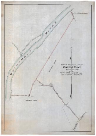
Erastus Worthington
1907